")


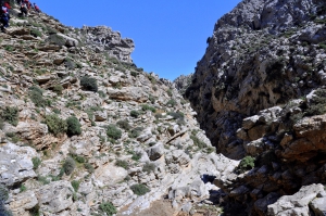
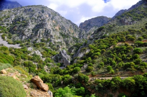
On the southeast side of Afendis Christos summit, above the villages Embaros you will meet the verdant vineyards at Erganos plateau at 900 meters altitude. The water gathered from the melting snow of the surrounding slopes and from many springs of the region form the main tributary of the Anapodaris river, Baritis, which crosses the plateau of Erganos and forms the rugged canyon of Erganos.
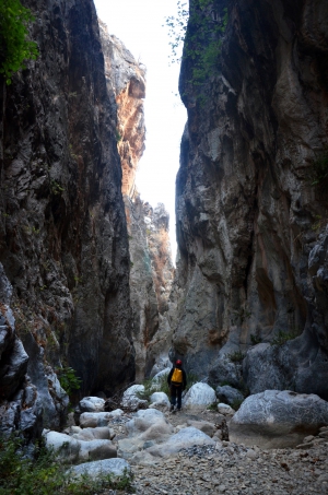
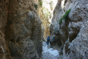
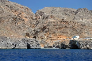
The canyon of Panagia (Virgin Mary), also known as Kalami I is parallel to the gorge Xerofarago or Kalami II and takes its name after the former monastery of Panagia Keralimeniotissa located at its exit.
Xerofarago Gorge is located south of Kalami village (Viannos area), 75km southeast of Heraklion. It is a small gorge ideal for canyoning (known to the canyoners as Kalami II) that terminates close to the old church of Panagia Keralimeniotissa, where another gorge, Kalami Gorge ends.
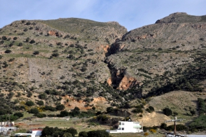
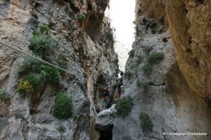
The canyon of Tsoutsouras is located in Tsoutsouras village and is one of the many inaccessible canyons of the area. It starts at position Sfakias and it's exit is located near the settlement, in Larinaki area, and at first glance it causes awe.
The Gorge of Ethia, officially known as Vorno, is located south of Heraklion, at the Asterousia Range. It starts from the village Ethia and, after tearing Asterousia northwards, it finishes at the plain of Messara, between the villages and Rotasi and Mesochori.
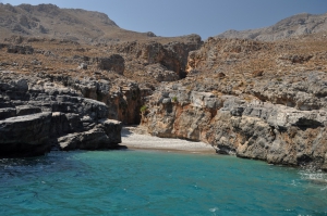
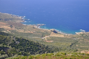
The wild and inaccessible canyon of Mesosfini is located 55km south of Heraklion city, in an isolated area west of the seaside village of Treis Ekklisies. Its entrance is located at a height of 450m, near the village of Mournies and Prinias, in the Asterousia Mountains. At its exit, 2km south, it is formed the majestic beach of Voidomatis, which can be accessed via a dirt track from Tris Ekklisies.
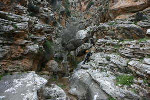
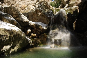
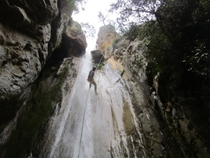
Just a few meters to the west of Tsoutsouros, the very narrow and smaller gorge of Troulla is formed. Being shorter than the Tsoutsouros canyon, it has attracted the attention of the canyoners and is very impressive with more than 15 beautiful waterfalls along its bed, the largest being 15m high.

At the drier side of Crete, near the seaside village Goudouras of Sitia Province we meet fouir parallel gorges of unique beauty. All of them are technical and descent requires rope. At the driest side of Crete, near the seaside village Goudouras of Sitia Province we meet fouir parallel gorges of unique beauty. All of them are technical and descent requires rope.
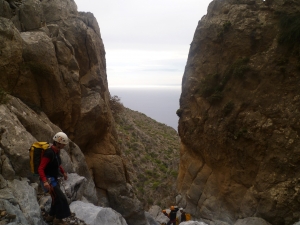
The gorge of the Holy Apostles in Lapathos is located south of Mount Dicti, 28km west of Ierapetra, 72km south of Heraklion, in the area of Kato Simi. This is a very rough canyon, which is a perfect challenge for very experienced canyoners. Its length is about 4km and the elevation difference between the starting and the ending point is about 900m.
Mesonas gorge is located on the northern slopes of the mountains of Thripti, near villages Kavoussi and Avgos. It is a short imposing gorge (4km long), that needs technical equipment for crossing it along its bed. The canyon connects the Plateau of Thripti to the plain of Kavoussi.
Canyon Kakoperatos located 10km south of Ahendrias village, on the eastern side of Asterousia Mountains. The distance from Heraklion is approximately 66km. The gorge is only crossed with technical equipment.

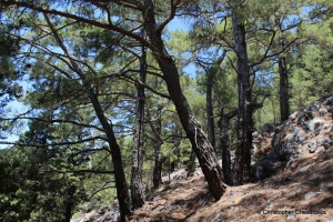
The forest village of Agios Ioannis at Sfakia province is the starting point of one of the most beautiful and best marked trails of Chania prefecture, the trail of Kormokopos. The word Kormokopos means place where trees are cut, due to the dense forest of the area.

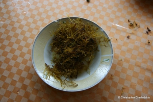
The macroalgae polisyphonia is a genus of marine algae found primarily in western Crete, with several species. It is reddish, has crisp flesh and grows on rocky grounds. It is found at the west seashores of Kissamos province and at a small part of Bali by Rethymnon

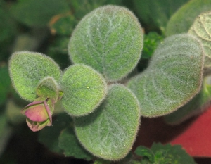
Dittany (Origanum dictamnus) (Greek: diktamos) is an endemic herb of Crete, the most famous of all, which is mainly used as a tea and as a therapeutic sip. Its name is taken after the Dikti Range (Lassithi Mountains), though it is also met in all ranges of Crete.
The gorge of Goula is located south of the village Kapetaniana and ends at Agios Ioannis seaside settlement. Like the two other gorges of the area (Koumos and Gerakia) it is impassable without canyoning equipment
The gorge of Valahas is formed south of Heraklion and the beach Elygia is formed at its exit. The highest rapel is 50m high and 4 hours are required for its crossing (only with canyoning equipment). The lower part of the gorge is covered by pine trees.

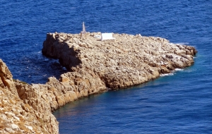
The church and lighthouse of Agios Sozon is located on a steep site, at the tip of Cape Stavros, at the northernmost point of the entire central Crete. The Cape of Zeus (Dios Akron) of the Venetian maps is believed to have hosted a sanctuary dedicated to Zeus in the ancient past.

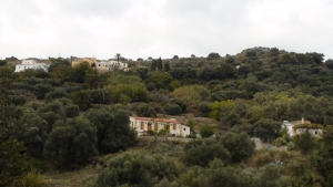
The route starts from Kissamos and is the first part of the European E4 trail in Crete. After crossing the villages Kato Palekastro, Korfiano and Grigoriana, we arrive at the ancient city of Polirinia and from there we cross the lush green villages Galouva, Lusakies Zahariana and, finally, Sfinari with the beautiful beach.
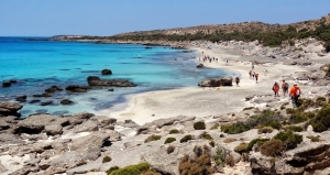
This part of the European trail E4 starts from Sfinari and ends at Chrisoskalitissa. It is one of the most beautiful and wooded parts of Crete with astonishing sea views. First we go through the desolated village Ano Sfinari, then Kambos, Plagia and Keramoti.
- Home
 Beaches
 Nature
 Past
Past Destinations
 Highlights
 West Crete
- Central Crete
- East Crete
- Towns
- Chania Prefecture
- Chania
- Paleochora
- Kissamos
- Georgioupolis
- Chora Sfakion
- Loutro
- Rethymnon Prefecture
- Rethymnon
- Agia Galini
- Plakias
- Spili
- Anogia
- Heraklion Prefecture
- Heraklion
- Hersonissos
- Malia
- Matala
- Agia Pelagia`
- Archanes
- Kokkinos Pirgos
- Lassithi Prefecture
- Agios Nikolaos
- Elounda
- Sitia
- Ierapetra
- Makrigialos
- Palekastro
- Zakros
- Lassithi Plateau
- Get Prepared


