Explore the Cretan

islets

Islets

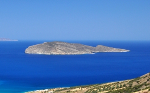
Crete is surrounded by dozens of small islands, islets and rocky outcrops, most of which are uninhabited. Some lie very close to the coast, while others are located farther away in the Cretan Sea and the South Cretan Sea. The largest and only inhabited one is Gavdos, the southernmost point of Greece and Europe, while the smaller islet of Gavdopoula lies nearby.

Among the best-known islets around Crete are Chrissi or Gaidouronisi and Koufonissi, south of Lassithi, Dia opposite Heraklion, Thodorou and Gramvousa in Chania, Spinalonga and Psira islet in the Gulf of Mirabello, the Paximadia islets in the Gulf of Messara, as well as the Dionysades, Elasa and Grandes in eastern Crete. Many of them feature beautiful beaches, impressive coastal landscapes, archaeological remains or historic fortifications.

These small islets are of particular ecological importance, as they provide safe nesting and resting grounds for seabirds and migratory birds. Koufonissi and the surrounding islets host an important colony of Eleonora’s falcons, while the Dionysades support one of the largest breeding populations of the species in Greece. Thodorou is a refuge for the Cretan ibex. Many of the islets and their surrounding marine zones belong to the Natura 2000 network and are protected for their rare habitats, flora, birdlife and seagrass meadows of Posidonia oceanica.

Some of the islets can be reached by excursion boats, while access to others is prohibited or restricted to protect their natural environment and archaeological sites. Visitors should therefore check the regulations currently in force before planning a trip and respect the fragile ecosystems of these small islands.

Gavdos Islet

Gavdos Islet

Gavdos lies in the South Cretan Sea, approximately 22 nautical miles south of Chora Sfakion, and forms the southernmost point of Greece and Europe. It has a triangular shape, an area of approximately 29.6 square kilometres and a permanent population that increases considerably during the summer months. The uninhabited islet of Gavdopoula lies northwest of Gavdos. Tradition identifies Gavdos with Homeric Ogygia, the island of Calypso where Odysseus remained before returning to Ithaca. Human presence on the island dates back to prehistoric times, while numerous archaeological remains testify to its long history. In more recent times, Gavdos was used as a place of exile for political prisoners during the Metaxas dictatorship. Its best-known landmarks include the restored old lighthouse, the scattered chapels, the traditional rural farmsteads and Cape Tripiti, with its characteristic natural arches and the large chair marking the southernmost point of Europe. The landscape of Gavdos combines pine forests, junipers, sand dunes, rocky shores and extensive sandy beaches. Sarakiniko and Agiannis are the best-known beaches, while Korfos, Tripiti, Lavrakas, Pirgos, Potamos and the island’s smaller secluded shores are also particularly beautiful. Karave is the main port of Gavdos and the arrival point for ferries. The entire islands of Gavdos and Gavdopoula belong to the Natura 2000 network. The coastal dunes with junipers at Sarakiniko, Agiannis and Lavrakas are of particular ecological importance, while the islands also provide valuable resting grounds for migratory birds. An extensive network of footpaths connects the small settlements, beaches and the most important sites of natural and historical interest. Ferry connections operate from Chora Sfakion, Paleochora, Sougia, Agia Roumeli and Loutro, depending on the season and the current timetable. As strong winds can cause cancellations, travellers should always check the schedule before departure.

Read more ...

Koufonissi Island

Koufonissi Island

Koufonissi, known in antiquity as Lefki, is an uninhabited island in the South Cretan Sea, approximately 3.5 nautical miles south of Goudouras and 10 miles southeast of Makrigialos. It covers an area of approximately 5.25 square kilometres and is the largest island of a small group that also includes the islets of Makrouli, Strongyli, Marmaro and Trachilos. The ancient name Lefki is probably associated with the white colour of its limestone and marl formations, while the modern name is attributed to the numerous cavities and sea caves along its coast. Although Koufonissi is uninhabited today, it preserves evidence of human activity from prehistoric to post-Byzantine times. Particularly important are the remains of the Greco-Roman settlement, the theatre, baths, water cisterns and workshops used for the production of purple dye. On the northern side of the island stands the small chapel of Saint Nicholas, the patron saint of local sailors. The remarkable concentration of antiquities has led to Koufonissi being informally described as the “Delos of Crete”. The landscape is dry and almost steppe-like, with sand dunes, low vegetation, white and yellow rock formations, caves and small sandy beaches with turquoise waters. Its flora includes rare species whose distribution is mainly associated with the southern Mediterranean and North Africa. Koufonissi, the surrounding islets and their coastal marine zone belong to the Natura 2000 network. They form an important area for migratory birds and support a notable colony of Eleonora’s falcons, while the surrounding sea contains reefs, marine caves and Posidonia oceanica seagrass meadows. Access is mainly provided by seasonal excursion boats from Makrigialos when weather conditions permit. There are no facilities, drinking water or natural shade on the island, so visitors should carry everything they need and avoid disturbing its fragile natural and archaeological environment. Available boat services and any access restrictions should always be checked before visiting.

Read more ...

Chrissi island

Chrissi island

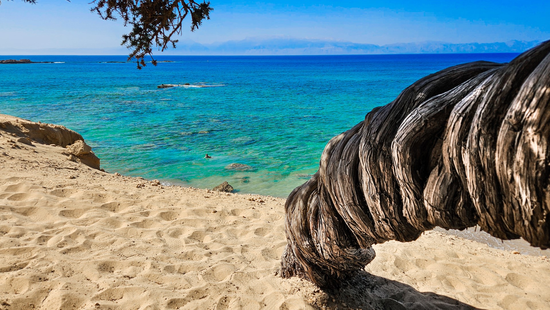
Chrissi, also known as Gaidouronisi or simply “Nisi” by the residents of Ierapetra, lies approximately eight nautical miles south of the town in the South Cretan Sea. It is a low and almost flat islet, known for its sandy shores, turquoise waters and countless shell fragments that give the sand white, golden and, in some places, pink shades. The name Chrissi is associated with the golden colour of the sand, while the name Gaidouronisi is traditionally linked to the former local practice of taking old donkeys from Ierapetra to the island. Traces of human presence and earlier activities have been found on Chrissi, including remains of a settlement, salt pans, rock-cut graves and the small chapel of Saint Nicholas. The most important natural feature of Chrissi is its coastal dunes with large junipers, which form a rare and particularly fragile habitat. The islet belongs to the Natura 2000 network and has also been designated a Wildlife Refuge. Its best-known shores include Belegrina or Golden Beach, Vougiou Mati, Hatzivolakas, Kataprosopo and Vages. Visits to Chrissi are now subject to strict environmental protection measures. Visitors may use only the designated beaches, while access to the interior and the juniper woodland is prohibited. Camping, overnight stays and the collection of sand, shells or any other natural materials are also forbidden. Disembarkation and the approach of vessels are permitted only under the conditions and at the locations specified by the current regulations and designated infrastructure. As these rules may change, visitors should obtain up-to-date information before departing from Ierapetra.

Read more ...

Agii Pantes Islet at Agios Nikolaos

Agii Pantes Islet at Agios Nikolaos

Directly opposite the port of Agios Nikolaos lies the islet of Agii Pantes. Together with the neighbouring islet of Mikronisi, it forms a natural breakwater that protects the town’s harbour from strong waves. Agii Pantes covers an area of approximately 0.44 square kilometres and takes its name from the small chapel dedicated to All Saints. The chapel celebrates on the first Sunday after Pentecost, when residents of Agios Nikolaos traditionally travel to the islet by boat to attend the service. Next to the chapel stands a vaulted building dating from the Venetian period. Several military structures from the Second World War survive across the islet, dating from the period when the Italians occupied the Lasithi region. These include circular gun emplacements, fortifications and an observation post on the eastern side. In 1957, Cretan ibex were introduced to Agii Pantes, and the islet was subsequently used as a protected breeding refuge. The animals were monitored and fed, while some were later transferred to other protected areas. Near the centre of the islet there is also a tiny sandy beach with clear blue water. We warmly thank Leonidas Klontzas for the information and photographs. [widgetkit id=1995]

Read more ...

  • 1
  • 2
Dia island

Dia island

1 1 1 1 1 1 1 1 1 1 Rating 3.98 (20 Votes)
Dia is an uninhabited island with 5 km maximum length and 3 km maximum width surrounded by small rocky inlets. It is located 6 miles north of Heraklion. It is one of NATURA's protected areas due to its status as a biotope for endemic plants and for plants with low dispersal within the Southern Aegean.

Read more ...

Gramvousa Islet

Gramvousa Islet

1 1 1 1 1 1 1 1 1 1 Rating 3.42 (302 Votes)
The island of Imeri Gramvousa is located 20km northwest of Kissamos, opposite the imposing Cape of Gramvousa and 2 miles northwest of the famous lagoon of Balos. Gramvousa is famous for its historical Venetian fortress, which still stands at a height of 137m, over the beach. The fort had also been used by pirates.

Read more ...

Spinalonga Islet

Spinalonga Islet

1 1 1 1 1 1 1 1 1 1 Rating 3.84 (25 Votes)
Spinalonga is a small island located at the entrance of Elounda lagoon and north of the Gulf of Mirabello. It has an area of 85 acres and its maximum height is 53 meters. The history of the island still inspires awe. It has been a Venetian fortress, a castle colony, a rebel refuge, a place of exile for lepers, a communication link with Cairo during the Second World War.

Read more ...

Paximadia islets

Paximadia islets

1 1 1 1 1 1 1 1 1 1 Rating 3.37 (227 Votes)
Paximadia Islands are two small uninhabited islets off the Gulf of Messara, 12km (7.5 miles) south of Agia Galini. By far they seem like a single island because they are very close. You may also hear locals refer to these as "Elephant", since from afar they remind you of a lying elephant. Their total length is about 3km.

Read more ...

Thodorou Islet

Thodorou Islet

1 1 1 1 1 1 1 1 1 1 Rating 3.94 (8 Votes)
The island of Agioi Theodoroi or Thodorou and located just opposite of the beach of Platanias in Chania, just half a mile northern. The history of the island and its ecological importance in preserving the protected species of the Cretan wild goat, make this small dot on the map very important.

Read more ...

Souda Islet

Souda Islet

1 1 1 1 1 1 1 1 1 1 Rating 3.79 (12 Votes)
Souda is the name of the small island that stands like a guard in the entrance of the gulf of Souda., a natural harbor protected by the high mountains the east of Chania, on the northeast side of the port of Chania.

Read more ...

Psira Islet

Psira Islet

1 1 1 1 1 1 1 1 1 1 Rating 4.00 (8 Votes)
Psira is a small uninhabited islet located 1 mile north of Tholos beach, situated at the northeastern edge of the Gulf of Mirabello. In Psira a Minoan settlement of 15-20 acres has been found, being one of the most important sites in Crete.

Read more ...

Dionysades Islets

Dionysades Islets

1 1 1 1 1 1 1 1 1 1 Rating 3.38 (4 Votes)
The Dionysades (also Gianysades) is a small group of islands off Sitia on the northeast coast of Crete. The group includes the islands Gianysada, Dragonada, Paximada, and Paximadaki. This island group is part of an environmentally protected area with many rare plants and animals including the falcon, Falco eleonorae, which finds sanctuary here.

Read more ...

  • 1
  • 2
Download Free Premium Joomla Templates • FREE High-quality Joomla! Designs BIGtheme.net