")


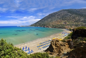
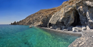
Bali has four beaches, which are formed in sandy coves with nice greenish waters. The beaches are almost always calm since the direction of Bali is western. They all are suitable for children and well organized. Moreover, water is cool because of the several springs that carry fresh water into the sea.

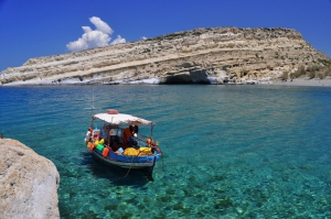
Matala is famous for the carved caves in the rocks and the hippies of the ‘70s. It is located close to Phaestus, the second-largest palace of the Minoan civilization. Matala was the port of Phaestus, and in the Roman Times, it became a port of Gortys.
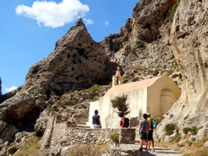
To get there you must either cross the gorge, by easy hiking of about 30-50’, or catch a boat from Matala, Agia Galini, or Kali Limenes. We definitely recommend the first option, as the route within the vertical walls of the gorge is breathtaking. On the way you will see the large caves were some hermits still live and the chapel of St. Anthony, with a well outside.

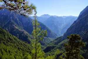
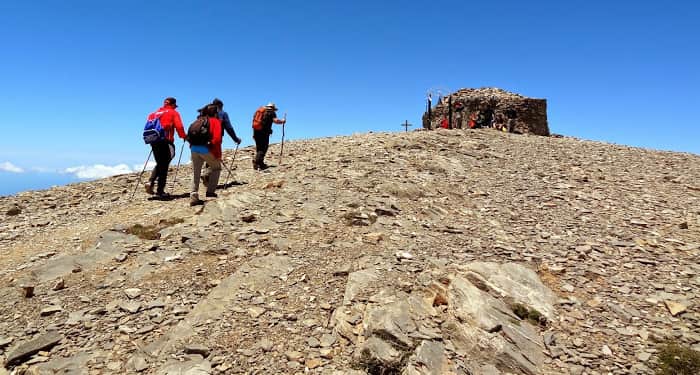
The Samaria Gorge is the longest trekking gorge in Europe and also the most famous of all. Thousands of tourists flock here daily in the summer season to walk from the top to the bottom. For many visitors, it is the sole purpose of their visit to Crete. The length of the gorge reaches 18km and takes almost 4-7 hours to hike from Omalos to Agia Roumeli, depending on trekking speed.
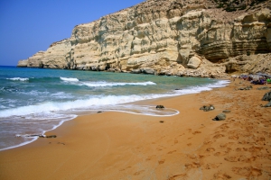
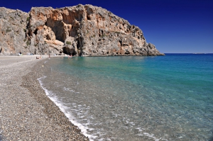
The Red Beach is located at location Moudia, 68km southwest of Heraklion and just 800m south of Matala famous resort. To get here you have to walk a trail that begins north of the settlement of Matala and crosses the hill north of Matala. There used to be some signs showing the way.

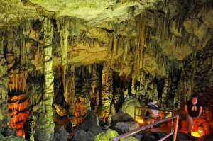
The impressive cave of Zeus, the Diktaean Cave, is located just 10 minutes walking-distance from Psychro, in Lassithi Plateau, at an altitude of 1025m. In Psychro there is plenty of parking areas, with plenty of restaurants nearby. Two paths leading to the cave start from the parking area. The easiest path is the left one, because in the right path (the oldest) the stones are worn by thousands of tourists and are slippery.
The majestic black beach of Aspes is located about 58km south of Heraklion, in one of the most remote and inaccessible areas of Asteroussia Mountains. It is situated 4km east of the hamlet of Treis Ekklisies.

The Gorge of Kourtaliotis is located 22km south of Rethymno and has a length of 3km. It is one of the most spectacular natural attractions of Rethymnon. It starts from the village of Koxare and flows between the mountains Kouroupis (984 m) and Xiro Oros (Dry Mountain - 904m). The huge cliffs of the canyon reach a height of 600 meters and are full of openings and caves, where significant fauna species live.
Also read:
- Home
 Beaches
 Nature
 Past
Past Destinations
 Highlights
 West Crete
- Central Crete
- East Crete
- Towns
- Chania Prefecture
- Chania
- Paleochora
- Kissamos
- Georgioupolis
- Chora Sfakion
- Loutro
- Rethymnon Prefecture
- Rethymnon
- Agia Galini
- Plakias
- Spili
- Anogia
- Heraklion Prefecture
- Heraklion
- Hersonissos
- Malia
- Matala
- Agia Pelagia`
- Archanes
- Kokkinos Pirgos
- Lassithi Prefecture
- Agios Nikolaos
- Elounda
- Sitia
- Ierapetra
- Makrigialos
- Palekastro
- Zakros
- Lassithi Plateau
- Get Prepared


