")


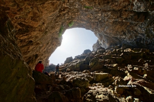
Tzanis Cave or Katavothra or Chonos, is located in Omalos Plateau in Chania. It reaches a length of 2500m and a depth of 280m. The cave has raised the interest of foreign tourists since 1865. Since 1961 caver groups of different nationalities explore the cave. Tzanis is accessible, but is not organized for tourists.
The cave of Agia Fotini is on located on Mount Louloudaki, 7km south of Avdou village, at an altitude of 760m. 35km east of Heraklion is the Avdou village, where a sign "Agia Fotini Cave - 7 km”, shows the direction. From there you enter a dirt road, which leads to a small square below the mouth of the cave. Following the steep path on foot, the visitor arrives at the entrance of the cave.

It is located at the exit of a small valley, a rare phenomenon in the wild Asterousia Mountains, which starts from the village Antiskari and ends in settlement. The fertile valley is used for growing early vegetables such as tomatoes, cucumbers, peppers, etc., since the temperature here is always high. Characteristic of the warm climate is that the swallows do not leave the area in winter.
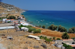
Pourgonero beach is located at Krassas area, just 500m east of the port of Tsoutsouras, in the area where the houses of the settlement stop. It is actually the eastern part of Tsoutsouras bay, located in front of the hill Sarakinos. According to the legend, the eternal sarcophagus of King Minos, the mythical king of Crete, is burried below this place.
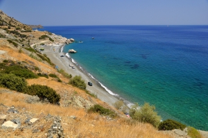
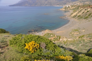
East of the village Platia Peramata you will firstly meet the longest beach of Platia Peramata, called Psili Ammos, which is totally isolated and very beautiful. The beach is not very suitable for camping, as there is no shade from trees. However, at the eastern end there are large white rocks, called Asproharaki, which offer shade to their lucky “occupiers”.
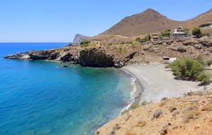
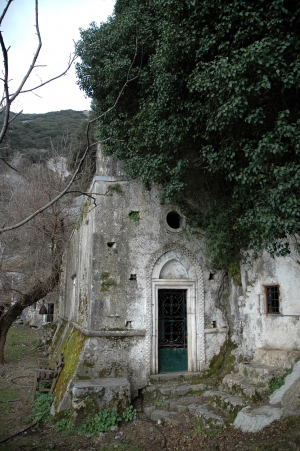
Loutra (i.e. Baths) is located 3km east of the seaside village Lendas, 77km south of Heraklion. It is known to locals because it hosts the port of Lendas, which is protected by the Cape Trafoulas on the east.

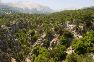
The forest Selakano is located 35km north of Ierapetra, in the southeastern part of the Dikti massif, surrounded by the four highest peaks (Lazaros 2085 m, Spathi 2148 m, Afendis Christos 2141 m, Psari Madara 2090 m). The area can be accessed via asphalted road that runs through a magical route till the village Selakano and starts either in Ierapetra or Kalamafka.
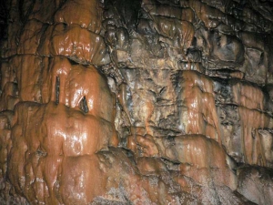
The cave of Kamares, also called Kamaraiko, is located at the southern foot of Psiloritis. In particular, it is situated on the slopes of Mount Soros, at an altitude of 1700m and northeast of the homonym village of Kamares. It is not important in terms of speleology, but the minoan findings made the cave a very important archaeological site.
Also read:
- Home
 Beaches
 Nature
 Past
Past Destinations
 Highlights
 West Crete
- Central Crete
- East Crete
- Towns
- Chania Prefecture
- Chania
- Paleochora
- Kissamos
- Georgioupolis
- Chora Sfakion
- Loutro
- Rethymnon Prefecture
- Rethymnon
- Agia Galini
- Plakias
- Spili
- Anogia
- Heraklion Prefecture
- Heraklion
- Hersonissos
- Malia
- Matala
- Agia Pelagia`
- Archanes
- Kokkinos Pirgos
- Lassithi Prefecture
- Agios Nikolaos
- Elounda
- Sitia
- Ierapetra
- Makrigialos
- Palekastro
- Zakros
- Lassithi Plateau
- Get Prepared


