Explore Cretan

Plateaus

Planes of History

Cretan history is highly related to its fertile plateaus
that fed generations of rebels.
The entire prefecture of Lassithi took
its name after the homonym plateau.

Lassithi | Nida | Omalos | Askyfou | Messara Plane

A humble botanical wonder

The plateau of Gious Kambos

Explore

Top Destinations

Lassithi Plateau

Explore

Top Selections

Omalos

Explore

Plateaus and Plains

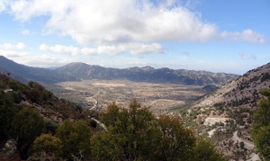
Crete's mountainous and karst landscape has created numerous large and small plateaus between its mountain ranges. Many are enclosed basins where water from the surrounding mountains collects before draining through sinkholes and underground channels. Sediments accumulated over time to form fertile soils, and many plateaus have been used for centuries for cultivation, livestock farming and seasonal settlement.

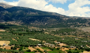
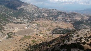
The largest plateau in Crete is the Lassithi Plateau, at an average altitude of about 850 metres, surrounded by the peaks of the Dikti Range. Its fertile land is extensively cultivated. The characteristic wind-powered water pumps on the plain and the old stone flour mills at its approaches are important elements of its agricultural history. Other plateaus in the same mountain range include Katharo, Limnakaro, Nissimos, Lapathos, Erganos and the Omalos Plateau near Viannos.

In the Psiloritis Range, the Nida Plateau stands out at an altitude of about 1,400 metres. The area is closely associated with pastoral traditions, stone shepherds' huts known as mitata and the Idaean Cave, one of ancient Crete's most important sacred caves. The smaller Stroumboulas Plateau lies among the eastern foothills of the range. In the White Mountains lies the Omalos Plateau, whose edge at Xyloskalo marks the start of the descent into the Samaria Gorge. Other plateaus include Askyfou, Tavri, Niatos and the smaller plateaus around Anopolis.

Fertile plains also extend between the mountains and near the coast. The largest is the Messara Plain in southern Crete, between Psiloritis and the Asterousia Mountains. Crossed by the Geropotamos River, it has been one of the island's most important agricultural areas since antiquity, as illustrated by the archaeological sites of Phaistos and Gortyn. Important cultivated areas also extend around Ierapetra, Kastelli Pediada and the coastal zones of Chania and Rethymnon.

Crete's plateaus and plains are closely connected with agricultural production, livestock farming, local architecture and traditional water management. They form landscapes of considerable natural and cultural value, where the close relationship between local communities and their environment remains visible.

Lassithi Plateau

Lassithi Plateau

1 1 1 1 1 1 1 1 1 1 Rating 4.47 (19 Votes)
The wonderful Lassithi Plateau is located about 25km south of Malia and 70km west of Heraklion city. Located in a peaceful and fertile region, it is surrounded by the wild mountains of Dikti and several smaller plateaus. The views of the surrounding mountains of Selena and Afendis Hristos are majestic.

Read more ...

Nida Plateau

Nida Plateau

1 1 1 1 1 1 1 1 1 1 Rating 3.89 (9 Votes)
The plateau can be reached via a dirt road starting from the picturesque village of Anogia, but also via a rugged dirt track from Gergeri. The plateau is used as pasture and is not cultivated. Due to overgrazing, you we’ll not see any trees in the plain, although it was previously covered by dense forest.

Read more ...

Omalos Plateau

Omalos Plateau

1 1 1 1 1 1 1 1 1 1 Rating 4.88 (16 Votes)
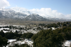
Omalos is located 38km south of Chania at an altitude ranging from 1,040 to 1,250 meters, surrounded by the high peaks of the White Mountains. The plateau is particularly beautiful in the winter, when it is frequently covered by snow. At older times, the plateau of Omalos was the shelter of the locals and the base of rebels during the two and a half centuries of the Turkish occupation, but also during all other wars against invaders.

Read more ...

Amari Valley

Amari Valley

1 1 1 1 1 1 1 1 1 1 Rating 3.44 (16 Votes)
Amari valley is formed between the Mountains Kedros and Psiloritis, at an altitude of 400-500m and is 25km long. It is the natural passage from the north to south Rethymno and Messara Plain. For its central location, it was the theater of several historical events, especially during the Ottoman rule.

Read more ...

Messara Plain

Messara Plain

1 1 1 1 1 1 1 1 1 1 Rating 3.33 (3 Votes)
The plain of Messara is located on the south side of Heraklion Prefecture, in an elongated area of 50km in length and with its width not exceeding 7km. In the south, the valley is protected by the wild Asterousia Mountains, while its western side is bounded by a vast beachfront with sandy beaches.

Read more ...

Anopolis Plateau at Sfakia

Anopolis Plateau at Sfakia

1 1 1 1 1 1 1 1 1 1 Rating 4.29 (7 Votes)
The Plateau of Anopolis is located in the area of Sfakia and more specifically 13km west of Hora Sfakion. It is a small plateau formed in the wild mountains of Sfakia, the most inaccessible province of Europe.

Read more ...

Askyfou Plateau

Askyfou Plateau

1 1 1 1 1 1 1 1 1 1 Rating 4.36 (11 Votes)
The Plateau of Askifou is located 50km south of Chania, in one of the nicest and most authentic areas of Crete. The wild mountains around and the serenity of the valley, form a magnificent landscape all year round.

Read more ...

Katharo Plateau

Katharo Plateau

1 1 1 1 1 1 1 1 1 1 Rating 4.80 (5 Votes)
The plateau Katharo lies 26km south of Agios Nikolaos and 16km west of Kritsa, at an altitude of 1150 meters. The waters of the Plateau are transported through the beautiful gorge of Havgas into Lassithi Plateau. Katharo is uninhabited, although there are several farmhouses belonging to the village of Kritsa.

Read more ...

Download Free Premium Joomla Templates • FREE High-quality Joomla! Designs BIGtheme.net