Explore Cretan

Plateaus

Planes of History

Cretan history is highly related to its fertile plateaus
that fed generations of rebels.
The entire prefecture of Lassithi took
its name after the homonym plateau.

Lassithi | Nida | Omalos | Askyfou | Messara Plane

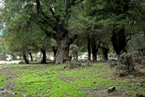
A humble botanical wonder

The plateau of Gious Kambos

Explore

Top Destinations

Lassithi Plateau

Explore

Top Selections

Omalos

Explore

Plateaus and Plains

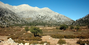
Crete's mountainous and karst landscape has created numerous large and small plateaus between its mountain ranges. Many are enclosed basins where water from the surrounding mountains collects before draining through sinkholes and underground channels. Sediments accumulated over time to form fertile soils, and many plateaus have been used for centuries for cultivation, livestock farming and seasonal settlement.

The largest plateau in Crete is the Lassithi Plateau, at an average altitude of about 850 metres, surrounded by the peaks of the Dikti Range. Its fertile land is extensively cultivated. The characteristic wind-powered water pumps on the plain and the old stone flour mills at its approaches are important elements of its agricultural history. Other plateaus in the same mountain range include Katharo, Limnakaro, Nissimos, Lapathos, Erganos and the Omalos Plateau near Viannos.

In the Psiloritis Range, the Nida Plateau stands out at an altitude of about 1,400 metres. The area is closely associated with pastoral traditions, stone shepherds' huts known as mitata and the Idaean Cave, one of ancient Crete's most important sacred caves. The smaller Stroumboulas Plateau lies among the eastern foothills of the range. In the White Mountains lies the Omalos Plateau, whose edge at Xyloskalo marks the start of the descent into the Samaria Gorge. Other plateaus include Askyfou, Tavri, Niatos and the smaller plateaus around Anopolis.

Fertile plains also extend between the mountains and near the coast. The largest is the Messara Plain in southern Crete, between Psiloritis and the Asterousia Mountains. Crossed by the Geropotamos River, it has been one of the island's most important agricultural areas since antiquity, as illustrated by the archaeological sites of Phaistos and Gortyn. Important cultivated areas also extend around Ierapetra, Kastelli Pediada and the coastal zones of Chania and Rethymnon.

Crete's plateaus and plains are closely connected with agricultural production, livestock farming, local architecture and traditional water management. They form landscapes of considerable natural and cultural value, where the close relationship between local communities and their environment remains visible.

Manikas Plateau

Manikas Plateau

1 1 1 1 1 1 1 1 1 1 Rating 4.00 (2 Votes)
The plateau Manikas is located at the province of Sfakia, at an altitude of 720 meters. Today, the settlement Manikas, after which it gets its name, has been abandoned and is only used by shepherds. The plateau hosts the beautiful stone-built church dedicated to St Emmanuel (celebr. August 21).

Read more ...

Vromonero plateau

Vromonero plateau

1 1 1 1 1 1 1 1 1 1 Rating 4.75 (4 Votes)
The Plateau of Vromonero or Lakkos Limas is located at an altitude of 1300m, 10km west of the village Kroussonas, in an amazing location east of the summit Skinakas of Psiloritis Mt, where the homonym observatory of the University of Crete is located. It can be accessed via a dirt track running through the gorge of Halasia, which starts from Livadi plateau and ends in Krousonas.

Read more ...

Niatos Plateau

Niatos Plateau

1 1 1 1 1 1 1 1 1 1 Rating 3.75 (4 Votes)
In Niatos the beauty is indescribable, as the views to the peak Kastri (2215m) of the White Mountains causes awe. If you ever drive to Sfakia via Askifou, do not forget to visit the two plateaus, as they are totally unknown and are awesome.

Read more ...

Livadi Plateau at Kroussonas

Livadi Plateau at Kroussonas

1 1 1 1 1 1 1 1 1 1 Rating 4.40 (5 Votes)
The Livadi (Lawn) Plateau of Kroussonas is located 9km west of the village Kroussonas and 35km southwest of Heraklion, on the eastern slopes of Psiloritis. It is a beautiful place to visit, especially in spring when the 300.000 pear and apple trees are blooming. The quiet green plateau with the background of the bare peaks of Psiloritis is a unique landscape.

Read more ...

Lapathos Plateau

Lapathos Plateau

1 1 1 1 1 1 1 1 1 1 Rating 4.67 (3 Votes)
The Plateau of Lapathos is located about 77km southeast of Heraklion and 36km west of Ierapetra, near Kato Symi village. It is a small but beautiful plateau. The background of the plateau is the wild beauty of the Lasithi mountains and the slopes of Selakano. The vegetation in the Plateau is not dense and there are many rocky places.

Read more ...

Plateau of Armenohandrades

Plateau of Armenohandrades

1 1 1 1 1 1 1 1 1 1 Rating 3.00 (3 Votes)
Plateau of Armenohandrades is located 23km south of Sitia and is a part of Crete that remains completely unknown, intact and authentic. It takes its name after the two settlements of Armeni and Handras, which today form a single settlement.

Read more ...

Krapi Plateau

Krapi Plateau

1 1 1 1 1 1 1 1 1 1 Rating 4.25 (4 Votes)
At the north side of the White Mountains, at the borders of provinces Apokoronas and Sfakia there is the small plateau of Krapi. Just above Krapi starts the natural passage called Katre Lagos that links north coast to Askyfoy plateau and Sfakia area.

Read more ...

Vothonas Plateau at Vafes

Vothonas Plateau at Vafes

1 1 1 1 1 1 1 1 1 1 Rating 4.33 (6 Votes)
Vothonas or Lakoudia is a very small plateau located 40km south of Chania city, near to the village Vafes. It can be accessed from Vafes via by a passable dirt road. The landscape of the surrounding mountains is spectacular, with majestic views to the White Mountains and the shores of Georgioupolis.

Read more ...

Download Free Premium Joomla Templates • FREE High-quality Joomla! Designs BIGtheme.net