Explore the Cretan

islets

Islets

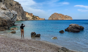
Crete is surrounded by about 80 islets. Gavdos, the southermost land and islet of Europe, is inhabited and has many amazing things for you to discover. Chrissi is the most exotic islet of Crete, with crystal turquoise water and white sand, reminding of Carribean. Koufonissi also has very nice beaches and important archeological sites and, fortunately, is totally unknown to visitors. Apart from them, there are other islets such as Thodorou (where cretan ibex is sheltered), Dia, Paximadia, Dionysades and many more.

Gavdos Islet

Gavdos Islet

Gavdos is the amazing island where the shipwrecked Odysseus was welcomed the Calypso, the anchorage of travelers and traders from Africa and the pirates, the place of thousands of summer visitors. Gavdos is the southernmost part of Europe, 32 nautical miles away from Paleochora, 22 from Sfakia and 170 in Tobruk, Libya. It is a small island belonging to Chania prefecture, just 30 km squares with triangular shape, with a maximum length of 10 km and width 5km. Karave, Korfos, Lakkoudi, Tripiti, Fetife, Sarakiniko, Agiannis, Lavrakas, Pirgos and Potamos beaches are some of the finest pearls of coast of the island. Kastri, Xenaki, Vatsiana and Ambelos are some of the picturesque settlements here. Find Accommodation in Gavdos

Read more ...

Koufonissi Island

Koufonissi Island

Koufonissi is a small island in the South Cretan Sea, 3.5 miles south of Cape Goudouras and 10 miles southeast of Makrigialos. The island is roughly six kilometres long and 5.5 kilometres across. It has an entire surface area of 5.25 km². Koufonissi is the largest of a cluster of 5 islands: Koufonisi, Makroulo, Strogilo, Trachila and Marmara. The ancient name Lefki (meaning white), was given by the glint of white limestone and marl in the sunlight. Instead, the current name, Koufonissi (meaning Cave-Island), is related to the many pits and caves shaped by the sea and rain. According to a second stronger version, the name comes after the many rats of the island, which are called "koufa" by locals. The island is uninhabited now, but is full of ruins that indicate human activity from the Early Minoan times to post-Byzantine years. The locals like to call Koufonisi as Delos of Crete, after the significant antiquities that have been found. The island has beautiful sandy beaches, it is mainly covered with fine sand and the scenery is not very different from an African desert. Visitors can admire the beauty of white rocks next to the blue of the sea and enjoy the tranquility of nature in turquoise waters. The landscapes alternate from the steep rocky shoreline, to the caves of yellow marl and the endless dunes. The prevailing vegetation is low, bushy, steppic and with many species, rare in the Greek and Cretan area. Characteristic species are Helianfhemmum stipulalum, the Lygeum spartum (grass of North Africa), Austragalus peregrinus (characteristic of the southern Mediterranean) and the rare Erodium classifolium, located at the northernmost point of its spread. It is worth visiting the picturesque church of Saint Nikolaos, the guard of seamen. It is a small beautiful Christian church in the north part of the island. Until 1976 shepherds used the island a sheep run, but there is no reference for permanent habitats in recent years. It is impressive that until late 1970s, large quantities of grain were grown on the island. Today Koufonissi is a haven for fishermen during windy days. In the last years the wealth of the history and the environment of Koufonissi has been recognized and studied. This knowledge and the beauty of the island are now offered to visitors as a gift that demands respect and protection. There are boats running to the islet from Makrigialos port. If you have a private boat, note that you should be very careful because the island is surrounded by many reefs. Walking through the island is easier and faster, if you follow the existing paths and the distance does not exceed one hour of walking. The visitor should have drinking water, and everything needed for one day in a warm, dry place without shade and without any infrastructure.

Read more ...

Chrissi island

Chrissi island

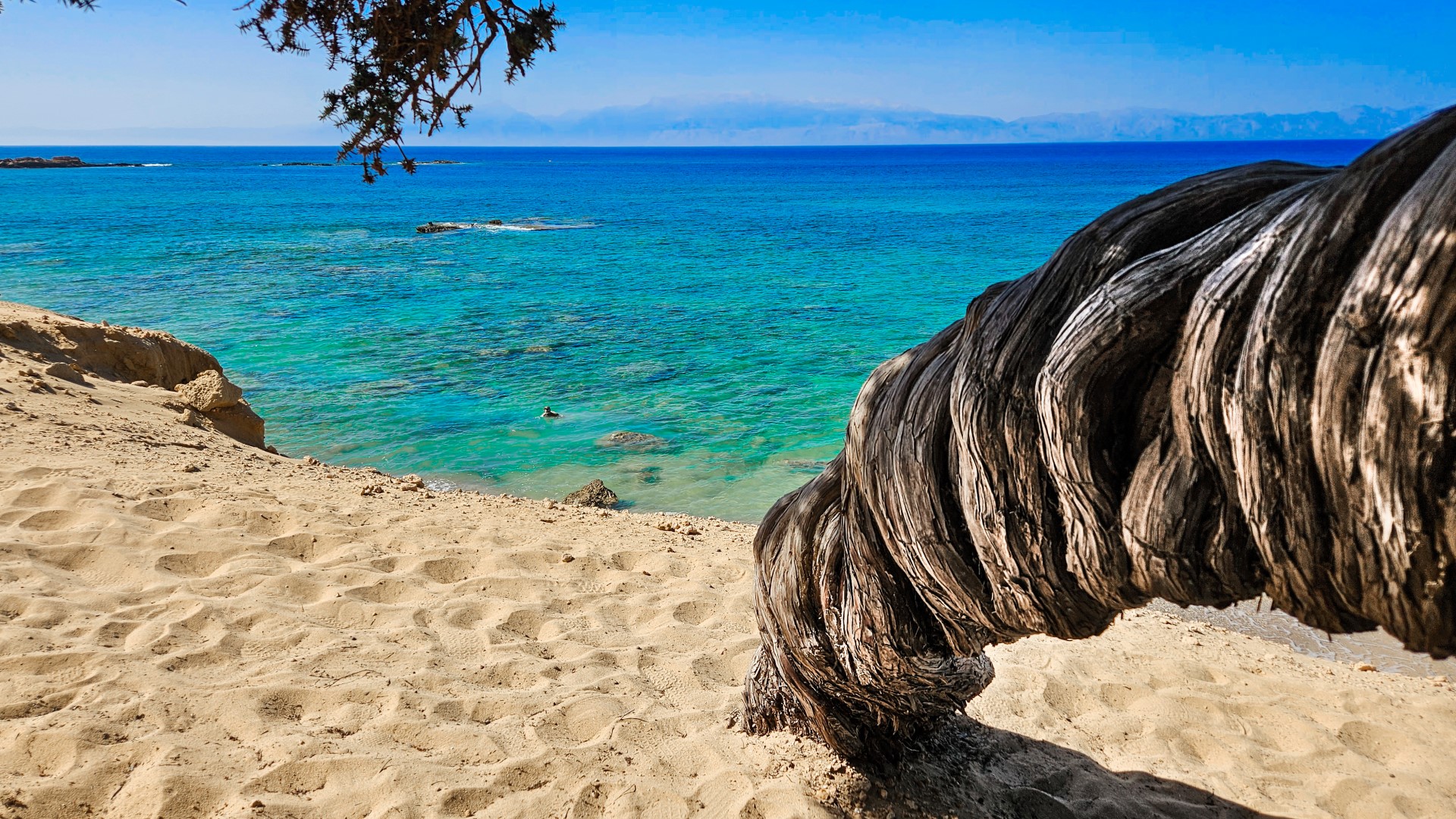
Chrissi island or Gaidouronisi is located 8 miles south of Ierapetra city, in the open South Cretan Sea. It is a flat islet very famous for its tropical blue water that cover all possible palette hues of blue and green, the protected forest with large juniper trees and the thousands of broken shells that make the sand pinkish. The residents of Ierapetra love this island and call it simply "the Island". It is said that years ago by Gianni Agnelli, the chairman of Ferrari, wanted to buy the island to make it a tourist attraction. Chrissi takes its name (golden in Greek) after the white sand that covers the entire island and comes mainly from shell debris. The tropical beaches are crowded by many visitors who come by the excursion boats that leave Ierapetra in the morning and return in the afternoon. Chrissi has been declared as an area of natural beauty and it is strictly prohibited to camp and spend your night here. You must keep away from the fragile juniper trees and avoid not collecting sand or shells.

Read more ...

Agii Pantes Islet at Agios Nikolaos

Agii Pantes Islet at Agios Nikolaos

Directly opposite the port of Agios Nikolaos lies the islet of Agii Pantes, which takes its name from the small church dedicated to All Saints. On the feast day of the church, celebrated 56 days after Orthodox Easter, dozens of residents travel to the island by boat to attend the religious service. Next to the church of Agii Pantes stands a vaulted building dating back to the Venetian period. Scattered across the island are several military structures dating from the Second World War, when the Lassithi region was occupied by Italian forces. Numerous circular gun emplacements can still be seen, along with fortifications at several locations. An old military observation post also survives on the eastern side of the island. Together with the neighbouring islet of Mikronisi, Agii Pantes acts as a natural breakwater, protecting the harbour of Agios Nikolaos from strong waves. Hybrids of the endangered Cretan ibex, locally known as agrimia, have also been transferred to the island for their protection. Near the centre of the islet, there is a unique tiny sandy beach with clear turquoise water. [widgetkit id=1995] {loadposition nearestplaces}

Read more ...

  • 1
  • 2
Mochlos islet and Archaeological site

Mochlos islet and Archaeological site

1 1 1 1 1 1 1 1 1 1 Rating 4.43 (7 Votes)
The islet Scoglio de Muflo of the Venetians, which is the island opposite of Mochlos, seems to have been a very important commercial center and port in antiquity till the Byzantine Era. The island, also called Psilos (i.e. Flea) (opposed to a larger island to the west called Psira, i.e. lice) is an archaeological site that still gets excavated.

Read more ...

Islet Agii Pantes

Islet Agii Pantes

1 1 1 1 1 1 1 1 1 1 Rating 4.00 (9 Votes)
Just opposite the port of Agios Nikolaos is the island of Agii Pantes (All Saints), which takes its name after the homonym chapel. On feastday of the temple (56 days after Easter) townspeople visit the island by boat to join the feast. Next to the church of All Saints we see a domed building that dates back to the Venetian Era.

Read more ...

Grandes Islets

Grandes Islets

1 1 1 1 1 1 1 1 1 1 Rating 5.00 (1 Vote)
The islands of Grandes is a complex of three small lowland rocks in the province of Sitia, about half a mile opposite the beautiful beach of Hiona. In fact, the largest area (300 acres) is occupied by the middle island, known as Prasonisi, which is oblong and has the highest altitude at 31 meters. In the middle of the island there is a beautiful beach with two tamarisk trees, surrounded by rocks.

Read more ...

Elasa islet

Elasa islet

1 1 1 1 1 1 1 1 1 1 Rating 5.00 (1 Vote)
Elassa is the easternmost territory of the province of Sitia and the entire Crete region, as it is located about 3 nautical miles east of Cape Sidero. It spans an area of 1.75 square kilometers, while the highest altitude is 75 meters.

Read more ...

Vryonissi beach at Kalo Chorio

Vryonissi beach at Kalo Chorio

1 1 1 1 1 1 1 1 1 1 Rating 5.00 (1 Vote)
East of Istron Bay there is a very small cove with three remote beaches, accessed on foot via a short path. The beaches are named Vryonisi (or Prasonisi), after the small Vryonisi (or Prasonisi) islet that is formed just opposite the small bay.

Read more ...

  • 1
  • 2

Also read:

Download Free Premium Joomla Templates • FREE High-quality Joomla! Designs BIGtheme.net