")


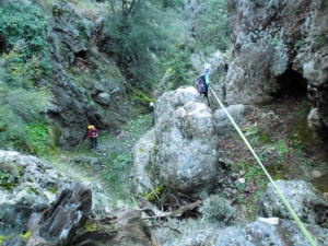
Pigaida is a long wooded gorge with very narrow passages ending at Zourva. Along its course there are several descents that need rope and make its crossing harsh.
The Gorge of Cyclamen or St George Gorge starts from the settlement Aletrouvari (altitude 300m), passes east of the village of Agios (St) Georgios and ends at the village Vandes (altitude 50 m).
The Gorge of Katsouna, near Vrysses, is believed to be the Xenia Street of Herodotus, according to who the guests of ancient Pergamos arrived through here in order to not have visual contact with the forts of the town. The length of the gorge is about one kilometer and starts from Vrysses to reach the entrance of the ancient city.
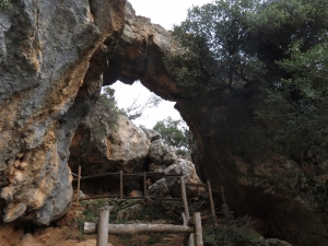
At the furthest tip of Akrotiri Cape there is the gorge of Diplochachalo. It is located close to the village of Chordaki, on the way to the famous beach of Stefanou. This is a small, stunning and purely technical canyon with 6 descents, 2 of which are quite high. It starts just below the quarry that dominates the area.

Kollita Gorges, i.e. Twin Ravines are located nearby the picturesque village Argyroupolis, about 22km southwest of Rethymnon city. They are named so, as they consist of two parallel canyons that end near Kato Poros settlement and is part of the E4 trail. The first canyon on the east is called Moudriano Gorge, while the west gorge is Kato Poros Gorge of Vilandredo Gorge, mostly known as the main Kollita Gorge.

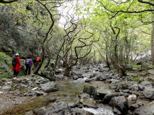
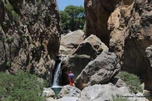
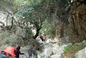
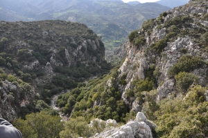
The gorge of Kotsyfos starts at Kannevos village and ends at Plakias. The starting point is very narrow with a width of about 10m, which gradually increases and reaches 600m. The total length is 1800m, and the almost vertical sides that reach a height of 600m. Inside the gorge, there is a small temple built inside a rocky cavity dedicated to Saint Nicholas.
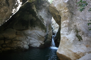
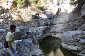
The Gorge of Swallows is located 33km south of town of Rethymno city, next to the famous beach of Preveli with the majestic palm grove and the stunning river. It starts close to the village Drymiskos, runs almost parallel to the canyon of Kourtaliotiko (that of Preveli) and ends at the beach of Drymiskiano Ammoudi. It’s name is taken after the the swallows that arrive in the area every summer.
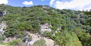
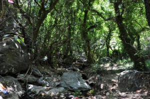
The Gorge of Arkadi starts just north of the Arkadi monastery and after a scenic route of 2 hours (some parts along the bed of the gorge as it is inaccessible), it ends near the village Pikris, where visitors can admire important Venetian architectural monuments. In the gorge of the exceptional natural beauty, the visitor has the opportunity to admire representative species of Cretan flora and fossils.
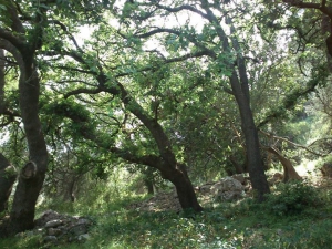
Approximately two kilometers northwest of the village Karines at position Faragi there is a small but impressive gorge, Kariniotiko Gorge. Kariniotiko canyon is completely unknown as the entire surrounding area is not included in the tourist routes. However, the surrounding area has exceptional natural beauty and hosts one of the most impressive oak wood of Crete with huge ancient trees.
Platys (i.e. wide) river is one of the rivers of foremost importance in Crete, flowing all year round. It gathers almost all water quantities of Amari Valley and leads them to the beach of Agia Galini. At a secret location between the settlements Agia Paraskevi, Vyzari, and Petrohori, the wide river gets narrow and forms two impressive ravines. The first is the small Mesa Faragi (inner gorge), reminding of the gorge of Kourtaliotis.
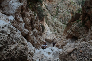
Gorge Smiliano or Kalamafka is located north of the village Ano Meros, about 100km southwest of Heraklion city. Through the gorge runs the Lygiotis river which is supplied by the valleys of Gerakari and the slopes of Samitos Mount. The canyon has a lot of water in winter and crossing it, by any means, is very tough.
The beautiful canyon Galliano starts southeast of Gallos and ends at the town of Rethymnon. It is 5.5km long and the walk is along a verdant ravine. Along the way we meet the mill of Saounatsides used till the 20th century, with traces of an old chapel next to it. In the gorge there is also the temple of St Anthony.
The lush canyon of Vederi starts from the village Fratzeskiana Metohia, passes next to the village Vederi and ends on the beach of Gerani (after 7km). The canyon has dense vegetation that makes trekking very difficult, as there is no footpath along its length.
Platania Gorge is located in the Amari valley, 38km southeast of Rethymno, on the western outskirts of Psiloritis. It is a unique trail, with impressive cliffs, vertical limestone rocks, rock roofs and caves. The trail is recommended for experienced mountaineers, although the first part of the trek is quite easy and well pathed, even for children who are physically fit.
Kollita Gorges, i.e. Twin Ravines are located nearby the picturesque village Argyroupolis, about 22km southwest of Rethymnon city. They are named so, as they consist of two parallel canyons that end near Kato Poros settlement. Here we refer to the easternmost gorge of Moundros.
Kissano Gorge is located 1km north of Kissos village, in Amari valley, and 34km southeast of Rethymnon, connecting the village το the small plateau of Gious Kambos. It is a short, but beautiful gorge, crossed by the rural road of the area.
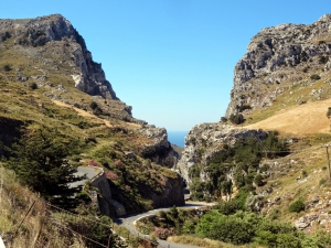
The canyon of Zoniana is located south of Zoniana village. Starting at an altitude of 950m, it ends at the village at an altitude of 650m. Through the gorge runs the "serpentine" Oaxis river that has water till spring. The gorge is easily accessible and safe for hiking, as its slope is small.
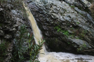
1.5km east of Spili, next to the main road connecting Spili to Agia Galini, you will meet the chapel of Agia Fotini, also known as Agia Fotia. Next to the road, you will find the springs of Agia Fotia, an old mill and a quite high waterfall (in winter).

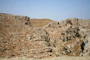
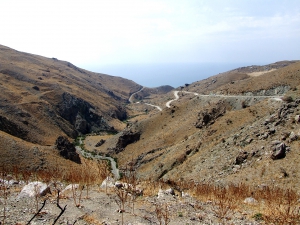
Achendrias gorge is located about 52km south of Heraklion, is approximately 8km long and ends on the beach Maridaki. It crosses the arid landscape of Asterousia Range that is characterized by bare mountains, sharp rocks and rough pasture lands. Throughout most of its length it is easily accessible and is dry in summer.
The Gorge of Agia Anastasia starts from Kenourgio Horio, Province Pediada (altitude 160m) and ending at the seaside settlement of Gournes. The name is taken after the cavernous chapel of St. Anastasia, located near its entrance. The vegetation is restricted to oleanders and the walls get narrow in several points. The descent of the gorge takes about three hours.
Also read:
- Home
 Beaches
 Nature
 Past
Past Destinations
 Highlights
 West Crete
- Central Crete
- East Crete
- Towns
- Chania Prefecture
- Chania
- Paleochora
- Kissamos
- Georgioupolis
- Chora Sfakion
- Loutro
- Rethymnon Prefecture
- Rethymnon
- Agia Galini
- Plakias
- Spili
- Anogia
- Heraklion Prefecture
- Heraklion
- Hersonissos
- Malia
- Matala
- Agia Pelagia`
- Archanes
- Kokkinos Pirgos
- Lassithi Prefecture
- Agios Nikolaos
- Elounda
- Sitia
- Ierapetra
- Makrigialos
- Palekastro
- Zakros
- Lassithi Plateau
- Get Prepared


