")


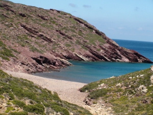
If you walk along the steep shores north of Maridati till Vai palmgrove, you will meet several small coves, totally secluded accessed only by boat or on foot (it takes 2:30 hours to reach Vai).The first beach you meet is called Kokkinos Kavos (Red Cape), named after the reddish soils of the area. The seabed is sandy and pebbly in places.
East of the main beach of Hiona, there are several small coves, where you can find a quiet place to swim alone and nude. The first sandy beach is called Bondalaki. Continuing driving along a bad dirt track to the esat, you will soon meet several coves with pebbles and enjoy the eerie landscape with gorges and wild mounts in the background. The last cove is Skaria and is the easternmost beach of Crete. It is highly affected by the sea currents (there is a lot of rubbish). The previous beach, Pilos, is formed in clay ground and is ideal for seclusion.
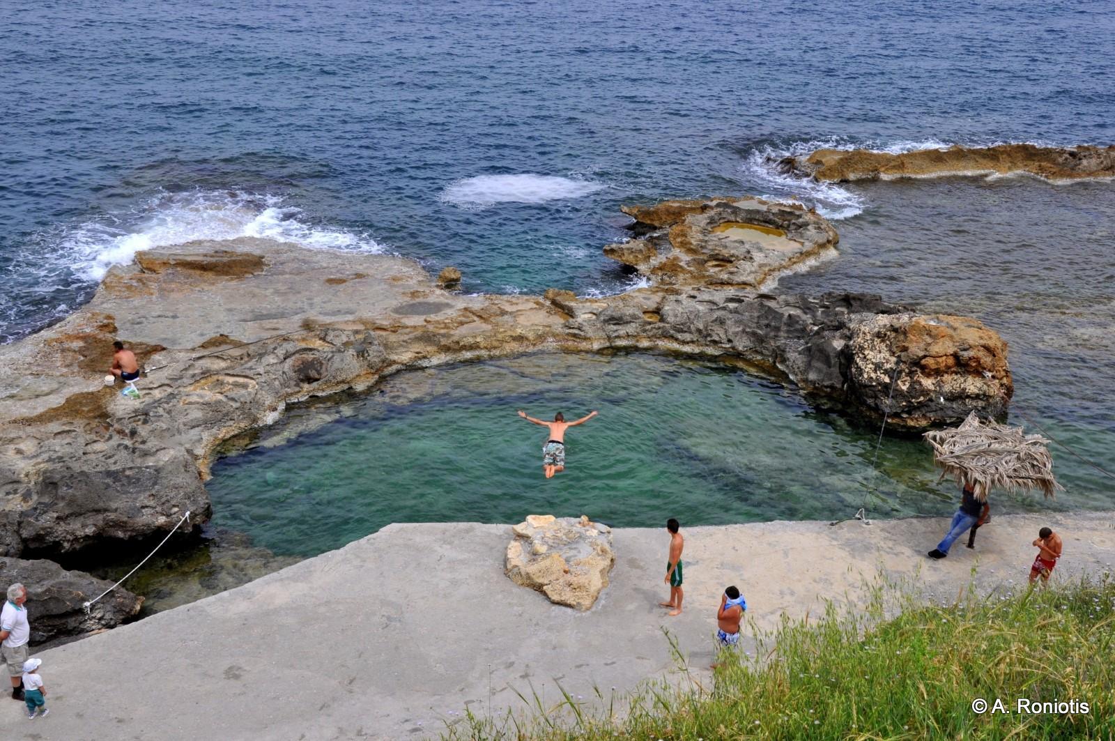
Kamarelles Beach, opposite the small islet of Marmaro and next to the ancient Roman Theatre, is an amazing sandy beach. It is very interesting to watch ancient pillars while snorkeling! On the south end of the beach, we meet two impressive natural arches, called Kamarelles.
500m east to Xerokambos you will find one of the weirdest landscapes on Crete. Here you will see a large dry lake next to the sea. You may not get very excited on summer, but if you come here in spring or in winter, you will understand why this is so important. In the winter Alatsolimni (Salt Lake), as it is called, is flooded with water, forming a small lagoon.
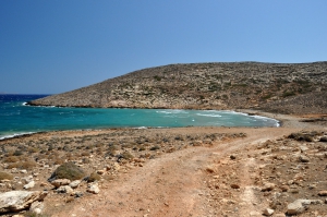
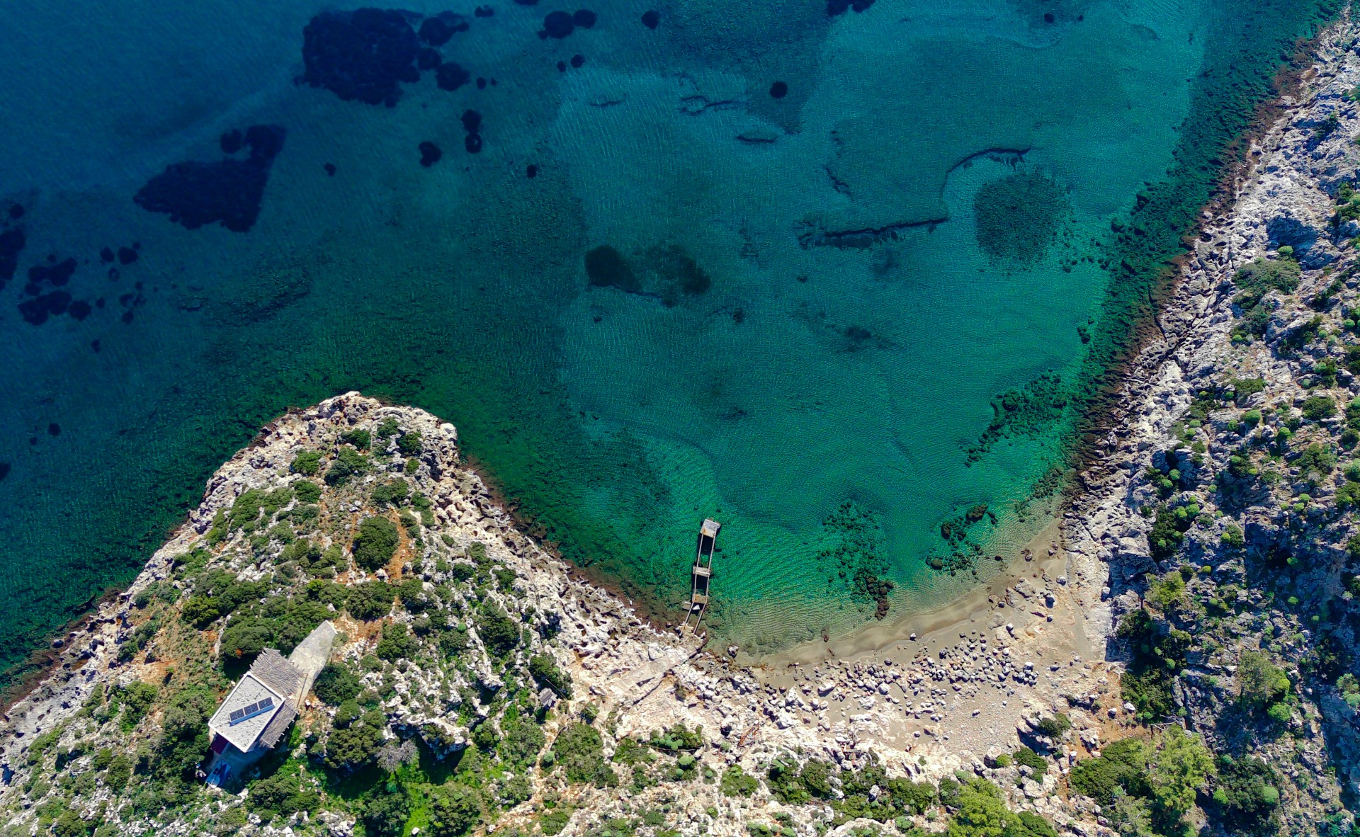
The first beach of Xerokambos (on the west) is the harbor of Amatos. A natural harbor with calm waters is formed there with several boats. The remote beach is pebbly and is ideal for fishing. There are 2-3 tamarisk trees and a ramp for launching boats. The road leading to the harbor from the settlement of Xerokambos is an accessible dirt road. From here starts the path to the beach of Agia Irini.
If you walk 1 hour east of Vlyhada beach at Livari (by Goudouras), you will soon reach the two deserted beaches of Tihida area. The area is full of caves and takes its name after the wall-like rocks (tihos in Greek) at the small beach, offering shade during summer.
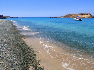
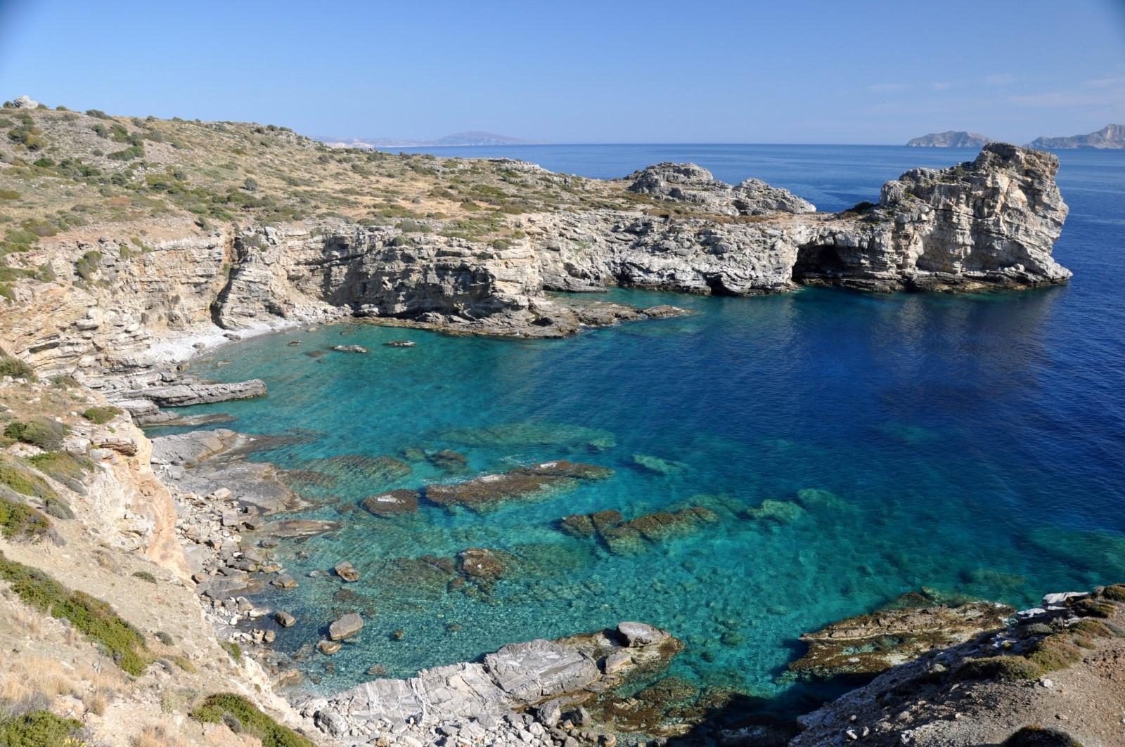
The longest beach at Koufonissi lies in the southeast part of the islet, overlooking Africa! Amazing clean water, rocky seabed ideal for snorkeling, and smooth sand ideal for playing beach tennis. The only problem is the lack of shade.
Kapsas Monastery is located 37km southwest of Sitia and 32km east of Ierapetra, between Makrigialos and Goudouras. It is a very old monastery built on the cliffs near the exit of the arid Pervolakia Gorge. To get here you can follow the paved road that links Makrigialos to Goudouras, but there are also (rare) bus services from Ierapetra.
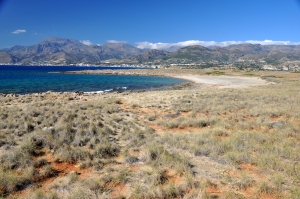
Psalidia means scissors in Greek and this name is taken after the shape of the bay. The surrounding area is very dry and is cover by low sand dunes and shrubs, but in September it turns to a paradise by thousands of white sand lilies. Moreover, if you walk to Lagada, you’ll meet many amazing rocks that are ideal for shooting photos.
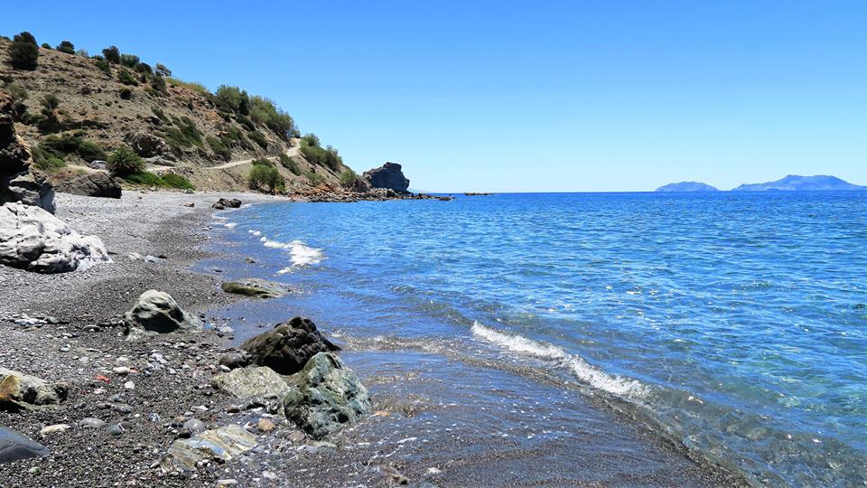
If you head 1km to the east of Myrtos you will meet the long beach of Sarikambos, that is more secluded, but the seabed becomes coarser. 2 more km on the east, you'll find a small bay next to the greenhouses of Nea Myrtos settlement. This is avoided for swimming due to the greenhouses that might pollute the water.

Opposite the bustling beach of Agia Marina, located to the west of Chania, are the islets of Agii Theodori, also known as Thodorou. To the south of the central island is a unique, extremely secluded beach
Just below the Sfakia fortress and inside the small harbor of Chora, you will find the beach of Ombrosgialos. It is minimally organized, has a southern orientation.
Agia Kyriaki is a picturesque corner of the city of Chania, located within the elegant and aristocratic district of Halepa. It borders the historic Tabakaria, where the old stone tanneries still stand.

Kladissos is a long sandy beach located in the area of Daratsos just 3 km west of the Venetian Port of Chania, opposite the islet of Lazaretta. The beach is formed west of the Kladissos River.
Vraskos beach is located in a secluded location at the exit of a small gorge between Koutalis and Almyrida, in the vicinity of Kokkinos Chorio. The wider area is full of fantastic caves.
Stavrolimni beach, also known as Stravolimni, is located at the northernmost tip of Gavdos. More specifically, it lies on the footpath that connects the beaches of Lavrakas and Pyrgos.

Stavromenos Beach lies just about 1 kilometer east of Sfakaki Beach and forms a natural continuation of the long coastline of Rethymno Bay.
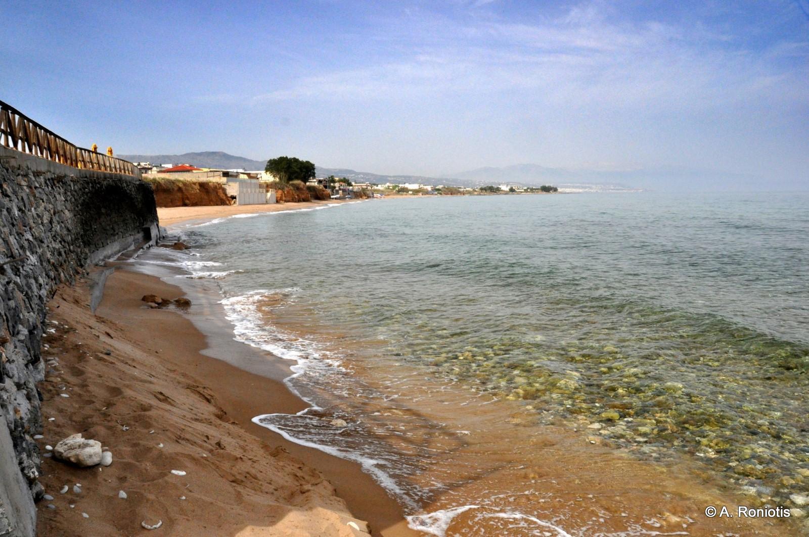
Sfakaki Beach is located right after Pigianos Kampos and forms part of the long stretch of Rethymno Bay and is renowned for its golden fine sand.
Finikidia beach is located in the territory of the village of Saktouria of Agios Vasilios, between Agia Galini and Agios Pavlos. It is formed near a stream, on the banks of which there is a fairly large cluster of Cretan palm trees (Phoenix theophrastii).
- Home
 Beaches
 Nature
 Past
Past Destinations
 Highlights
 West Crete
- Central Crete
- East Crete
- Towns
- Chania Prefecture
- Chania
- Paleochora
- Kissamos
- Georgioupolis
- Chora Sfakion
- Loutro
- Rethymnon Prefecture
- Rethymnon
- Agia Galini
- Plakias
- Spili
- Anogia
- Heraklion Prefecture
- Heraklion
- Hersonissos
- Malia
- Matala
- Agia Pelagia`
- Archanes
- Kokkinos Pirgos
- Lassithi Prefecture
- Agios Nikolaos
- Elounda
- Sitia
- Ierapetra
- Makrigialos
- Palekastro
- Zakros
- Lassithi Plateau
- Get Prepared


