")


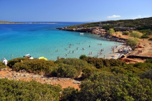
Kolokytha is a small island just opposite the Peninsula of Spinalonga, 12km north of Agios Nikolaos and close to Elounda. Opposite the island, there is the fantastic beach of Saint Luke, mostly known as Kolokytha. To access the beach you should first follow a scenic route: From the town of Elounda, follow the road leading to the East, along the shore. You will pass the old salt pans on your right hand, which now hosts many birds.
The last beach north of Agios Nikolaos, on the way to Elounda, is the beach of Katsikia (i.e. goats). The area is named after the many goat pens in the past. Similarly, Agios Nikolaos town was called Mantraki that means goat pen. Katsikia host a nice sandy beach with stones in a places, well hidden in front of the hotel Candia Park. To get there you should walk either across the hotel or around it.
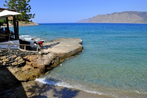
500m north of the legendary Mirabelo hotel you will find the tranquil beach of Havani, where a well organized municipal beach operates. In Havania there are options for accommodation and food. On the beach you will find a lifeguard and water sports. According to reports, during the years of Ottoman rule there was a small port and its remnants are still visible in the sea.
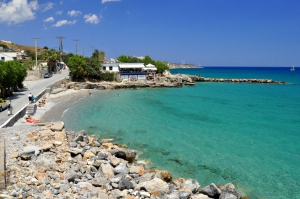
Ammoudi is located just 1km north of Agios Nikolaos city centre, in a large and well protected bay. It is a small sandy beach with shallow waters, which is preferred both by locals and visitors. It is hidden among large tamarisk trees and picturesque buildings, offering many options for accommodation and eating around. The beach has also water sport facilities.
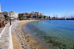
In front of the big tamarisk trees of the square Kitroplatia there is a small beach with sand and pebbles in places. Here you will find umbrellas and showers. Next to it there are many options for accommodation, food and drink. It is a perfect choice for children and anyone looking for a beautiful and clean beach, close to all amenities of a city.
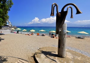
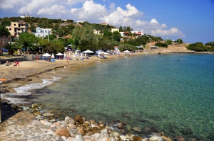
Ammos Beach is located 500m south of the center of Agios Nikolaos. It is a long beach which starts near the city's marina, at Nearchos Street. It runs near the stadium of the town and extends to the south, to the Municipal Beach. The part near the marina is a beautiful beach with umbrellas, sunbeds, showers, water sports, restaurants, and hotels around it. It is located near the city center and its stores. The water is shallow, ideal for little kids and the sea is usually flat.
The first beach you come across, next to the tavern Gargadoros is the main beach of the area. It is pebbly and well organized, a really good choice for those staying in Agios Nikolaos and wanting to escape from the ordinary things. From the main beach, if you walk till the small pier on the north, you will find the second beach from the other side (of the pier).
Almiros Beach is located 2.5km south of Agios Nikolaos and is the most popular beach in the city. It is shaped near the exit of the Almiros River, which empties on the south part of the beach. Next to the beach, the protected wetland of Almiros hosts several rare birds, towering eucalyptus trees, reeds, and some palm trees.
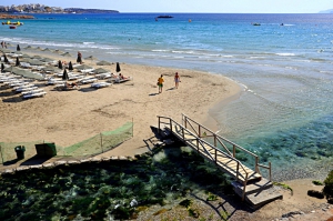
In front of the touristic settlement, there is a nice sandy beach with turquoise waters. The sea surface is mainly flat because the beach has an easterly orientation. while winds in Crete come mainly from the west. The beach is organized with umbrellas, sunbeds, and water sports.
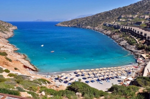
The beach is artificial and is formed in a narrow bay, which is very well protected from the winds. Only easterly winds could affect the area, but they are very rare in Crete. The beach has fine white sand, making the colors of the sea stunning. It is very well organized, because it is operated by the luxurious local hotel.
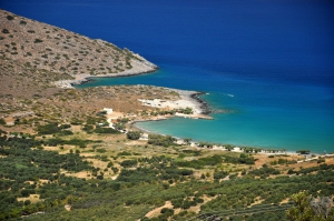
Istro(n) is located 12km east of Agios Nikolaos and 22km north of Ierapetra, very close to Kalo Chorio. It is a quiet village, situated in a lush valley full with olive groves and springs, which has been developed during the last decades. However, the development was fortunately mild, mainly due to the regional building restrictions because of the archaeological discoveries. The main growth driver of Istron is undoubtedly the emerald beaches which are scattered in three adjacent bays.
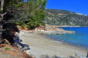
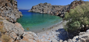
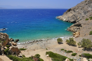
1km east of settlement Istron we meet a well hidden beach in a steep bay. The beach is called Pilos, but is widely known as Istron Bay, after the homonym hotel that is built on the steep slopes of the bay. While it seems as private, there is a path leading to the beach starting from the west of the hotel.
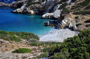
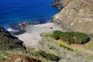
It is a small and secluded pebbly beach within a rocky bay. It is totally unorganized without any facilities. There is a nice cave in the sea, however the sea streams gather a lot of rubbish at the wider area. The next beach you'll meet is the beach with the abandoned camping site of Gournia. It is very secluded, but rubbish is very often due to the currents.
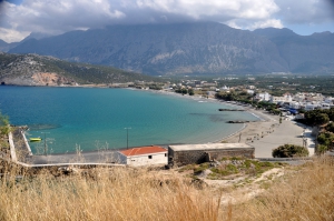
Pahia Ammos is located 20km east of Agios Nikolaos, on the road connecting Agios Nikolaos with Sitia and Ierapetra. It is a large village, built on the north side of the narrowest part of Crete, at the exit of a fertile plain with olive groves. The local beach and the sights of the surrounding area have contributed to the mild development of the village. In the village you will find small hotels, rooms and taverns.
To get there you should follow the dirt road that crosses the green meadows west of Kavoussi, known as Lakos Ambelion position, till the entrance to the gorge. From here begins a short path, not particularly difficult, leading after 10 minutes on the beach of Agriomandra. Just before you reach the beach you will see several small caves in the rocks.
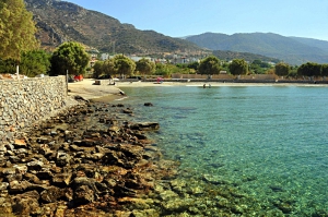
Tholos is located 26km east of Agios Nikolaos and 4km north of the village Kavousi. Locals might also call it Kavoussi beach, due to the nearby village. The beach is formed at the exit of a fertile valley, surrounded by huge olive groves and vine groves. The region has been touristically developed, but very mildly, being ideal for a relaxing holiday.
The village retains the traditional elements of Crete intact and is an ideal destination for a relaxing holiday. The villagers, mostly originating from the village Sfaka, are very friendly and you will feel very familiar with them on the first day. If you're lucky, you might meet some of the events organized by the locals, such as fishing contests.
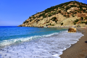
Richtis is located around 20km west of Sitia and 45 east of Agios Nikolaos, in the exit of the homonym Gorge of Richtis that starts from the village Exo Mouliana. In order to reach the beach you can follow the paved road starting from Exo Mouliana. Alternatively, you can trek in the lush gorge.
East of the beach of Richtis, you can see the rough and steep mount of Liopetro, which housed the fort of Liopetro (at the site of current Prophet Elijah chapel). Below Liopetro there is the very old church of St. John, accessible through a very bad road starting from the main road connecting Lassithi to Sitia (initially cement road).
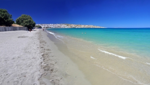
Sitia is the easternmost city on Crete and is located 64km east of Agios Nikolaos. The wider area of Sitia province hosts several small beaches where you can enjoy the sun and the sea. However, some who prefer to stay close to town, can visit the long city beach.
Also read:
- Home
 Beaches
 Nature
 Past
Past Destinations
 Highlights
 West Crete
- Central Crete
- East Crete
- Towns
- Chania Prefecture
- Chania
- Paleochora
- Kissamos
- Georgioupolis
- Chora Sfakion
- Loutro
- Rethymnon Prefecture
- Rethymnon
- Agia Galini
- Plakias
- Spili
- Anogia
- Heraklion Prefecture
- Heraklion
- Hersonissos
- Malia
- Matala
- Agia Pelagia`
- Archanes
- Kokkinos Pirgos
- Lassithi Prefecture
- Agios Nikolaos
- Elounda
- Sitia
- Ierapetra
- Makrigialos
- Palekastro
- Zakros
- Lassithi Plateau
- Get Prepared


