")


 Psaro Nero Gorge
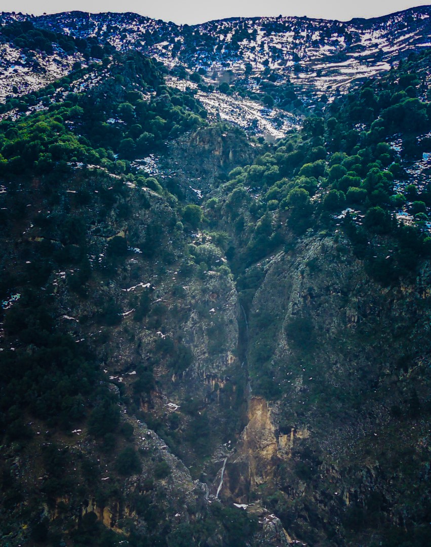
The plane of Embaros at the eastern part of the province of Viannos is surrounded by five majestic canyons, all tributaries of Baritis river which in turn flows into the river Anapodaris. All five canyons of Embaros are only accessible with canyoning equipment. The gorges are Psoraris, Eligas, Armihias, Psaro Nero and Erganos.
The shortest of them, but very beautiful, is the gorge of Psaro Nero also called Gaidarou Kolos (donkey's ass). Psaro Nero is formed just above Katofygi village. Its name is taken after the spring Psaro Nero, having water all year round and irrigating farmland in the local villages. Access to the upper entrance of the canyon is possible through a dirt road that connects the village Miliaradon to Omalos plateau. The entrance to the gorge is a few meters after the water springs of Koutsounara position.
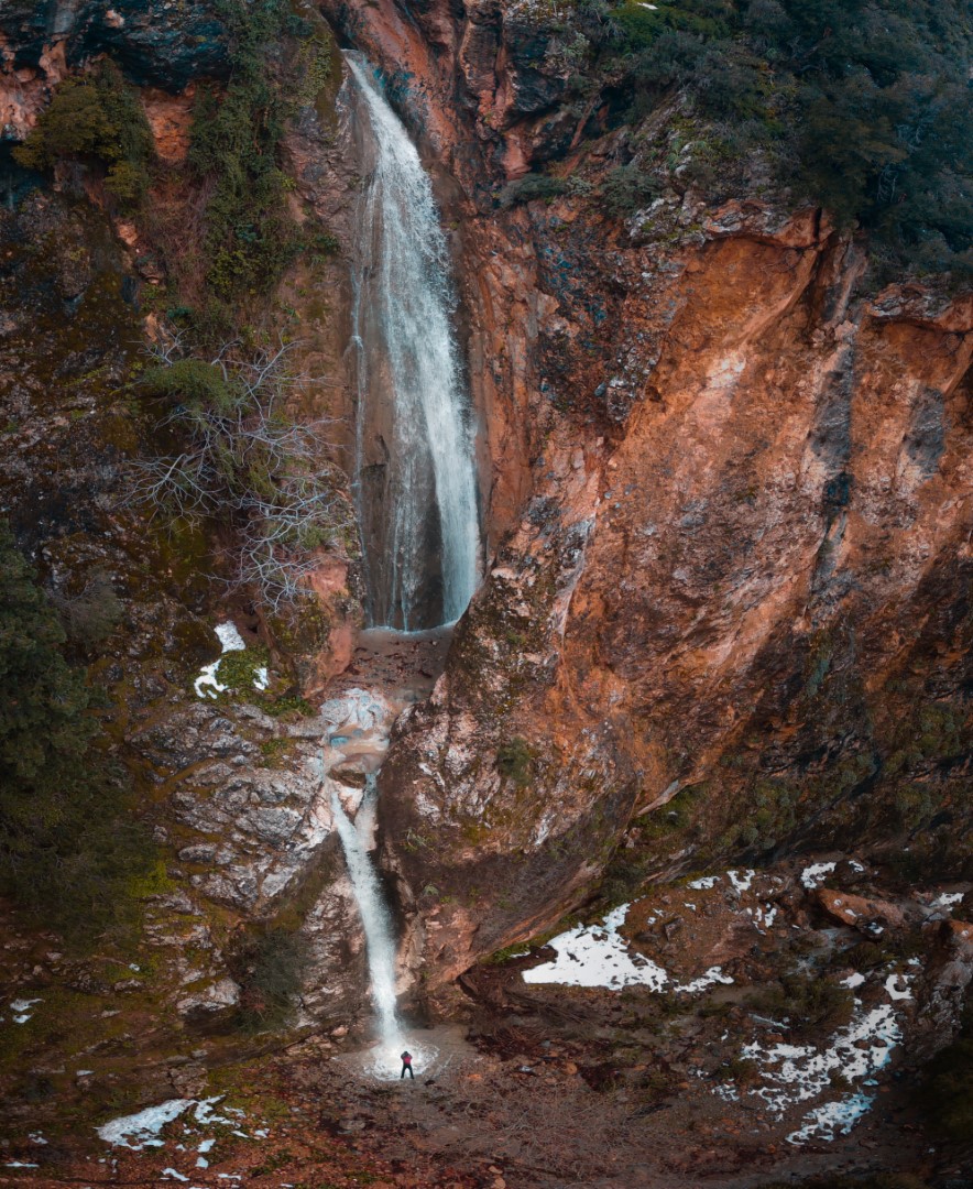
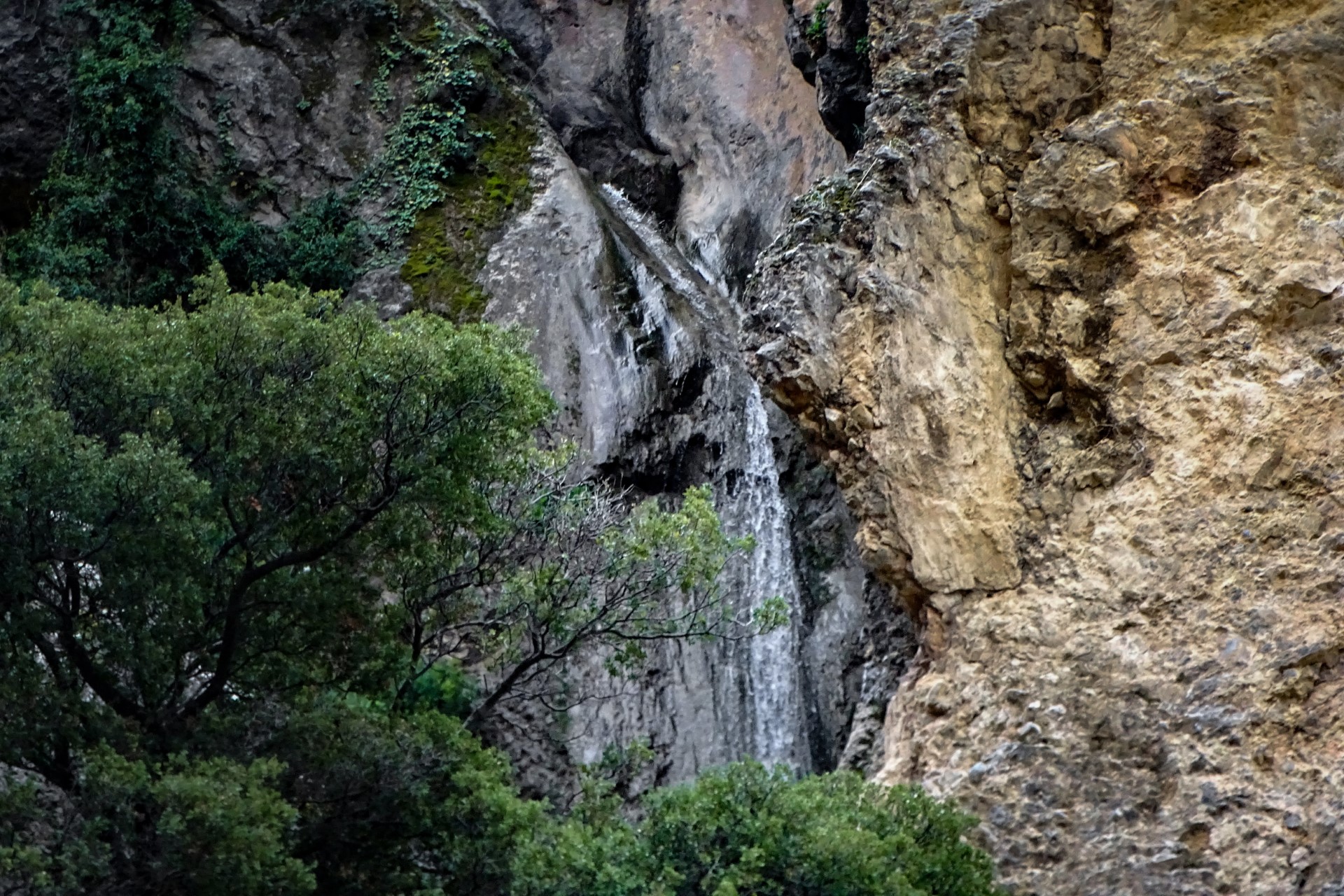
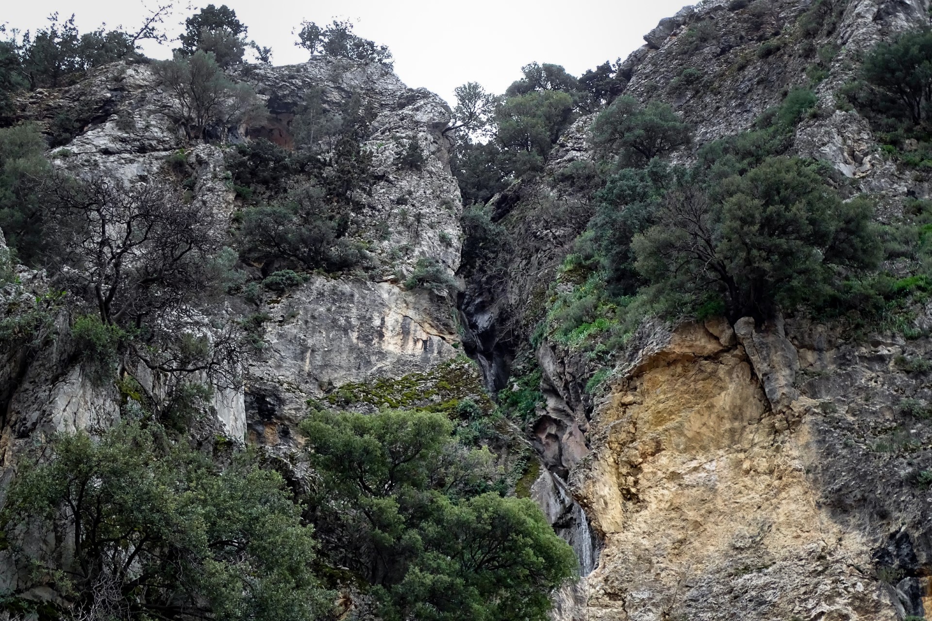
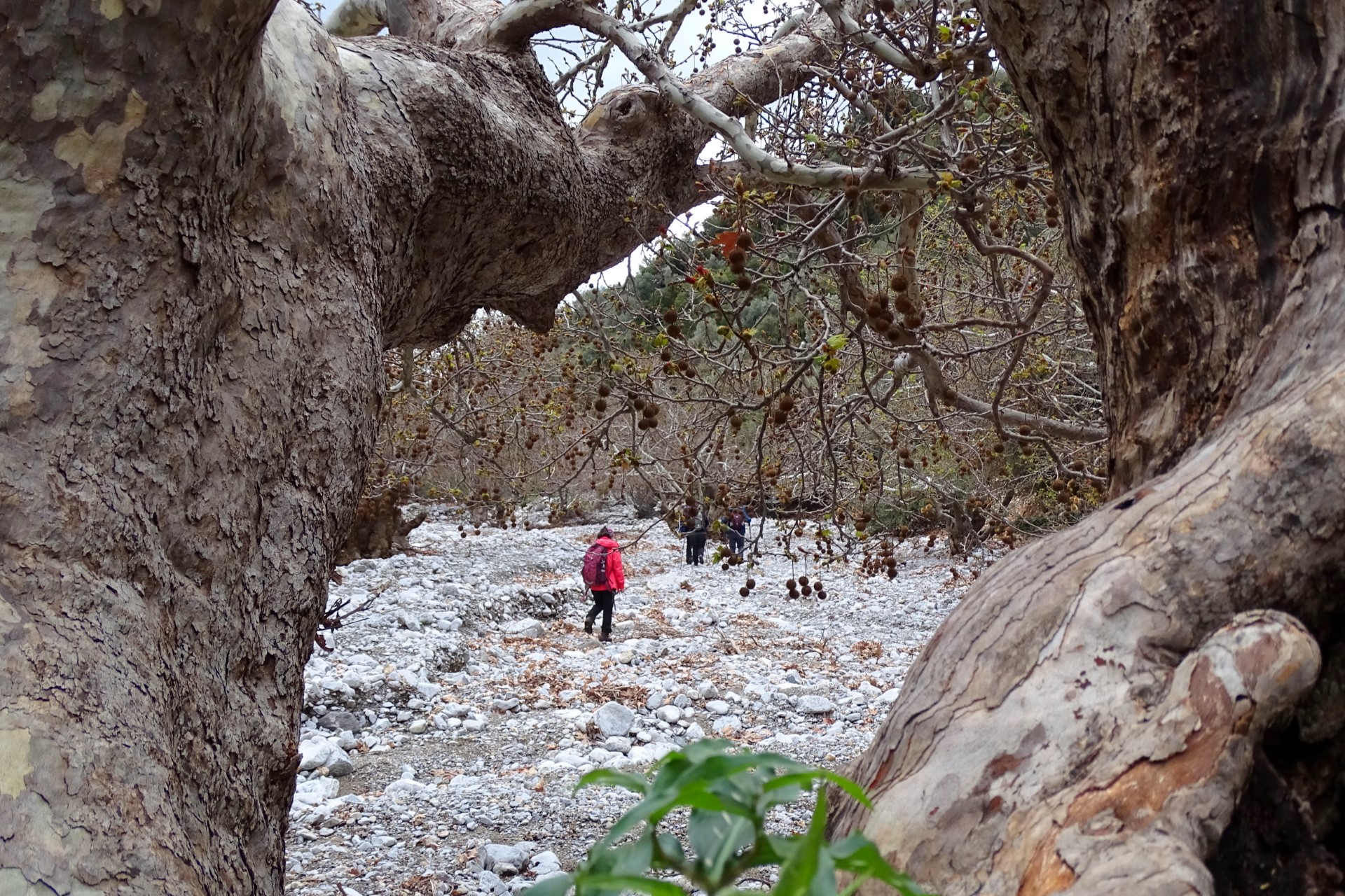
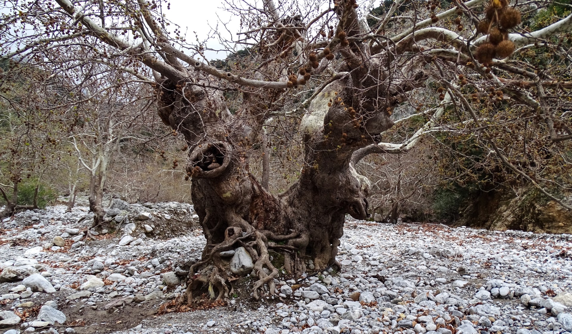
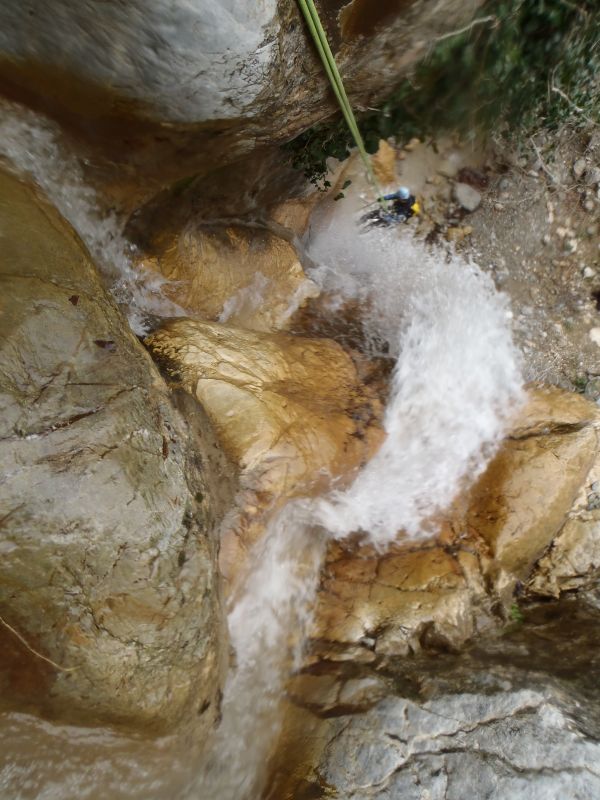
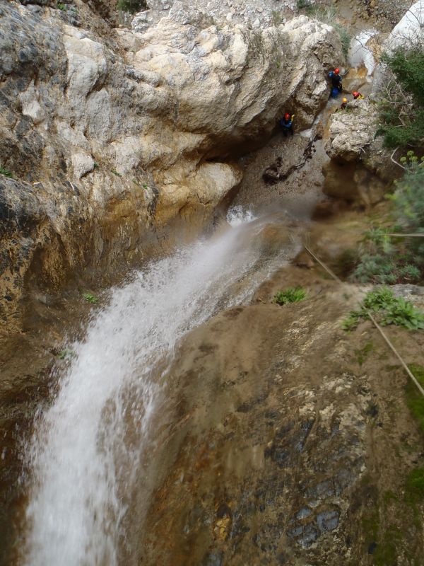
The ravine that opens after Koutsounára is that which later forms Psaro Nero Gorge, initially vegetated with oaks and plane trees. After descending the riverbed for half an hour the landscape suddenly changes dramatically and the gorge becomes really impressive. Overall the gorge forms about 10 waterfalls but the highest three are the last ones. The highest is 28m meters high and is truly perpendicular. The last part of the gorge is a natural wonder with the water having sculpted the stone.
The bolted gorge is very popular to canyoners in winter months because of the incredibly beautiful waterfalls. Even in summer, the lack of water emphasizes the beautiful colors of the gorge, with the highest fall having an incredible pinkish color. The exit of the gorge in Baritis river near Katofygi is full of ancient plane trees, forming one of the most extended platan woods in Crete.

What is near me?
Additional Info
- Length (km): 0.8
- Type: Canyoneering equipment needed
- Location: Heraklion Prefecture
- Water: Water till spring
- Difficulty (0-10): 6
- Altitude difference (m): 300
- Hiking Hours: 2
- Accessibility: Walking
- Maximum Rapel Height (m): 30


