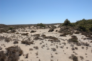
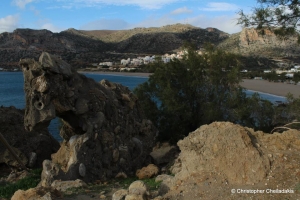
The geological formations of Crete reveal the long history of a landscape that continues to change. Tectonic movements raise or lower parts of the island, while water, wind and the sea erode the rocks and create new landforms.
Karst landforms are particularly widespread, developing through the dissolving action of water on limestone. Water enters cracks, gradually widens them and creates underground cavities and passages. Caves, shafts, sinkholes and grooves on exposed rock surfaces are different expressions of this process.
The same process, combined with the underlying tectonic structure, helps shape enclosed basins and plateaus. Small depressions, often called lakki in Crete, collect soil and moisture, creating conditions that differ from the surrounding rocky terrain. Sinkholes, locally known as choni, channel surface water into the underground drainage network.
Elsewhere, differences in the resistance of rocks to weathering and erosion produce natural sculptures, rock towers and cavities. Along the coast, former marine notches and sea caves now standing above the water record changes in relative sea level and uplift of the land.
These formations are part of Crete’s geological heritage and help explain how the present landscape developed. Observing and photographing them without carving, removing material or causing other damage allows us to appreciate them while preserving their integrity.