








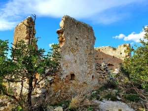
The koule of Kalonyktis is located on the hill of Agiasmatsi on the outskirts of the village of Kalonyktis in the province of Rethymno. This large tower was built by the Ottomans after the Great Cretan Revolution of 1866, being part of the large network of towers - koules - for the control of the Cretan revolutionaries.
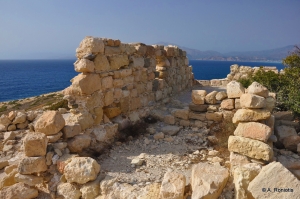
Koules of Matala is located on the hill Kastri above the famous beach of Matala. The access is very easy, as its very close to the path that heads to the Red Beach.
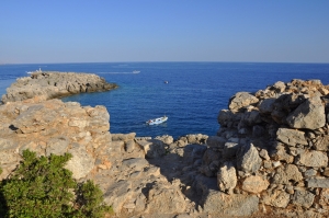
Most visitors of Loutro know about the fortress of Koules, which even today dominates over the village.However, they are unaware of the existence of a second fortress which is very easily accessible. The fortress of Kastella is located south of the village and next to the harbor where the big ships from Chora Sfakion stop.

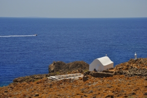
Between Loutro Sfakion and the famous beach of Glyka Nera, at Perlovakia, we meet the white brushed chapel of the Holy Cross (Timios Stavros) where a big feast takes place on September 14th every year.
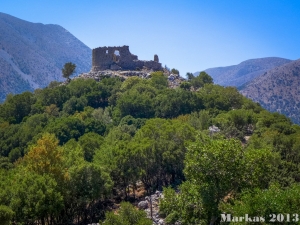
Askyfou Plateau, about 50km south of Chania city, is located in a strategic position and is formed on the passage that connects the southern shores of Sfakia to the north coasts of Crete. Sfakia did always breed great revolutionaries and the Turks always wanted to control them. Thus, in response to the Cretan Revolution of 1866, they began construct Koules, i.e. small castles, in the most important locations of Sfakia.
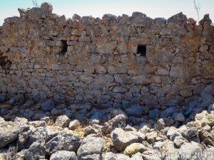
Here we meet the remnants of a small Koules (Turkish fort) that had visual contact with the koules of Agios Ioannis and Loutro. Almost nothing survives from the fort, apart from some wall foundations. Also, there are modern water cisterns, apparently built with material of the fortress.
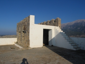
Besides the two Koules of Askyfou, several other Koules had been constructed in the present province of Sfakia in order to suppress the revolutions of the Sfakians.
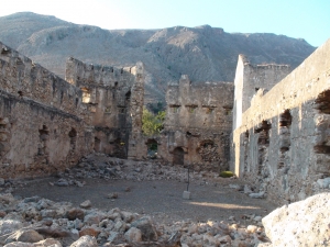
Above Loutro there are still the ruins of the Turkish fortress, Koules, which dominated over the current settlement. The building was built in 1868 and had two towers on west and east sides. It has rectangular shape and some of its walls survive. Outside the walls, there are big tanks surviving.
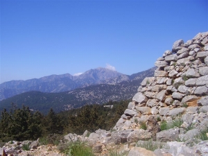
The Koules of St. John still stands deserted, while the visitor still sees the cisterns for storing water. The place can be accessed via a trail crossing the beautiful landscape with cypress trees and the views of the Libyan Sea.
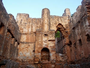
On the west side of the exit of Samaria Gorge, above the current village of Agia Roumeli, the Turks built the Koules of Agia Roumeli to suppress the rebels hiding in the gorge. This Koules is in quite good condition. There were three more towers in wider area of Agia Roumeli (in Skoteini, Aggelokambos and Sideris positions)
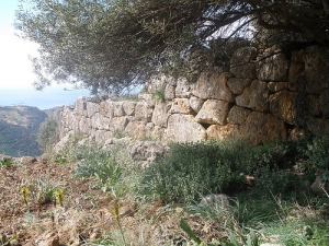
Here we meet one of the many koules (Turkish forts) that were built by the Turks in Selino district so as to control the surrounding slopes and valleys.
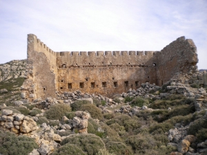
The Koules of Spaniakos controlled the valleys, the passages and the towering peaks around it, while on the south lies the Libyan Sea. It had a very important role in the suppression of the revolution of 1866-1869.
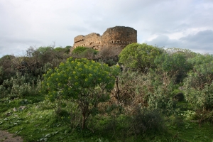
The Koules in Nio Chorio is located in the middle of Apokoronas Province, about 25km southeast of Chania and close to the village of Nio Chorio. On the hill of the fort leads a road starting from Nio Chorio. The fort is not well preserved, with only a few walls standing and commemorating its glorious past.
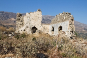
One of the many Turkish towers (Koules) built by the Turks in Crete is that of Plakias at South Rethymno. It was built on a hill of conglomerate grounds, with steep cliffs at its east and south sides, inside a fortified enclosure.
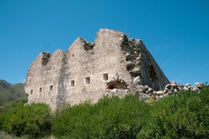
The most important passage of Rethymnon prefecture was that of Agios Vasilios (south), through where Turks and Greeks traveled from Mesara plain to Sfakia area. Thus, several towers (kouledes) were built. Such one Koules was built near the entrance of the gorge Kourtaliotis, near the village Koxare. The tower was partially destroyed by the Cretan rebels in 1896.
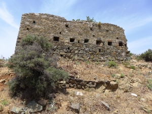
At the eastern edge of the valley of Amari, two towers were built, the Koules of Vathiakos and Lochria. The Koules of Vathiakos, built on the hill south of the village, served a dual purpose. First, it controlled the passages to Messara.
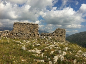
One of the many defensive towers (koule) built by the Turks at the strategic places that controlled the passages between the different regions of Crete and was the Koule of Meronas, next to the current church dedicated to Prophet Elijah. The point has panoramic views to the valleys of Amari and Potami. The Koule survives in bad condition.

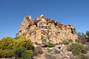
Fodele area was a very important passage during the Venetian and Turkish Era, which made the occupiers build towers and forts at almost every peak. The Turks wanted to fully control the passage of Fodele and simultaneously monitor the bay (the current beach of Fodele), where the Greek ships often beached for supporting the rebels.
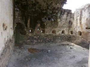
At the small valley of Kamares - Grigoria - Magarikari were the Koules of Grammeni and the Koules of Kremastos. The first was built between Grigoria and Magarikari, next to the current road. It is in good condition, with almost all of its roof surviving.
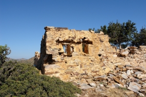
One of these Turkish Towers was built at the position Kelia, just above Fodele beach (south of the beach) overlooking the sea. Today some ruins of the fort remind of its glory past, although completely abandoned by the local government. Next to it, we meet the chapel dedicated to Saint John, which once served as a monastery. The cells (kelia) of the monks gave their name to the area.
- 1
- 2
Also read:
- Home
 Beaches
 Nature
 Past
Past Destinations
 Highlights
 West Crete
- Central Crete
- East Crete
- Towns
- Chania Prefecture
- Chania
- Paleochora
- Kissamos
- Georgioupolis
- Chora Sfakion
- Loutro
- Rethymnon Prefecture
- Rethymnon
- Agia Galini
- Plakias
- Spili
- Anogia
- Heraklion Prefecture
- Heraklion
- Hersonissos
- Malia
- Matala
- Agia Pelagia`
- Archanes
- Kokkinos Pirgos
- Lassithi Prefecture
- Agios Nikolaos
- Elounda
- Sitia
- Ierapetra
- Makrigialos
- Palekastro
- Zakros
- Lassithi Plateau
- Get Prepared


