








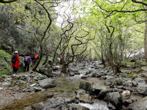
Kollita Gorges, i.e. Twin Ravines are located nearby the picturesque village Argyroupolis, about 22km southwest of Rethymnon city. They are named so, as they consist of two parallel canyons that end near Kato Poros settlement and is part of the E4 trail. The first canyon on the east is called Moudriano Gorge, while the west gorge is Kato Poros Gorge of Vilandredo Gorge, mostly known as the main Kollita Gorge.
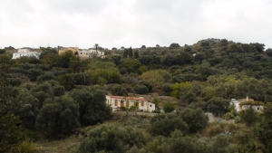
The route starts from Kissamos and is the first part of the European E4 trail in Crete. After crossing the villages Kato Palekastro, Korfiano and Grigoriana, we arrive at the ancient city of Polirinia and from there we cross the lush green villages Galouva, Lusakies Zahariana and, finally, Sfinari with the beautiful beach.
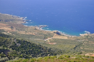
This part of the European trail E4 starts from Sfinari and ends at Chrisoskalitissa. It is one of the most beautiful and wooded parts of Crete with astonishing sea views. First we go through the desolated village Ano Sfinari, then Kambos, Plagia and Keramoti.
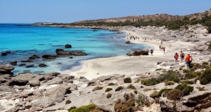
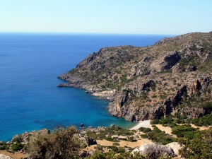
This amazing hike is about 16km long and takes about 5-6 hours. The trail is clear and well-marked with the typical E4 back-yellow signs. It crosses the archaeological site of Lissos, where you can find water from the local spring. It isn't too difficult but plenty of water, sun protection, and steady shoes are recommended.
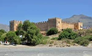
The part of the European path E4 that connects Chora Sfakion with Frangokastelo and then with Rodakino is all on paved road and can be visited even by car.
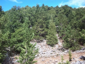
Starting from Sougia, apart from the gorge of Agia Irini, we can choose the alternative route that comes through the beautiful settlement Koustogerako. Then the trail continues and crosses the pine wood by Olisma and conludes at Seliniotikos Gyros, i.e. the southwest passage to Omalos Plateau.
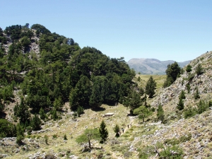
Some of those who cross the gorge of Agia Irini, start their course from the plateau Omalos and reach the village of Agia Irini, before entering the canyon via the E4 trail. The trail has amazing views to the groves with the full of the typical cypress trees of the White mountains.
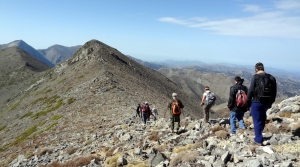
One of the most mystical and most demanding paths of Crete is the European trail E4 crossing of Mountain Desert of the White Mountains. Crossing the White mountains usually takes three days. The proposed route starts at the plateau of Omalos and the first night is spent at Refuge Kallergis.
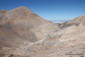
This is probably the harderst part of the entire Cretan E4 path, but also one of the most amazing sceneries you could ever imagine. The signing of E4 with poles and brushed marks is quite sufficient, but we have to be careful for not losing our directions. This course has some steep passages, thus it is not suggested to cross it in winter when snow is high.
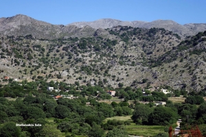
This part of the E4 European path runs along the main paved road connecting Askyfou with Asfendou and Kallikratis villages. The road crosses the scenic and wild east part of the White Mountains and has amazing views to their core to the west. It is suggested that you visit the path with a car.
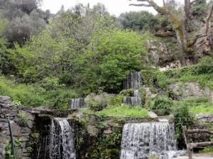
This section of the E4 European path is the last running on the east White Mountains and is entirely on a paved road. The road connecting Kallikratis village to Asi Gonia then heads to Argiroupolis. The views of the surrounding mountains and valleys and the lush green area of Argiroupolis Springs are the highlights of this route. As the path runs along a paved road, it is suggested that you visit it by car.
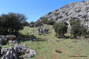
This part of the E4 path has as its main feature the ascent of Mount Kryoneritis, which has panoramic views of the northern and southern coast of Crete. The course continues north and ends at Alones village.
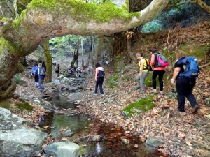
The branch of the European path E4 that descends from Kryoneritis heads northwards to meet the north E4 branch coming from Argiroupolis. This part of the route offers a nice stroll in lush green ravines and the ghost village of Nissi near Moudros and Kato Poros.
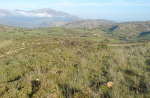
The area of Moundros hosts two different trails which are parts of the E4 European trail. The one heads to the east and after crossing the position Nifis Potamia heads to the village Agouseliana. The entire trail is via paved and dirt track, being an ideal cycling route.
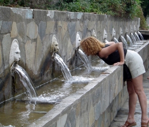
This trail starts from Agouseliana, comes north of the villages Katsogrida and Atsipades, passes through Koxare, meets the upper entrance of Kourtaliotiko Gorge, crosses Mixorouma and Dariviana, and stops at Spili. It is very easy, as it is mostly on paved and unpaved roads.
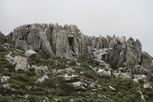
The route starts from Spili, reaches the spring of Agia Fotia, and then ascends to Kissos. It comes above the Monastery of the Holy Spirit and climbs to the summit of Mount Kedros (1776 m.). From there we go back and meet the trail that leads to the Church of the Prophet Elijah and descends to Gerakari. This route is a part of the European E4 trail.
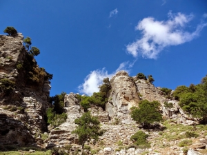
From Gerakari the European E4 trail continues for Elenes and then to Amari. Then it comes through the villages Opsigias, Petrohori, Vizari and Fourfouras. From there it ascends to Psiloritis Mount, via road (up to 760m. altitude) and trail, to reach the mountain shelter of Toumbotos Prinos. The route runs through a wooded and rough landscape, with mainly oak trees.
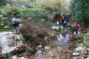
This route offers some nice views of the fertile hinterland of Rethymnon, mainly using dirt and paved roads. The route starts from Agios Konstantinos, crosses Kalonihtis and Ano Valsamonero, before reaching Monopari, then Kastelos, and finishes at Armeni Minoan necropolis.
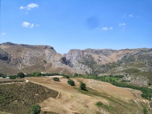
This part of the European trail connects Armeni to Arkadi, with its highlights being the Minoan Peak sanctuary of Vrissinas, the valley of Potami dam and Prasses gorge and finally the historical monastery of Arkadi. Due to being quite long, the route an be divided in two parts, from Armeni to Prasses and from Prasses to Arkadi.
Also read:
- Home
 Beaches
 Nature
 Past
Past Destinations
 Highlights
 West Crete
- Central Crete
- East Crete
- Towns
- Chania Prefecture
- Chania
- Paleochora
- Kissamos
- Georgioupolis
- Chora Sfakion
- Loutro
- Rethymnon Prefecture
- Rethymnon
- Agia Galini
- Plakias
- Spili
- Anogia
- Heraklion Prefecture
- Heraklion
- Hersonissos
- Malia
- Matala
- Agia Pelagia`
- Archanes
- Kokkinos Pirgos
- Lassithi Prefecture
- Agios Nikolaos
- Elounda
- Sitia
- Ierapetra
- Makrigialos
- Palekastro
- Zakros
- Lassithi Plateau
- Get Prepared


