







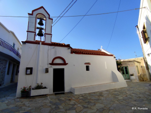
A few meters from the central square of the village Stavrochori (formerly Stravodoxari) in the province Ierapetra is the oldest neighborhood of the village, Mesochoria. In the square of Mesochoria, where narrow picturesque alleys lead, is the two-aisled church of Saint George and Panagia.

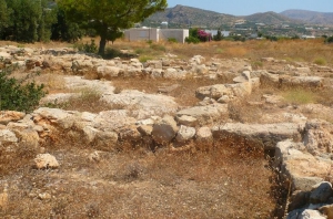
The very quiet area of Makrigialos with the plain and the sheltered beach could not be ignored by the Minoans, who left important traces of habitation. The main finding is a rural mansion, a miniature Minoan palace in position Plakakia, found in 1971 by Kostas Davaras.

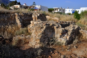
The fertile valley and the sheltered harbor of Makrigialos was an ideal location for its habitation throughout the ages. One of the relics of the past is the Roman villa which was unearthed at Katovigli position in 1977, above the current port of Makrigialos, by the archaeologist N. Papadakis. Earlier, looted graves and a headstone of the 4th century AD were found on site.

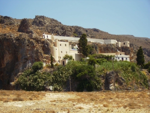
The Monastery of St. John in Kapsas is located 9km east of Makrigialos next to Goudouras. This is owned by Toplou Monastery, near Sitia, and is dedicated to the Beheading of St. John the Baptist, celebrated on August 29.

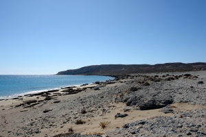
The beautiful beachfront facing east and extending from the northernmost point of Koufonisi to the small well beneath the outpost of the island is called Anemertia. Anemertia's northern part is sandy, while the south is mainly rocky.

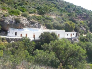
In a lush green ravine formed between Analipsis and Pefki we meet the former monastery of St. George of Samakidis. The church celebrates on November 3rd and is built in a cave. According to tradition, in 1471 Joseph Samakidis, who lived in the monastery of Panagia Kera by village Pilalimata left his monastery due to pirate raid.

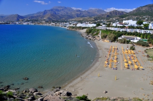
Lagoufa is located right after the east end of Makrigialos main beach, around 59km southeast of Agios Nikolaos and 24km east of Ierapetra. It consists of two adjacent protected coves, which are formed near the big hotels of Makrigialos.
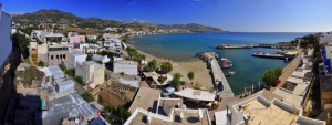
Being initially a humble harbor with no roads in the ‘50s, Makrigialos has faced strong growth and has become the largest tourist destination in the region. It actually consists of two settlements, Makrigialos and Analipsi, which are now united.
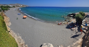
Kalamokanias is located 57km southeast of Agios Nikolaos and 22km east of Ierapetra, on the west side of Makrigialos settlement. It is located on the west side of the hill that rises behind the harbor area. It takes its name after the migratory bird stilt (Himantopus himantopus) that has red legs and body reminding of a miniature stork and stops in the local streams.
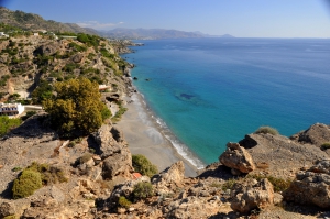
Agia Fotia, one of the favorite beaches of all Cretans, is located 45km southeast of Agios Nikolaos and 12km east of Ierapetra. It is a small bay formed at the mouth of a small stream that descends from the surrounding mountains. The settlement takes its name after the local Church of Agia Fotini (or Agia Fotia). The area is hidden in plane trees and tamarisks, while the bay is surrounded by high mountains and cliffs that create a magic scenery.

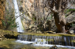
The Gorge of Mylonas or Agios Ioannis is located 18km east of Ierapetra. It starts near the village Agios Ioannis, at an altitude of 500m, and ends at the beach of Kakia Skala.
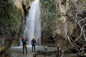
Nearby the lush green and full of water springs Orino village we meet one of the most steep rivers of Crete. Its springs are located high on the plateau Abelia on the slopes of Thripti and Papouri mounts. They shortly form a river which crosses the village square and enters the rugged canyon of Orino.

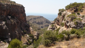
The Gorge of Pefki (Pefki means Pines) is one of the most beautiful small gorges of Crete, with amazing rock formations shaped by the natural forces and with lush vegetation. The length of the gorge is 4.5 km and the elevation difference of the entering point and the exit reaches 300 meters.The gorge starts south of the village Pefki and ends in Aspros Potamos dorp, 2km north of Makrigialos.
Also read:
- Home
 Beaches
 Nature
 Past
Past Destinations
 Highlights
 West Crete
- Central Crete
- East Crete
- Towns
- Chania Prefecture
- Chania
- Paleochora
- Kissamos
- Georgioupolis
- Chora Sfakion
- Loutro
- Rethymnon Prefecture
- Rethymnon
- Agia Galini
- Plakias
- Spili
- Anogia
- Heraklion Prefecture
- Heraklion
- Hersonissos
- Malia
- Matala
- Agia Pelagia`
- Archanes
- Kokkinos Pirgos
- Lassithi Prefecture
- Agios Nikolaos
- Elounda
- Sitia
- Ierapetra
- Makrigialos
- Palekastro
- Zakros
- Lassithi Plateau
- Get Prepared


