")


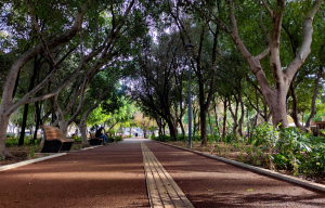
Georgiadis Park is the largest green space in the city of Heraklion. It has been formed next to the Venetian Walls and is bounded by Dimokratias Avenue, Harilaou Trikoupi Street and the Vigla area.

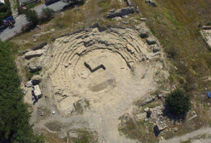
The current city of Ierapetra is built on the site of the ancient city of Ierapytna. Its current name Ierapetra was preceded by other names such as Kyrva, Kamiros, Pytna, and Ierapytna.

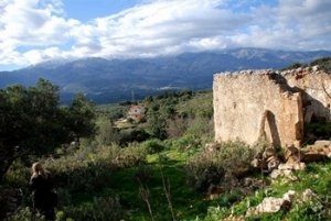
The tower of Aga at Tsifliki is located in a privileged position in Elounda lagoon, on the road leading to Plaka. In fact, the settlement Tsifliki owes its name to this residence, which was the base of the chiftlik (Turkish system of land management) of the region.

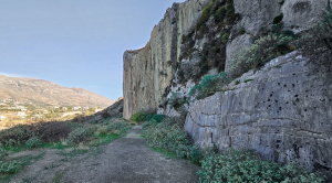
At the eastern end of the sandy beach of Plakias, at the base of the Karavos peninsula, the impressive limestone rock of Paligremnos is formed. Paligremnos is a geological fault with a great height and extremely smooth surface that exceeds 80 meters.

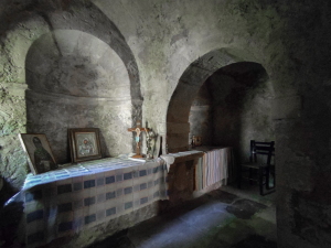
The cavernous church of St. Anthony (Agios Antonios), maybe a former monastery, is located above the starting point of the gorge of Kato Asites, at a beautiful green location with plane trees and springs.

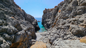
Pikrovlychada (or Petrovlychada) beach is formed at the exit of a small steep canyon with technical descents that starts at an altitude of about 900 meters south of the village Ethia.

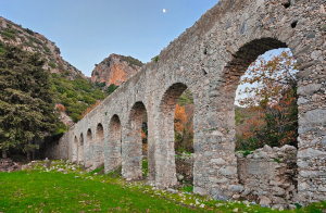
The watermill of Agia Fotia is located below the church of Saint Photini (Agia Fotia), at the exit of the Agia Fotia Gorge at the foot of Mount Vorizis and very close to Spili.

- Home
 Beaches
 Nature
 Past
Past Destinations
 Highlights
 West Crete
- Central Crete
- East Crete
- Towns
- Chania Prefecture
- Chania
- Paleochora
- Kissamos
- Georgioupolis
- Chora Sfakion
- Loutro
- Rethymnon Prefecture
- Rethymnon
- Agia Galini
- Plakias
- Spili
- Anogia
- Heraklion Prefecture
- Heraklion
- Hersonissos
- Malia
- Matala
- Agia Pelagia`
- Archanes
- Kokkinos Pirgos
- Lassithi Prefecture
- Agios Nikolaos
- Elounda
- Sitia
- Ierapetra
- Makrigialos
- Palekastro
- Zakros
- Lassithi Plateau
- Get Prepared


