")


 Havgas Gorge (Katharo) at Lassithi Plateau
Havgas Gorge is the unique long gorge in the Lassithi Plateau and is formed between the peaks Katharios Lakkos (1190m) and Katharia Kefala (1269) of the Range Dikti. The river Megalos or Xenikos coming through the gorge collects water from the plateau Katharo, runs across Lassithi Plateau and moves them in the sinkhole Chonos. Then, the water comes out from Fleves springs at Kastamonitsa or an artificial water pipe at Gonies and then through the river Aposelemis reaches the dam lake of Aposelemis. The name havgas and some corruptions (such as havgoudi) is a common name in gorges in East Crete; it means gorge.
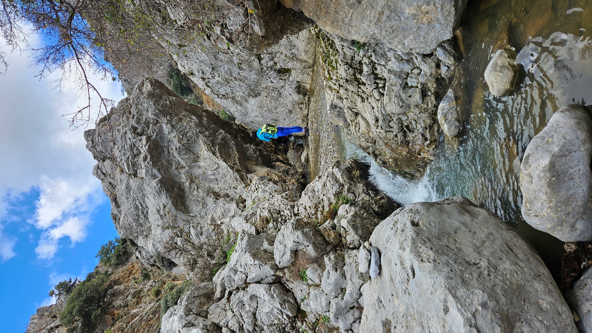
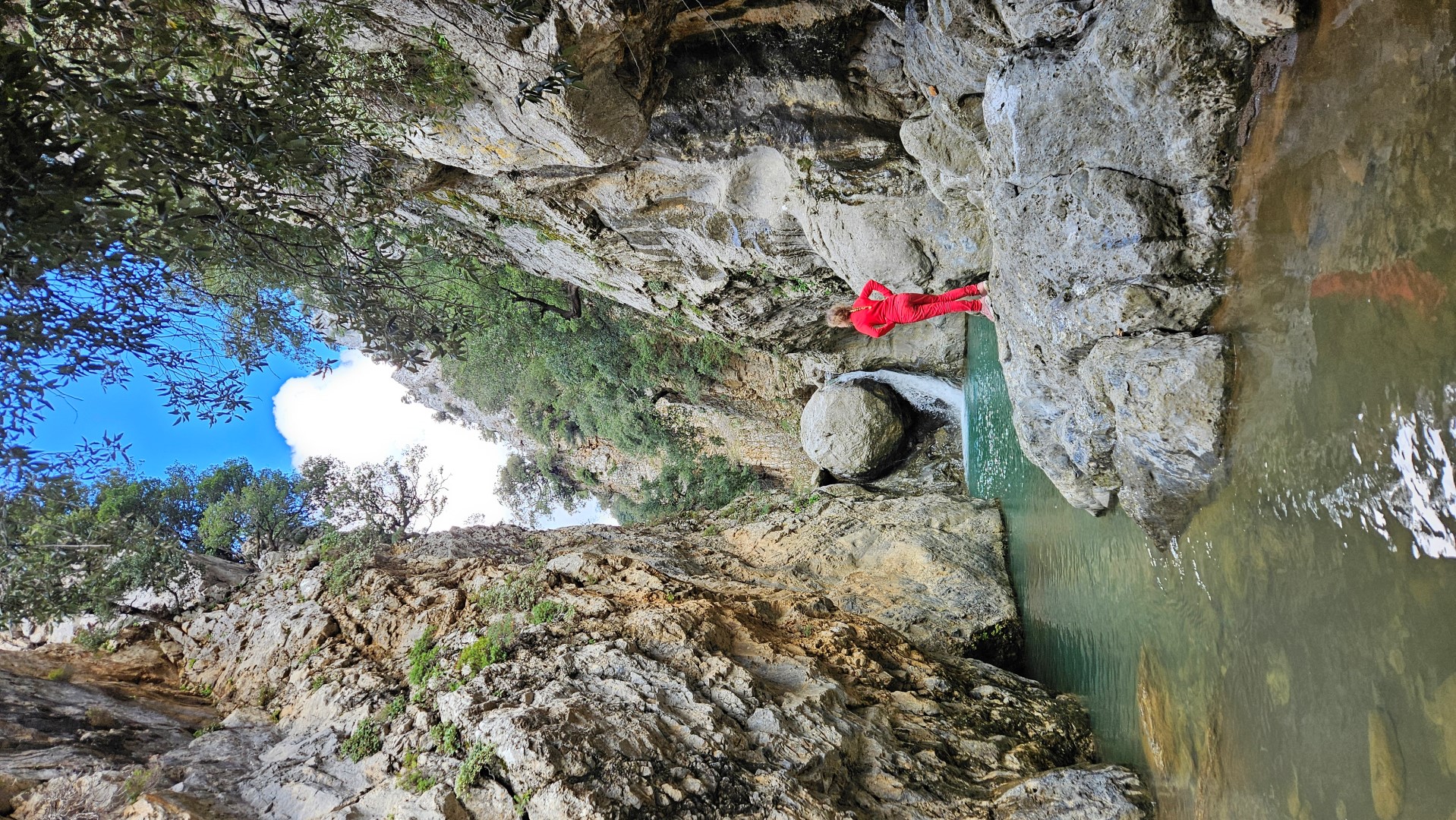
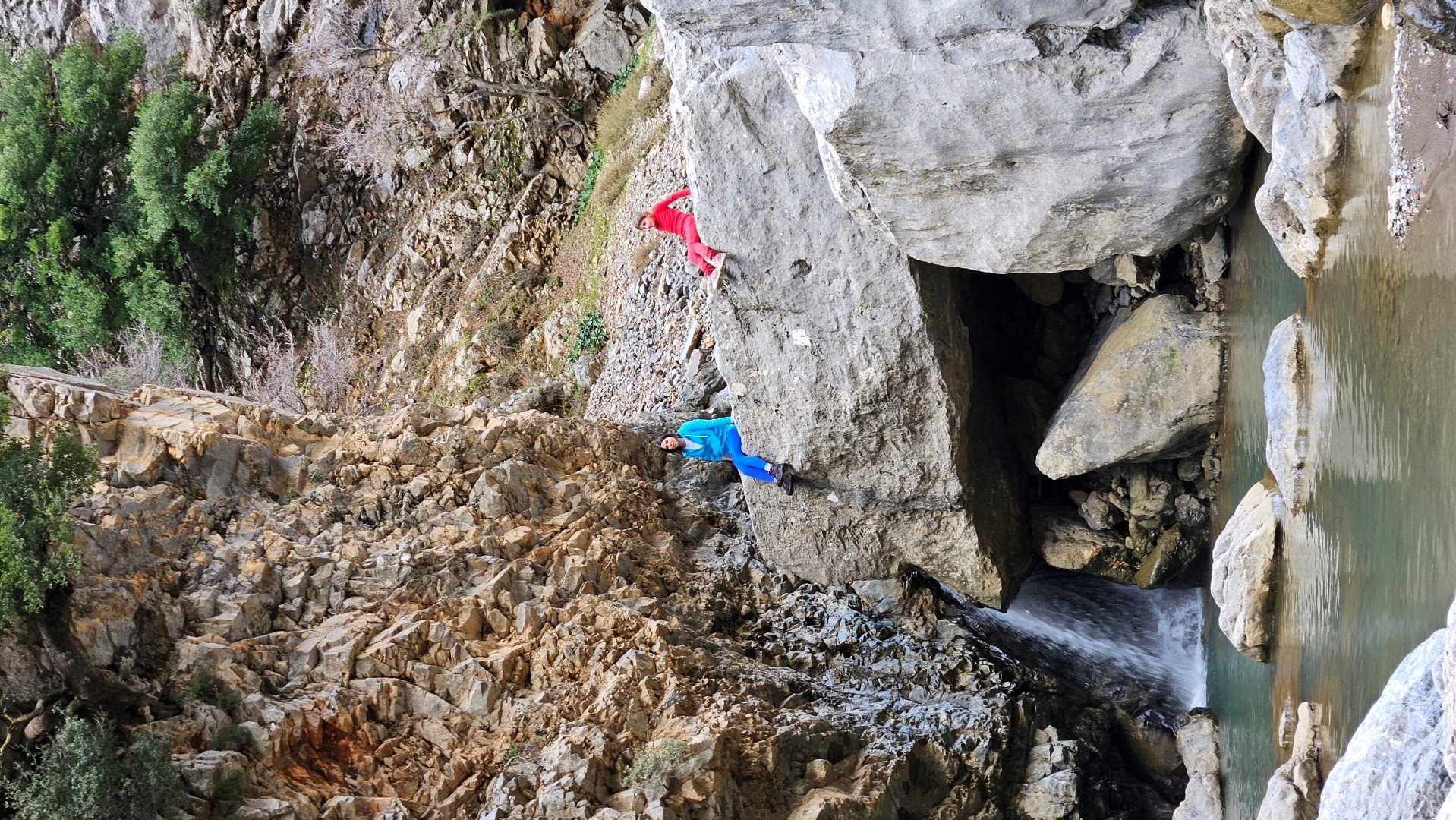
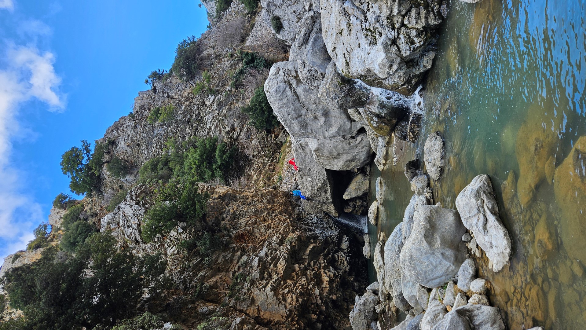
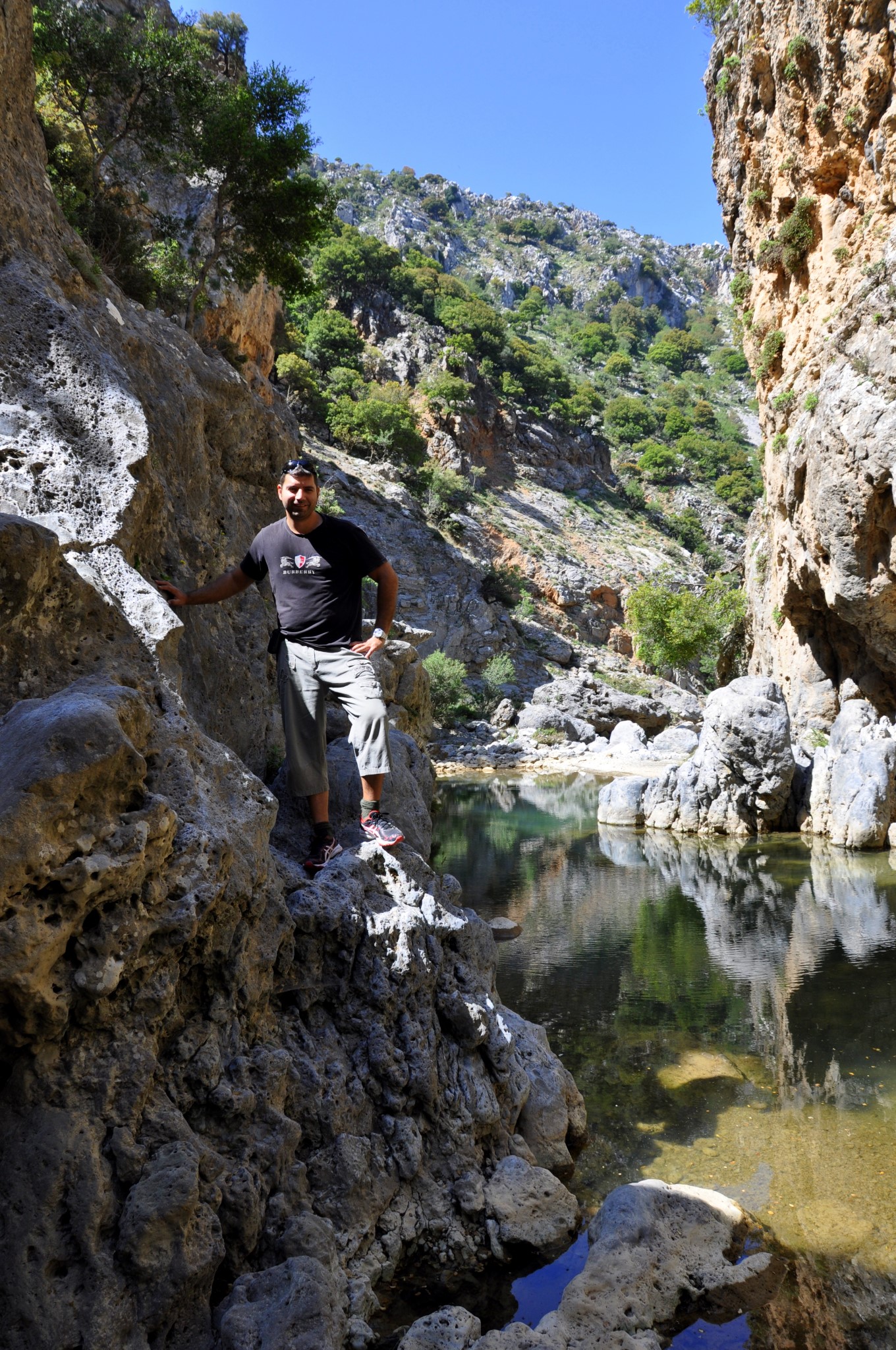
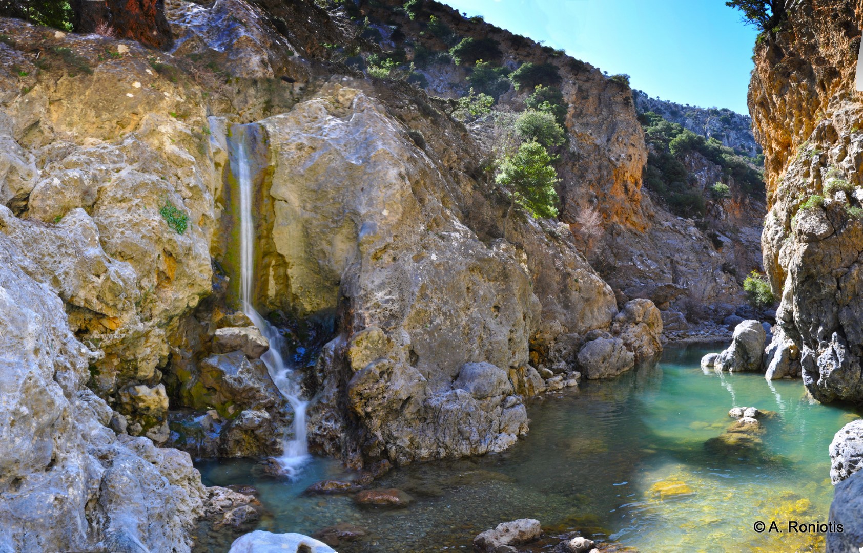
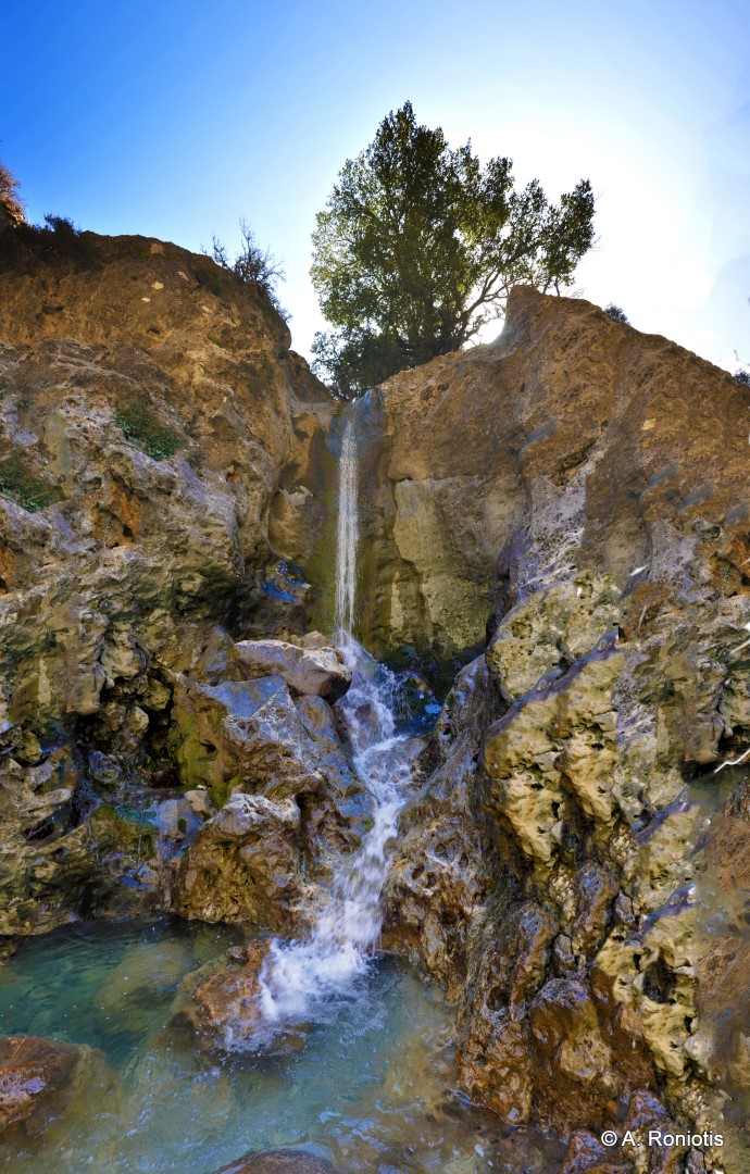
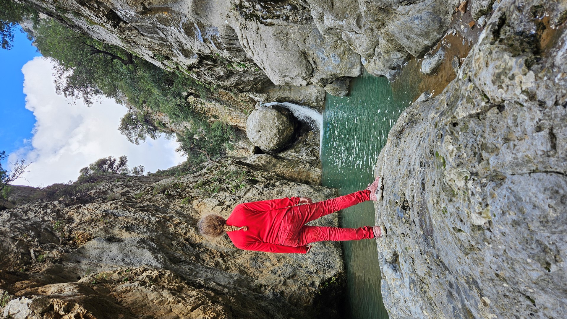
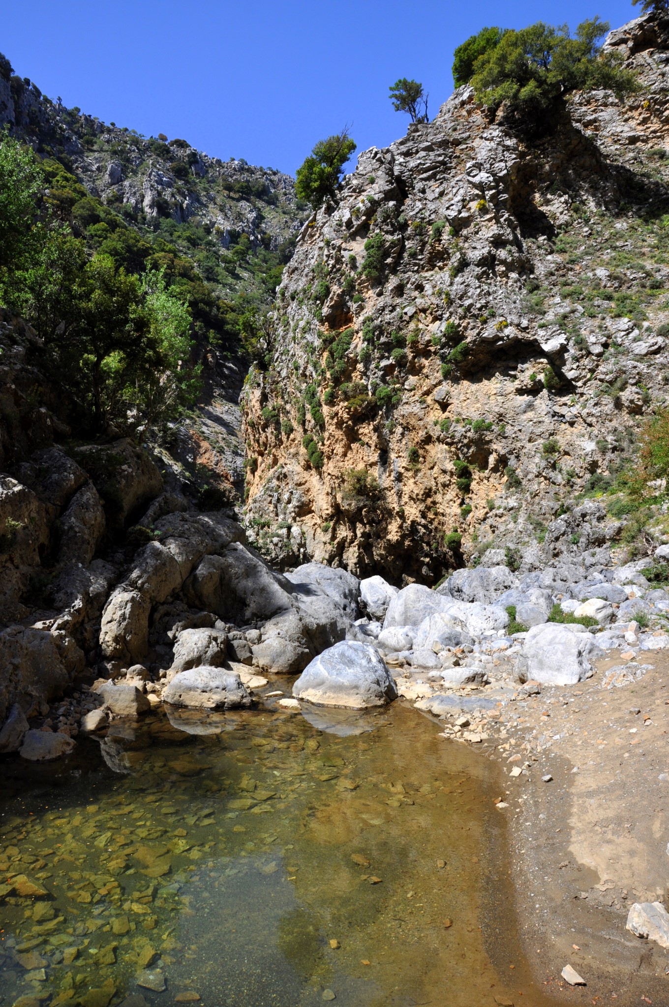
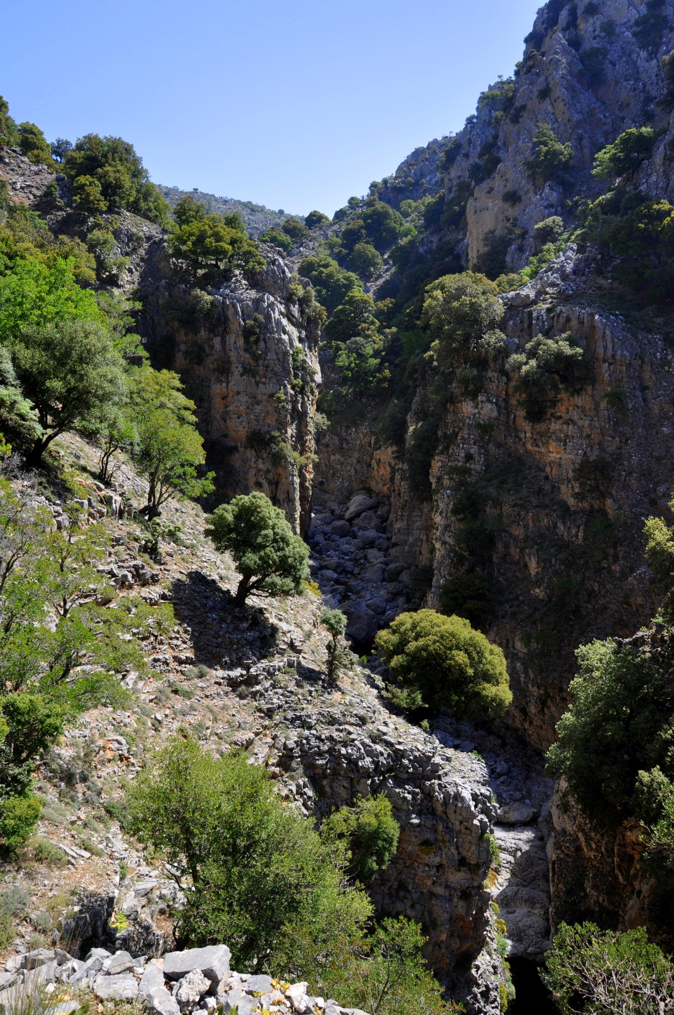
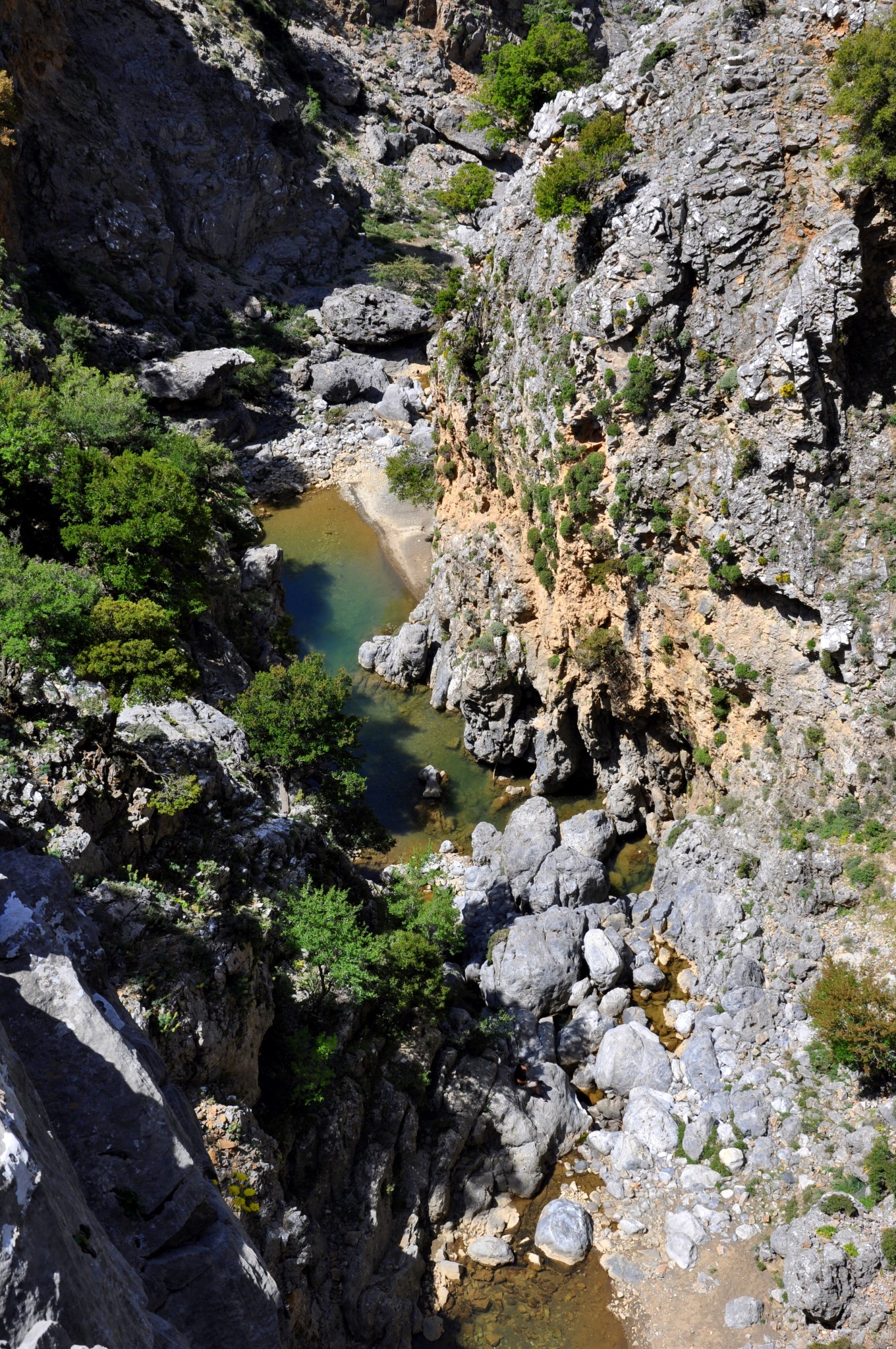
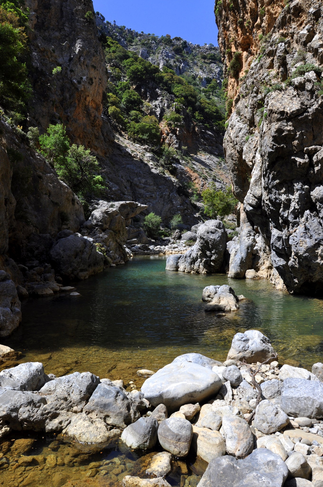
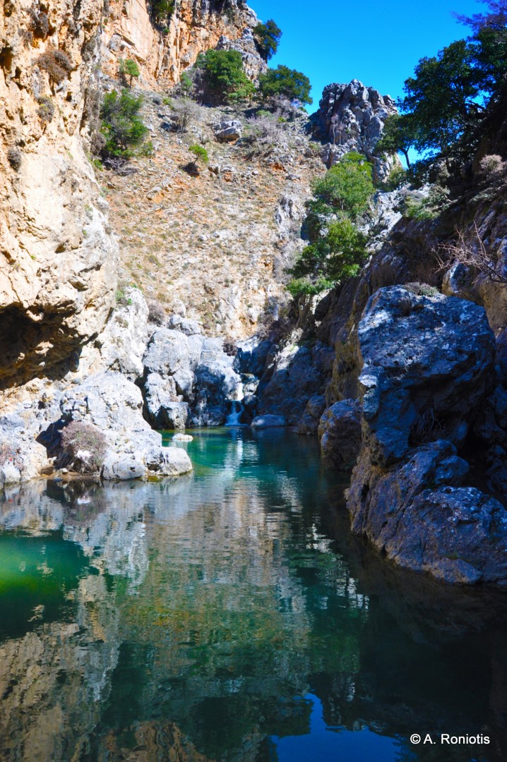
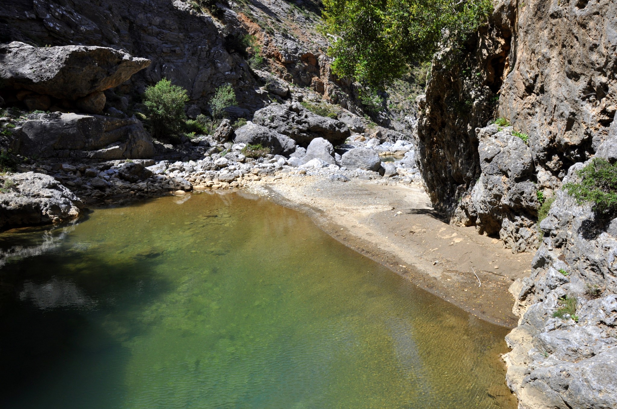
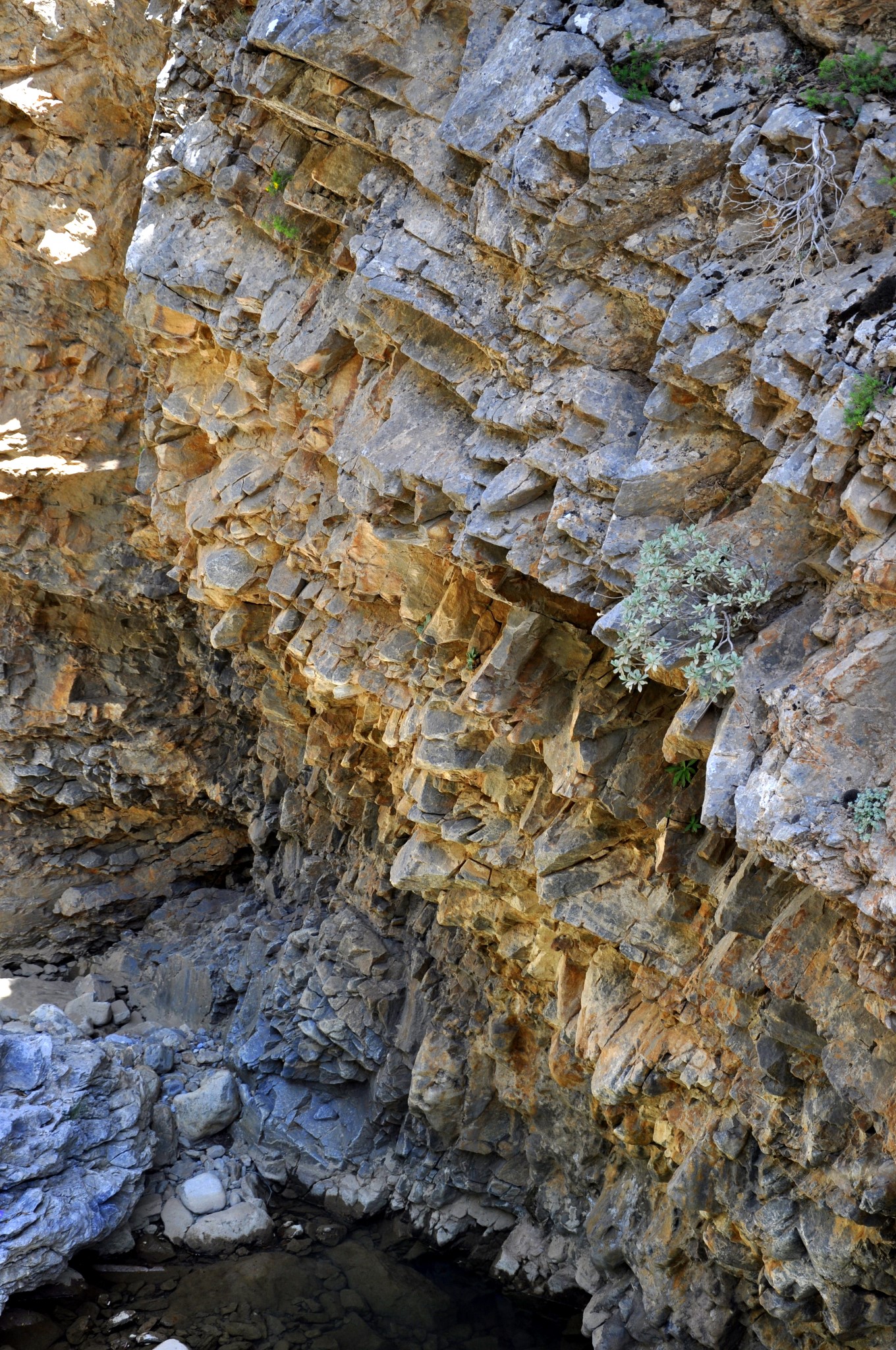
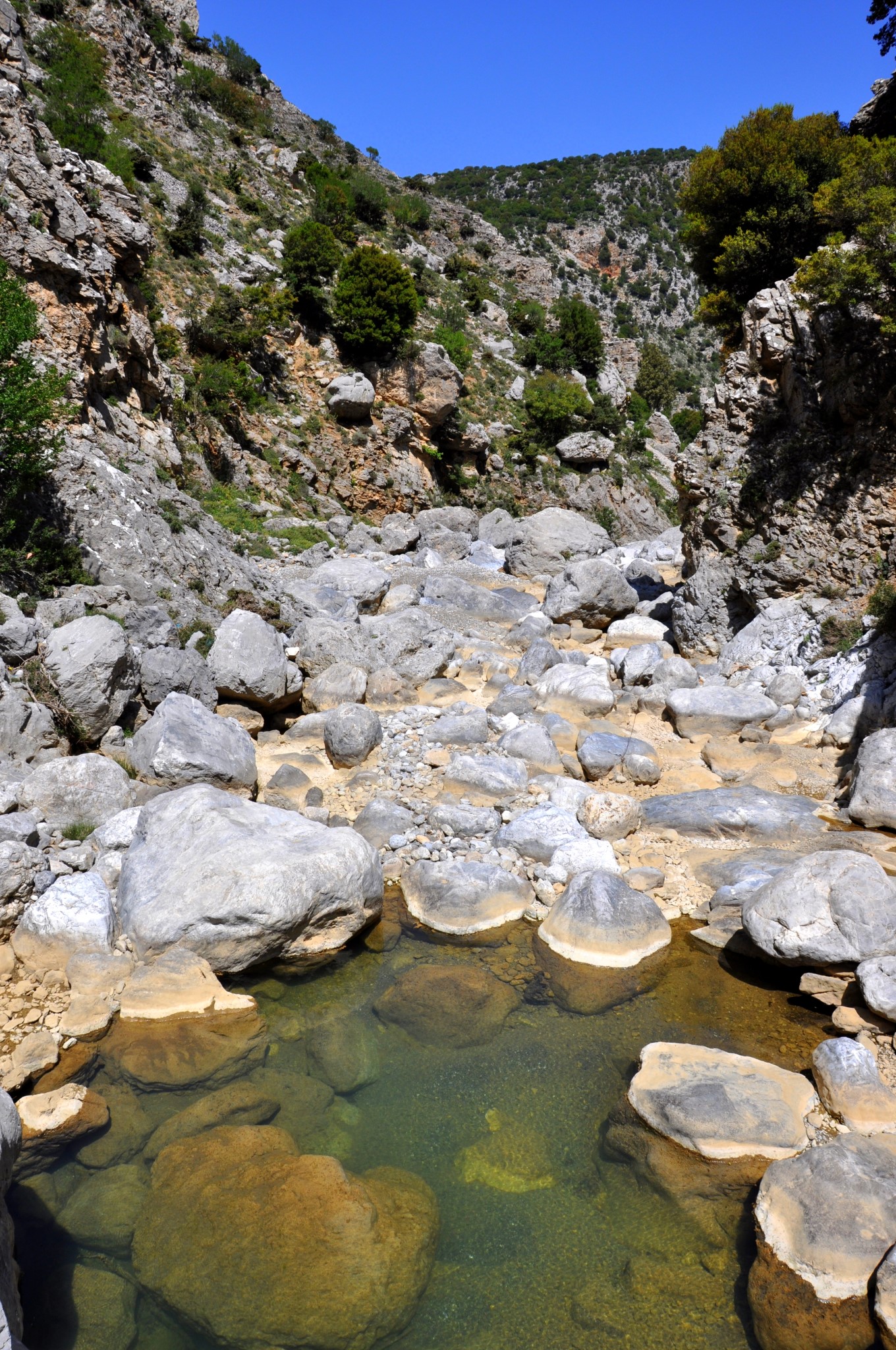
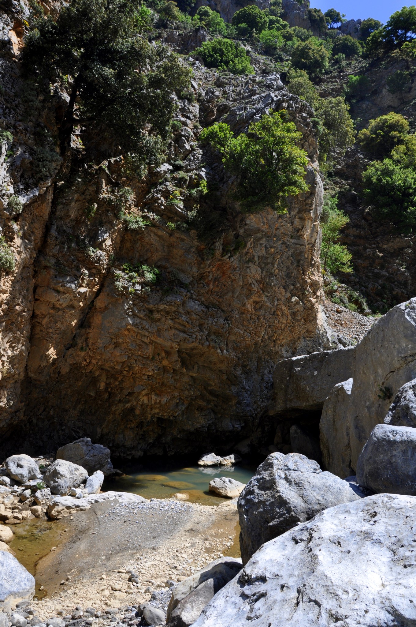
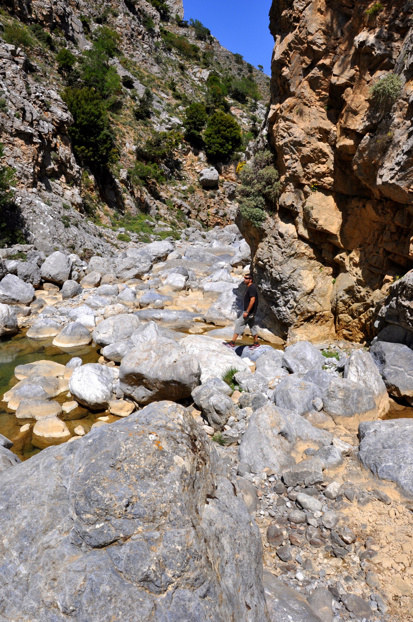
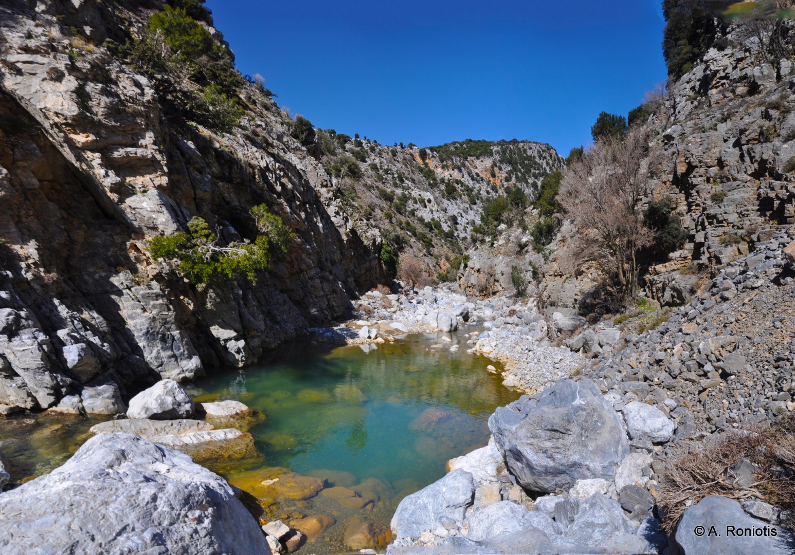
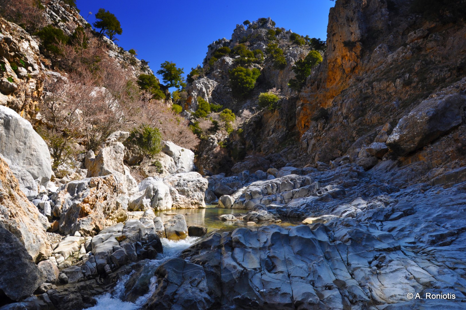
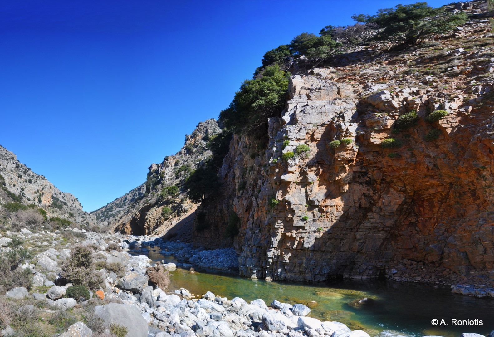
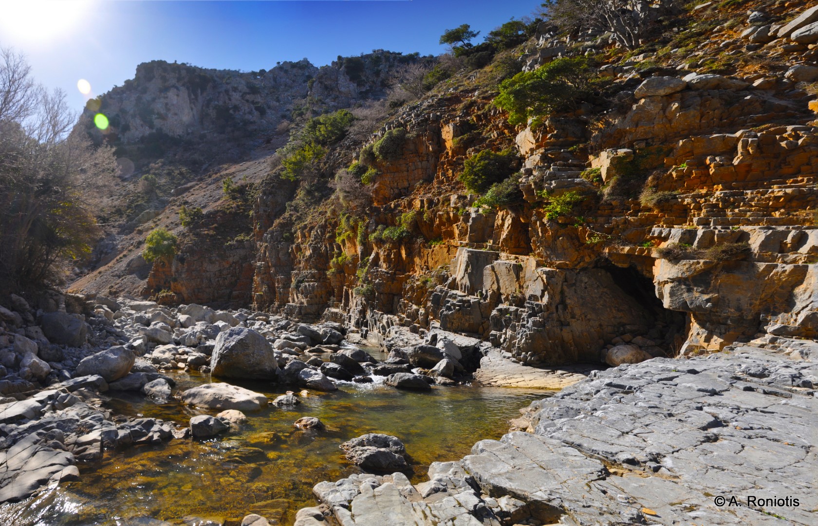
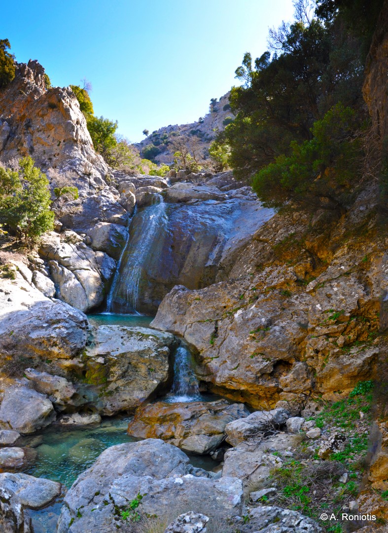
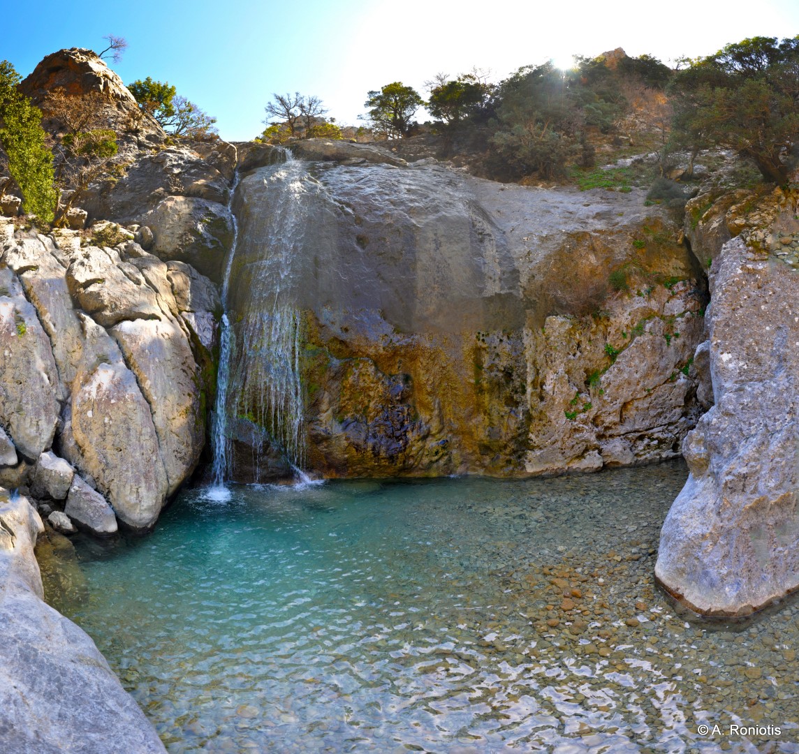
The gorge has a total length of about 4 km and is relatively smooth and accessible to everyone in the section starting from its exit, where it is quite open and creates impressive landslides on the sides. Then the gorge narrows sharply and the course ascends to the beautiful lake of Neraidokolimbos (fairy pond), at the base of a small waterfall with a round boulder. Neraidokolimbos blocks the access to the rest of the gorge and in order to overcome it, you need to go back a few meters and follow the E4 European footpath on the sides of the gorge that leads to the Katharo Plateau. Here the local tradition tells that the fairies of the gorge used to have their bath.
Exactly at the point just before meeting Neraidokolimbos, the small side gorge of Plystra ends, forming successive waterfalls that empty at the main stream of Havgas. A few meters above the gorge, the characteristic waterfall of Plystra is created with small flow of water even in summer, collecting water from the north slopes of the peaks Lazaros and Spathi. In Plystra, the legend tells that the fairies washed their underwear.
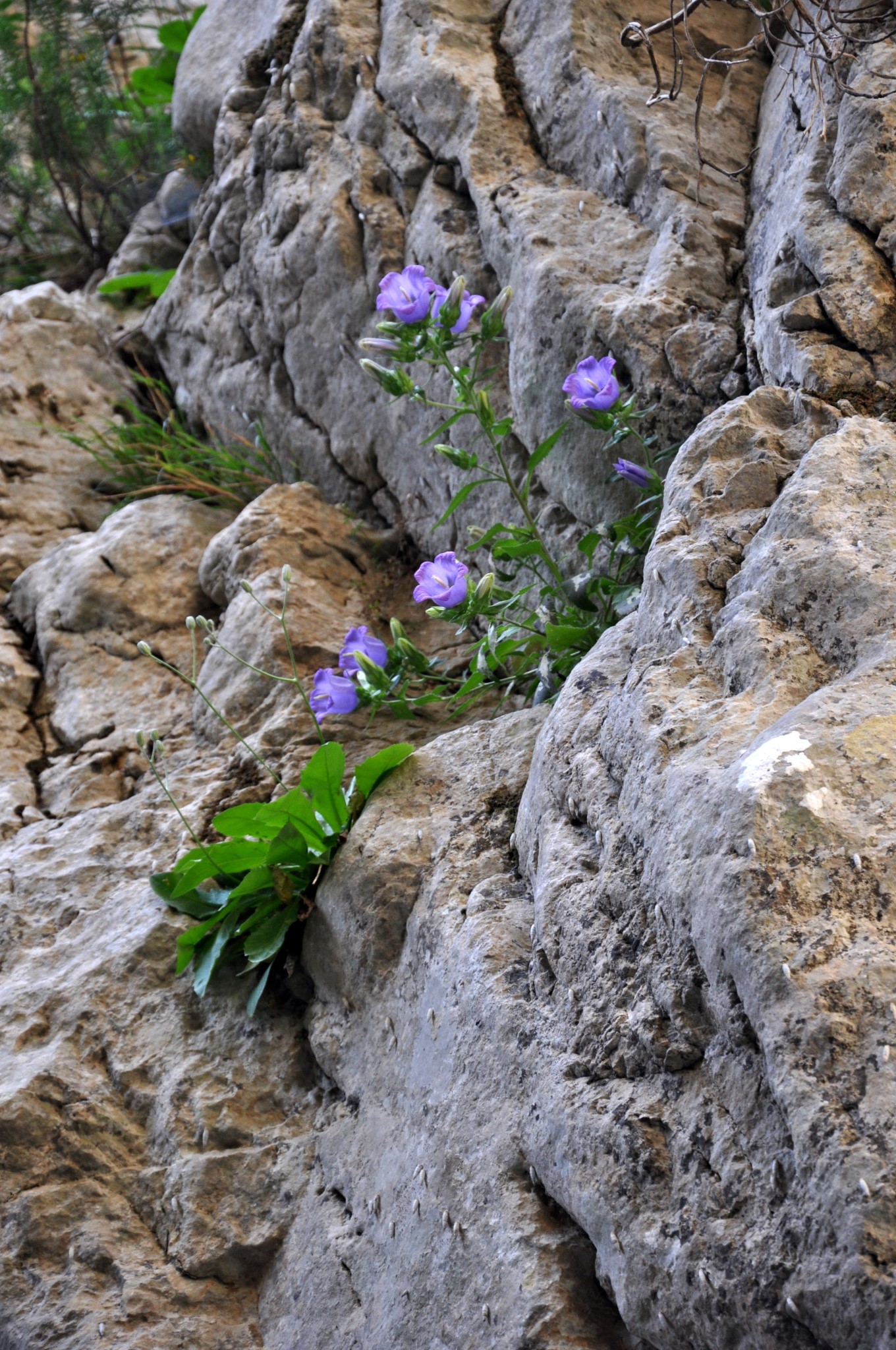
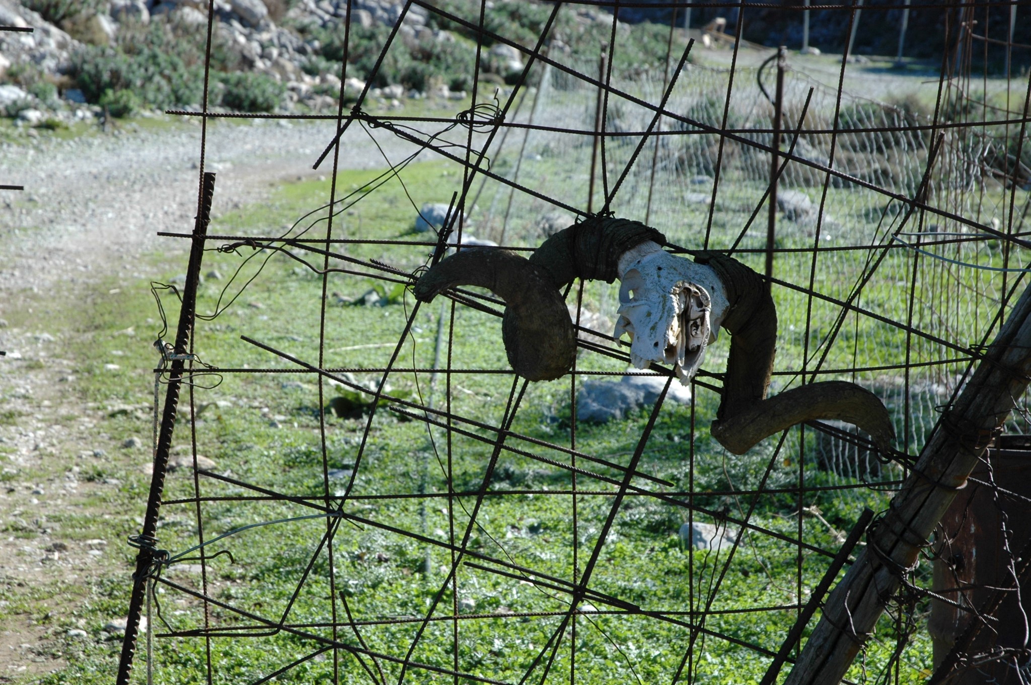
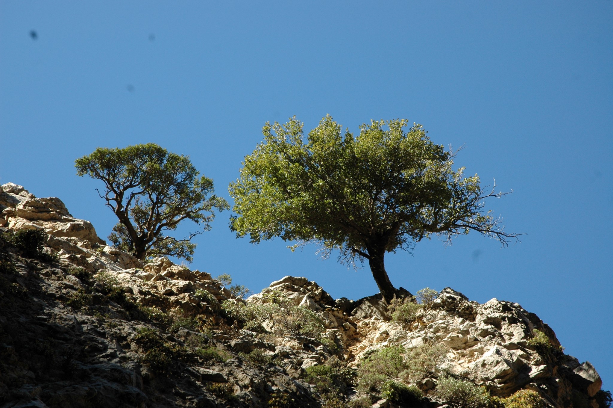
The landscape inside the gorge, which is part of the E4 trail, is truly quiet as there are very few visitors who decide to visit it. If you decide to cross it, follow the most common route, i.e. upside down, entering from its exit, next to the reservoirs of the village Agios Georgios, through dirt roads that start from the village Agios Konstantinos. On its slopes there are many trees, mainly maples and holm oaks. The river has water only after heavy rains or snowfalls, while the lake of Neraidokolymbos has water all year round.
Alternative course (starting from Katharo): Instead of following the path from Agios Konstantinos, you can start from the Katharo plateau and descend through the riverbed. At the point of the Neraidokolimbos, however, you will either have to jump into the water or go back.

What is near me?
Additional Info
- Length (km): 2
- Type: Hiking gorge, E4 trail
- Location: Lassithi Prefecture
- Water: Water till spring
- Difficulty (0-10): 2
- Altitude difference (m): 50
- Hiking Hours: 1
- Accessibility: Dirt track


