








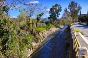
The River Tyflos (Blind) is located in Kissamos province and its main stream is about 20 km long. The river has water until early summer, depending on the rainfall of the year.
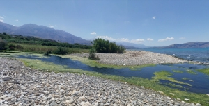
The river Mouselas flows through the valleys that form east of the White Mountains and flow into the western boundary of the large beach of Episkopi, in the large bay of Almyros that has the most rivers in Crete. It is the natural border of the prefectures of Chania and Rethymno.
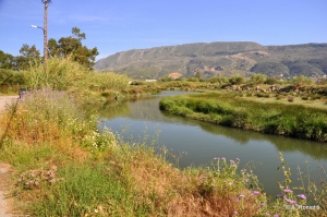
The River Moronis or Pera collects its waters from the wider area of Souda and Chania Crafts Park and transfers them to Souda beach. Its overall length does not exceed 5km, but it is important as it flows all year round.
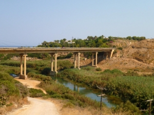
Geropotamos in Rethymno is a long river that flows into the beach of Geropotamos, at the site of ancient Avlona, where it forms an important wetland. Its name means "sacred river", while near its exit it is also known as Avlopotamos due to the ancient city Avlona. Geropotamos gathers the waters from many tributaries on the northern side of Psiloritis.
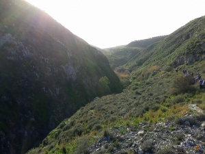
Litheos Potamos (Lethean River) collects water from the basin of Gergeri and Panassos in the south-eastern roots of Psiloritis. It continues its course as a wide river from Apomarma, during which many vertical streams meet the main stream. Throughout its course one meets many dilapidated watermills, while we also encounter traces of the ancient aqueduct that transferred water from Gergeri to Gortyn.
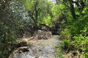
Gazanos River gathers the water from the eastern slopes of Psiloritis Range and is one of the most important rivers in Crete. Initially it gathers water from the areas around Asites and then merges with the stream of Kroussonas in the village Sarchos. Then it crosses from the beautiful area Kolimbithres with the small waterfall Xepatomenos, and just before Gazi it merges with the stream coming through the Goniano gorge.
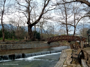
The Boutakas River is located in the province of Apokoronas in Chania, which originates from the White Mountains near Vafes village. It passes through the village of Vrysses, where there are many beautiful taverns, and flows into the beautiful beach of Kalyvaki in Georgioupolis, after being mixed with salt water.

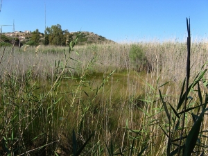
The wetland of Almyros is very close to the town of Agios Nikolaos, making it a real paradise for the area. It is a marshy area of 48 acres that is permanently watered with brackish water from karst springs. The average annual flow rate is about 2000 liters per second.
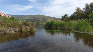
The lake and the river Almyros in the area of Georgioupolis form one of the most important wetlands of western Crete. In the lake, we find many aquatic birds and aquatic plants like reeds, myrtles, and oleanders. The lake is natural and is watered by the water of the White Mountains. The bank has been formed in order to assist in the operation of a small 300kW hydroelectric power station.
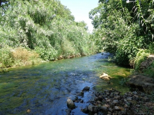
The river Keritis is located near Chania and belongs to the rivers with the largest water supply in Crete. It gathers the waters of the massif Lefka Ori from the area of Zourva and Meskla. After a course of more than 25 km it ends at the beach of Platanias. During its flow it merges with many streams and tributaries.
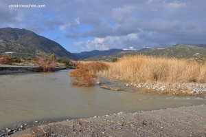
The River Anapodaris is located in south-central Prefecture of Heraklion and exits near the village of Tsoutsouras and Keratokambos. More specifically, it starts gathers water from east-central Heraklion and southern Dikti, with may smaller rivers (eg Baritis) flowing into it. Close to Demati village a nice arched bridge crosses the river.
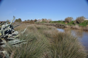
Aposelemis River is one of the longest rivers in Crete, which receives the groundwater of the plateau of Lassithi from the springs of Fleges, near Kastamonitsa village. Then, it runs near the village Avdou, where it changes route and joins the river of Ambelos Gorge, continues to Potamies, where a large dam has been constructed, and it reaches the position Xerokamares, where it joins the small river of Karouzana. Then, it passes through the gorge of Aposelemis and heads towards the northern shores of Heraklion, where it exits into a small wetland near Gouves.
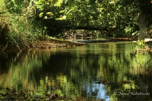
Kyliaris river starts near Stylos village by Apokoronas Province and ends at the beach of Kyani Akti near Kalives. It’s 5km long and is the second largest river in water flow in Crete. The name Kyliaris means the river that carries stones away. It's ancient name was Pyknos (i.e. dense), due to the dense vegetation along its banks.
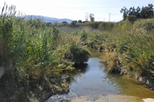
The river Giofyros or Diakoniaris is located in the northern prefecture of Heraklion. It is watered by several tributaries close to the village of Profitis Ilias (Prophet Elijah) and flows next to the Pancretan Stadium, in Heraklion city.
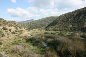
Akoumianos river is the third larger river (in water quantity) in the province of Agios Vasilios (after Megas and Platys River). It gets its water from dozens of sources from the slopes of the mountains Kedros and Asiderotas and has water all year round, especially in its upper part.
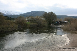
Perastikos has a large quantity of water although it is formed very close to the shore. Along its short, 50m-long course, it forms a very important wetland that hosts several bird species. Near its source, there is a bridge connecting both sides of the beach.
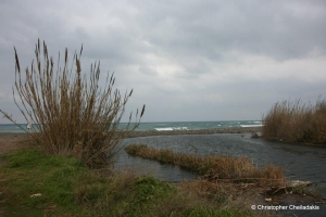
To the west of the prefecture of Chania and 20 kilometers away from the city of Chania we meet the estuary of Tavronitis. Tavronitis with Platanias are the two largest rivers in the western part of Chania. At its exit to the sea, the river forms a delta which is a very important wetland.
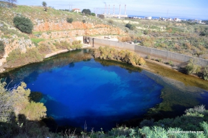
Almiros spring can probably most satisfactory explain the term paradox. This spring is located at the northeastern side of Psiloritis, a few hundred meters far from the sea and the city of Heraklion, and it runs off the highest water quantity in Crete directly into the sea through the homonym river of Almiros! The water of the spring is brackish because somewhere quite deep it is mixed with seawater.
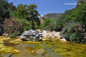
The River Platis Potamos is one of the rivers of Crete with lot of water and dense vegetation. Indeed, along the banks there are several stone bridges with arches built by the inhabitants of the area to cross the river.
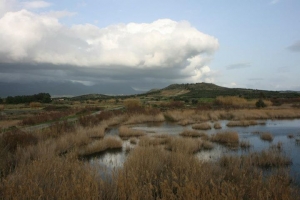
Geropotamos, the sacred river of the Minoans, gathers the water of Mesara Plain and exits inside the military airport of Tymbaki, close to Kokkinos Pirgos. The coastline south of Kokkinos Pyrgos has several places where small ponds of foremost ecological importance are formed, with the nicest being at the area of Pahia Ammos (or Afratias), which can be accessed through dirt track.
Also read:
- Home
 Beaches
 Nature
 Past
Past Destinations
 Highlights
 West Crete
- Central Crete
- East Crete
- Towns
- Chania Prefecture
- Chania
- Paleochora
- Kissamos
- Georgioupolis
- Chora Sfakion
- Loutro
- Rethymnon Prefecture
- Rethymnon
- Agia Galini
- Plakias
- Spili
- Anogia
- Heraklion Prefecture
- Heraklion
- Hersonissos
- Malia
- Matala
- Agia Pelagia`
- Archanes
- Kokkinos Pirgos
- Lassithi Prefecture
- Agios Nikolaos
- Elounda
- Sitia
- Ierapetra
- Makrigialos
- Palekastro
- Zakros
- Lassithi Plateau
- Get Prepared


