








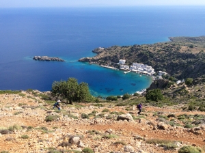
A very demanding trail due to very high slope is the old mule track that once linked the picturesque harbor of Loutro with the town of Anopolis. It can, however, be much easier if you start from Anopolis and go down to Loutro. In any case the panoramic view to the sea and to Loutro is breathtaking.

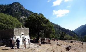
The proposed trekking route in the canyon starts from Niato Plateau (near Askifou Plateau) and runs along the European trail E4. You initially meet the abandoned village of Kali Lakki. From here starts the canyon, which is one of the greenest gorges in Crete, with incredibly interesting flora. Oaks, cypresses, and pines are the main trees in Sfakiano Gorge.
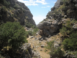
The canyon of Asfendou is one of the many gorges in Sfakia province, starting from deserted hamlet of Asfendou that currently houses some local sheep herders. Along the canyon runs a passable but steep trail, parallel to the streambed. In many places the Libyan sea is visible.
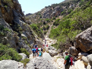
The small but impressive gorge of Anydri is located east of Paleochora. It starts from the village Anidri and after a snaky course, about 3km long, between high cliffs it concludes at the beautiful beach Gialiskari.
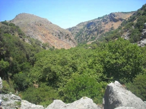
Gorge Chalase or Porofarago starts near the village Sassalos and ends before the village Makronas after 4 hours of course in dense vegetation. Crossing it is not very easy because at one point it has a large scree (chalase) and there is no trail.
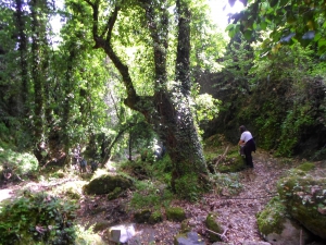
The lush canyon of Boriana (mainly known as Karanou Gorge) starts from the village Boriana and joins the River Mavropiliotis after 1800 meters in a nicely landscaped trail. Along the trail we meet a ruined watermill, caves, entrances of the old iron ore quarries (known locally as quarries of Averof), a charcoal furnace and galleries.
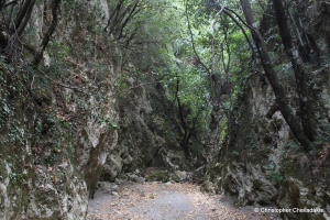
The Gorge Kydoni is a small lush green paradise near the village Karanou, which has been adorned with a beautiful trail and information signage. The trail starts from the fountain of the village and is very easy to walk and appropriate for children.
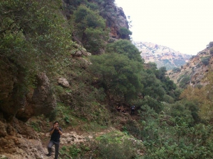
The Gorge of Cyclamen or St George Gorge starts from the settlement Aletrouvari (altitude 300m), passes east of the village of Agios (St) Georgios and ends at the village Vandes (altitude 50 m).

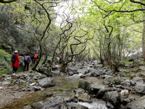
Kollita Gorges, i.e. Twin Ravines are located nearby the picturesque village Argyroupolis, about 22km southwest of Rethymnon city. They are named so, as they consist of two parallel canyons that end near Kato Poros settlement and is part of the E4 trail. The first canyon on the east is called Moudriano Gorge, while the west gorge is Kato Poros Gorge of Vilandredo Gorge, mostly known as the main Kollita Gorge.

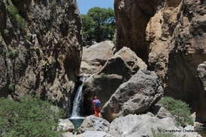
Platys (i.e. wide) river is one of the rivers of foremost importance in Crete, flowing all year round. It gathers almost all water quantities of Amari Valley and leads them to the beach of Agia Galini. At a secret location between the settlements Agia Paraskevi, Vyzari, and Petrohori, the wide river gets narrow and forms two impressive ravines. The first is the small Mesa Faragi (inner gorge), reminding of the gorge of Kourtaliotis.
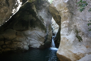
Gorge Smiliano or Kalamafka is located north of the village Ano Meros, about 100km southwest of Heraklion city. Through the gorge runs the Lygiotis river which is supplied by the valleys of Gerakari and the slopes of Samitos Mount. The canyon has a lot of water in winter and crossing it, by any means, is very tough.
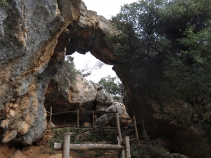
Platania Gorge is located in the Amari valley, 38km southeast of Rethymno, on the western outskirts of Psiloritis. It is a unique trail, with impressive cliffs, vertical limestone rocks, rock roofs and caves. The trail is recommended for experienced mountaineers, although the first part of the trek is quite easy and well pathed, even for children who are physically fit.
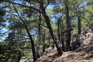
The forest village of Agios Ioannis at Sfakia province is the starting point of one of the most beautiful and best marked trails of Chania prefecture, the trail of Kormokopos. The word Kormokopos means place where trees are cut, due to the dense forest of the area.

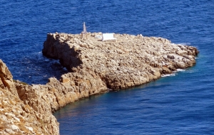
The church and lighthouse of Agios Sozon is located on a steep site, at the tip of Cape Stavros, at the northernmost point of the entire central Crete. The Cape of Zeus (Dios Akron) of the Venetian maps is believed to have hosted a sanctuary dedicated to Zeus in the ancient past.
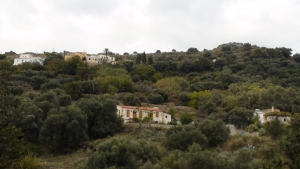
The route starts from Kissamos and is the first part of the European E4 trail in Crete. After crossing the villages Kato Palekastro, Korfiano and Grigoriana, we arrive at the ancient city of Polirinia and from there we cross the lush green villages Galouva, Lusakies Zahariana and, finally, Sfinari with the beautiful beach.
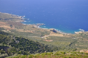
This part of the European trail E4 starts from Sfinari and ends at Chrisoskalitissa. It is one of the most beautiful and wooded parts of Crete with astonishing sea views. First we go through the desolated village Ano Sfinari, then Kambos, Plagia and Keramoti.
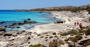
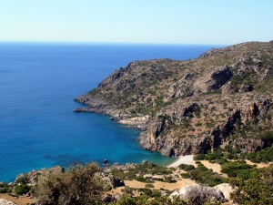
This amazing hike is about 16km long and takes about 5-6 hours. The trail is clear and well-marked with the typical E4 back-yellow signs. It crosses the archaeological site of Lissos, where you can find water from the local spring. It isn't too difficult but plenty of water, sun protection, and steady shoes are recommended.
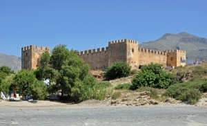
The part of the European path E4 that connects Chora Sfakion with Frangokastelo and then with Rodakino is all on paved road and can be visited even by car.
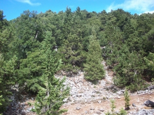
Starting from Sougia, apart from the gorge of Agia Irini, we can choose the alternative route that comes through the beautiful settlement Koustogerako. Then the trail continues and crosses the pine wood by Olisma and conludes at Seliniotikos Gyros, i.e. the southwest passage to Omalos Plateau.
Also read:
- Home
 Beaches
 Nature
 Past
Past Destinations
 Highlights
 West Crete
- Central Crete
- East Crete
- Towns
- Chania Prefecture
- Chania
- Paleochora
- Kissamos
- Georgioupolis
- Chora Sfakion
- Loutro
- Rethymnon Prefecture
- Rethymnon
- Agia Galini
- Plakias
- Spili
- Anogia
- Heraklion Prefecture
- Heraklion
- Hersonissos
- Malia
- Matala
- Agia Pelagia`
- Archanes
- Kokkinos Pirgos
- Lassithi Prefecture
- Agios Nikolaos
- Elounda
- Sitia
- Ierapetra
- Makrigialos
- Palekastro
- Zakros
- Lassithi Plateau
- Get Prepared


