The town of

Tymbaki

Tymbaki Town

Tymbaki is a busy agricultural town on the Messara Plain, in the historic province of Pyrgiotissa, close to important beaches, wetlands and archaeological sites.

Tymbaki lies approximately 65 km southwest of Heraklion, on the western side of the Messara Plain. It is one of the main agricultural centres of southern Crete, surrounded by extensive olive groves, vegetable fields and greenhouses. A significant part of the produce grown in the area is distributed throughout Greece or exported abroad.

The beach of Kokkinos Pirgos is only a short distance away, while the Minoan Palace of Phaestus and the Minoan villa of Agia Triada are also easily accessible. The large Church of Saint Titus stands near the centre of the town, around which much of its commercial activity is concentrated.

Tymbaki during the Second World War

The modern appearance of Tymbaki is closely connected with the events of the German occupation. In early 1942, the German forces ordered the evacuation of the settlement, forcing its families to seek shelter in the surrounding villages. Most of the houses were demolished, and building materials taken from them were used in the construction of the nearby military airfield.

The airfield was intended to support Axis operations in North Africa and the Mediterranean. Forced labour from the wider area was employed during its construction, while the installations were repeatedly targeted by Allied bombing. After the war, Tymbaki had to be largely rebuilt, which explains why relatively few older buildings survive in the town today.

Geropotamos and Katalyki

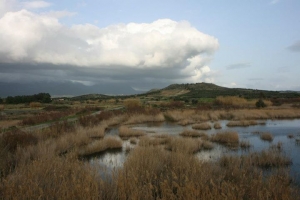
The Geropotamos River, the principal river of the Messara Plain, reaches the sea near Tymbaki. Close to its mouth and Kokkinos Pirgos lies the small Katalyki wetland, an important stopover for waterbirds and migratory birds. In earlier times, the marshes of the area encouraged the spread of malaria and restricted the development of the coastal settlements.

hotels near Tymbaki Crete

  • 1
  • 2
Matala beach

Matala beach

1 1 1 1 1 1 1 1 1 1 Rating 2.83 (244 Votes)
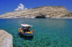
Matala is famous for the carved caves in the rocks and the hippies of the ‘70s. It is located close to Phaestus, the second-largest palace of the Minoan civilization. Matala was the port of Phaestus, and in the Roman Times, it became a port of Gortys.

Read more ...

Kokkinos Pirgos beach

Kokkinos Pirgos beach

1 1 1 1 1 1 1 1 1 1 Rating 2.02 (189 Votes)
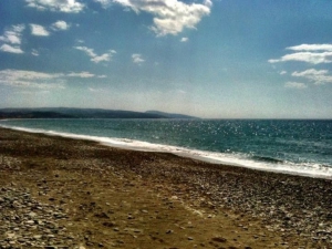
Kokkinos Pirgos (i.e. Red Tower) is located 67km west of Heraklion and close to the town of Tymbaki. The name is taken after the tower that was there and was built with reddish soil. The purpose of this tower at this point is still unknown. It is the seaside village of Timbaki, home of the port of the region and developed touristically.

Read more ...

Paximadia islets

Paximadia islets

1 1 1 1 1 1 1 1 1 1 Rating 3.37 (227 Votes)
Paximadia Islands are two small uninhabited islets off the Gulf of Messara, 12km (7.5 miles) south of Agia Galini. By far they seem like a single island because they are very close. You may also hear locals refer to these as "Elephant", since from afar they remind you of a lying elephant. Their total length is about 3km.

Read more ...

Phestos Palace

Phestos Palace

1 1 1 1 1 1 1 1 1 1 Rating 3.85 (13 Votes)
Phaistos was one of the most important palatial centres of Minoan Crete. Its palace commands a magnificent position above the fertile Messara Plain and is today one of the island’s most significant archaeological sites.

Read more ...

Kalamaki beach

Kalamaki beach

1 1 1 1 1 1 1 1 1 1 Rating 2.02 (184 Votes)
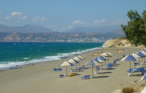
Kalamaki is a small seaside village located 65km southwest of Heraklion, between Matala and Kokkinos Pirgos. The beach in front of the village is only a small part (2,5 km) of the vast seafront that stretches along the long Bay of Messara.

Read more ...

Faneromeni Dam Lake

Faneromeni Dam Lake

1 1 1 1 1 1 1 1 1 1 Rating 3.83 (6 Votes)
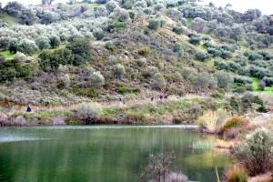
The dam of Faneromeni is located 7km west of the village of Zaros and about 7km north of Tympaki. It is located in a scenic location, in a verdant valley at the southern foot of Psiloritis Mount. The artificial lake covers an area of approximately 1000 acres and has a capacity of 20 million cubic meters.

Read more ...

Geropotamos River

Geropotamos River

1 1 1 1 1 1 1 1 1 1 Rating 2.75 (8 Votes)
Geropotamos, the sacred river of the Minoans, gathers the water of Mesara Plain and exits inside the military airport of Tymbaki, close to Kokkinos Pirgos. The coastline south of Kokkinos Pyrgos has several places where small ponds of foremost ecological importance are formed, with the nicest being at the area of Pahia Ammos (or Afratias), which can be accessed through dirt track.

Read more ...

Agia Triada Royal villa

Agia Triada Royal villa

1 1 1 1 1 1 1 1 1 1 Rating 3.00 (3 Votes)
At the banks of the river Geropotamos, at position Agia Triada, the Minoans built a small palace that was excavated by the Italian Archaeological School at Athens in 1902-1914. This Royal Villa was built in the 16th century B.C. (New Palace period) and was probably used as a summer villa for the king of Phaestus or as permanent residence after the destruction of Phaestus palace in 1450BC.

Read more ...

  • 1
  • 2

Also read:

Download Free Premium Joomla Templates • FREE High-quality Joomla! Designs BIGtheme.net