")


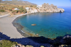
The coastal village of Agios Pavlos (St. Paul) is located 58km south of Rethymno, west of Agia Galini, and on the edge of Cape Melissa. You can access the area by driving from the villages Akoumia or Sachtouria.
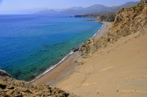
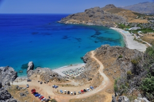
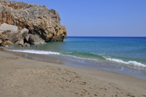
One of the best-kept secrets in Rethymno aside from Akoumiani Gialia or more popularly known as Triopetra beach to tourists and locals alike, is the breathtaking Melissa Cape Sandhills, by Agios Pavlos, which is considered among the best beaches in Crete.
Ligres is located 51km south of Rethymno and 7km south of the village Kerames, at the foot of the imposing mount of Siderotas. It is actually the northbound part of the beachfront called Akoumiani Gialia.
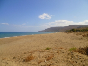
The village Kerames is located 49km south of Rethymno, close to the village Agalianos. South of the village are many beautiful beaches, with the most famous being the beaches of Akoumiani Gialia, namely Ligres, Triopetra and St. Paul sandhills. The beachfront north of Akoumiani Gialia is called Keramiani Gialia, meaning Keramean Beach, named after the nearby village.
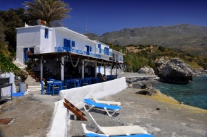
The poor asphalt road that leads to Keramiani Gialia stops near the local harbor of Agia Fotini, also known as Agia Fotia. Agia Fotia has some stunning tiny pebble beaches, ideal for snorkeling and swimming. These are surrounded by marvellous huge rocks.
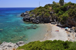
Between Gialopotama and the harbor of Agia Fotini, there are two adjacent beaches with fine pebbles and sand, surrounded by huge rocks. These beaches, called Pirgos, are ideal for snorkeling and nudism. There is a bad dirt track heading to Pirgos, starting 500m north of Gialopotama
The beautiful unknown beach of Gialopotama is formed west of a small hill, on which a few small houses and apartments for renting are built. The beach is sandy and has deep cool water. The rocks lying around it make it ideal for snorkeling.
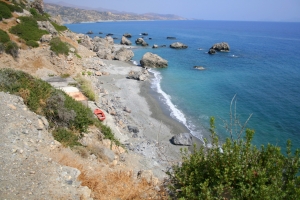
South of the picturesque hamlet of Drymiskos lies a series of consecutive coves forming several beaches along 3 km. The entire region bears the name Drymiskian Beach. The successive beaches separated by rocks and reefs which make snorkeling a real experience. The site remains virtually unknown to most people mainly because the access is difficult.
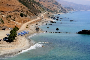
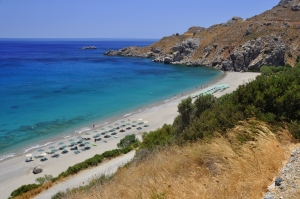
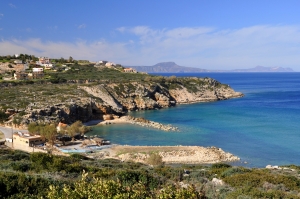
Ammoudi is a beach complex located 32km south of Rethymno and 4km east of Plakias. To get here, you have to drive by paved road from the village of Lefkogia.
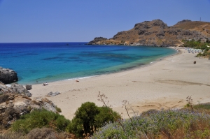
Skinaria Beach (or Shinaria) is located 33km south of Rethymno, 3km south of the village Lefkogia, in the east part of the wider Plakias area. The beach is relatively unknown to most locals, but for its few visitors it remains a heaven and some of them regard it as one of the best beaches of Crete.
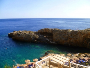
The beach that stretches in front of the resort is a long bay with beautiful turquoise waters and coarse white sand. Here you will find all the services of a very well organized beach like umbrellas, snack bars, showers, changing rooms, water sports, scuba diving centre, great hotels, restaurants, horse riding centre etc.
The Pirates’ Fjord is located 33km south of Rethymnon, in a secluded cove south of Mouri or Karavos Cape, near Plakias. It is a very narrow cove, formed between enormous vertical cliffs. The tiny beach shaped here has sand at its starting point and doesn’t exceed 2m in width.
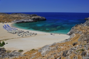
Fotinari (or Foteinari) is located 37km south of Rethymno, between Plakias and the beach of Souda. There are two beautiful quiet beaches, which are formed in the hug of two small coves with lush vegetation. The rocky seabed is ideal for fishing and snorkeling.
It is actually the last beach of the vast beachfront of Plakias, called Yialia, which starts at Shinaria, several kilometers away. Unlike the true meaning of the name (the Latin word suda means narrow passage), the bay of Souda is quite large.
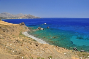
In this rugged landscape there are a few small beaches, totally secluded and which can be accessed by boat or on foot. The beaches, starting from east to the west are Kokkinos Volakas, Stavri, Filadelfi, Parahoristra, Agios Antonios, Hohlakas and Klimata.
Klimata is a big bay in which there are three adjacent beaches. On the west side of the bay, there is the small harbor of Rodakino, accessed through a cement-paved road from Korakas. From there you can easily reach the first beach, situated next to the harbor.

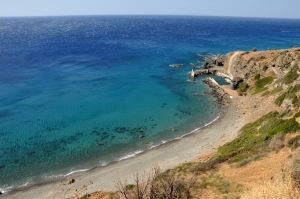
At the exit of the river that runs in the canyon of Rodakino, 2km south of the village, there are many beautiful and tranquil beaches. To visit them you should take the road that leads to Korakas. Despite the fact that it has a great beachfront, Rodakino is not highly developed and still retains its traditional character and harmony.
The beach is actually divided into two large beaches and is secluded, since access is not as easy as the nearby beaches of Korakas and Polirizos. On the beach there are no facilities, just a small tavern (and another one on the west part of the beach).
The beach Episkopi is located 45km east of Chania and 14km west of Rethymnon, in a fertile valley with lowlands. It takes its name from the nearby village, Episkopi, located 2km southern. Almost no-one Greek knows this place, but everybody knows the family Vardinoyannis, originating from here. This is one of the richest families in Greece.
- Home
 Beaches
 Nature
 Past
Past Destinations
 Highlights
 West Crete
- Central Crete
- East Crete
- Towns
- Chania Prefecture
- Chania
- Paleochora
- Kissamos
- Georgioupolis
- Chora Sfakion
- Loutro
- Rethymnon Prefecture
- Rethymnon
- Agia Galini
- Plakias
- Spili
- Anogia
- Heraklion Prefecture
- Heraklion
- Hersonissos
- Malia
- Matala
- Agia Pelagia`
- Archanes
- Kokkinos Pirgos
- Lassithi Prefecture
- Agios Nikolaos
- Elounda
- Sitia
- Ierapetra
- Makrigialos
- Palekastro
- Zakros
- Lassithi Plateau
- Get Prepared


