")


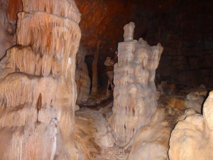
The cave Faneromeni is located at an altitude of about 770m, above the village Avdou in Louloudaki range. It is hard to access it, due to very steep slopes and dense vegetation. The cave is about 45m long, 9m high and its width varies from 4 to 12m. It has a rich cave decor including stalactites, stalagmites and columns.

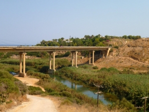
Geropotamos in Rethymno is a long river that flows into the beach of Geropotamos, at the site of ancient Avlona, where it forms an important wetland. Its name means "sacred river", while near its exit it is also known as Avlopotamos due to the ancient city Avlona. Geropotamos gathers the waters from many tributaries on the northern side of Psiloritis.

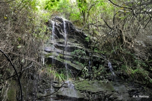
In the area of Podares between Fodele and Marathos and within walking distance of the monastery of Agios Panteleimonas, a stream merges with the main river of Santorinios. Along the way, this stream, like many others in the area, forms some waterfalls in winter. The most easily accessible fall is located on the dirt road leading to Santorinios and forms a small 4m natural slide with a small pond at its base.

Next to the only house of Chrissi island, at position Spilios, we meet the old saltpan where salt was produced in the past. In winter the spot turns into a small pond with brackish water and it attracts many migratory birds. This is not the only pond on the island, as a smaller one is formed in the location of Kaki Alyki.
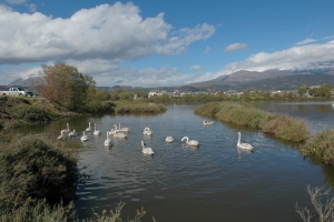
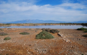
The small lake of Katalyki (Kato Alyki) is located next to the beach of Kokkinos Pyrgos, about 2 km west of Tymbaki. The wetland formerly constituted a united wetland with the Geropotamos delta, but the road construction, water decrease and land use for building Tymbaki airport have separated it from the main delta

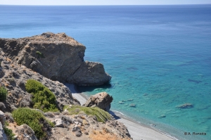
Between the settlements Tsigounas and Platia Peramata there are several beaches with the characteristic black pebble of southern Crete. One of the most unknown and secluded is the long beach of Agios Onoufrios, in a secluded location with many greenhouses almost hanging from the cliffs.

Elassa is the easternmost territory of the province of Sitia and the entire Crete region, as it is located about 3 nautical miles east of Cape Sidero. It spans an area of 1.75 square kilometers, while the highest altitude is 75 meters.


- Home
 Beaches
 Nature
 Past
Past Destinations
 Highlights
 West Crete
- Central Crete
- East Crete
- Towns
- Chania Prefecture
- Chania
- Paleochora
- Kissamos
- Georgioupolis
- Chora Sfakion
- Loutro
- Rethymnon Prefecture
- Rethymnon
- Agia Galini
- Plakias
- Spili
- Anogia
- Heraklion Prefecture
- Heraklion
- Hersonissos
- Malia
- Matala
- Agia Pelagia`
- Archanes
- Kokkinos Pirgos
- Lassithi Prefecture
- Agios Nikolaos
- Elounda
- Sitia
- Ierapetra
- Makrigialos
- Palekastro
- Zakros
- Lassithi Plateau
- Get Prepared


