







Cities
Iraklion (Heraklion or Herakleion) is the largest urban centre in Crete, the capital of the region and the economic centre of the island. Hania (or Chania) is the second biggest town in Crete and is well known for its scenic old town and harbor. Rethymnon is built between the two other large cities of Crete. The town still maintains its old aristocratic appearance, with its buildings dating from the 16th century, arched doorways, fountains etc. Agios Nikólaos is the capital of the Lassithi province of Crete and is built around a picturesque lake on the north-western side of the Mirabello bay.
Heraklion city
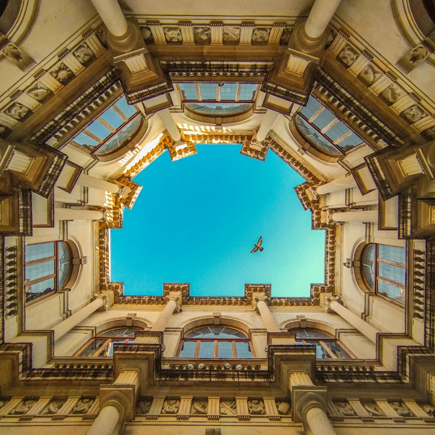
Heraklion is the largest city in Crete and the administrative and economic centre of the island. Its wider urban area has a population of approximately 200,000, while the Municipality of Heraklion recorded 179,302 permanent residents in the 2021 census. The city is home to important public services, universities and major scientific and research institutions, as well as Crete’s principal airport and one of its busiest ports. At the beginning of the 20th century, Heraklion still retained much of the appearance of a historic Mediterranean city, with remarkable Venetian, Ottoman and neoclassical buildings. During the following decades, however, rapid population growth and largely unplanned urban development transformed its character. The arrival of refugees after the Asia Minor Catastrophe of 1922 created an urgent need for new housing, while the extensive post-war reconstruction of the city led to the demolition of many old buildings and their replacement by blocks of flats. Despite these losses, Heraklion still preserves important monuments and neighbourhoods that reveal different aspects of its long history. Visitors can discover traces of its Venetian and Ottoman past, while even local residents may be surprised by the lesser-known corners of the city and the stories hidden behind them. The history of the area reaches back to the Minoan period, when the coast of present-day Heraklion served as the port of the great city and palace of Knossos. A small fortified settlement continued to exist during the Byzantine period, but the foundations of the medieval city were laid after Crete was conquered by Andalusian Arabs in 824. They developed the settlement into the fortified city of Rabḍ al-Khandaq, meaning the Castle of the Moat, from which the later names Chandax and Candia originated. After the Byzantine reconquest of Crete in 961, the city became known locally as Kastro and later as Megalo Kastro, meaning the Great Castle. During Venetian rule it developed into Candia, the fortified capital of the Kingdom of Crete and one of the most important cities of the eastern Mediterranean. The Ottomans called it Kandiye, while the old name Heraklion was gradually revived during the 19th century and had entered official use before the end of Ottoman rule. [widgetkit id=1326]
Chania city
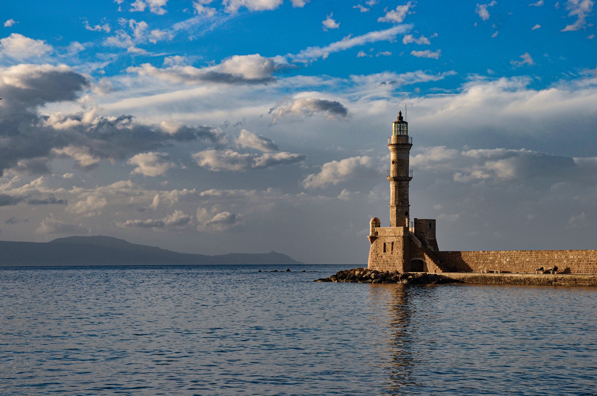
Chania, often described as the “Venice of the East”, is widely regarded as one of the most beautiful cities in Greece. Chania is the second-largest city in Crete after Heraklion. According to the 2021 census, the Municipal Unit of Chania has 54,559 inhabitants, while the wider Municipality of Chania has a population of 111,375. Unlike several other large Cretan cities, Chania has preserved much of its historic character. Its Old Town and Venetian Harbour, with their narrow lanes, historic buildings and imposing Egyptian Lighthouse, form one of the Mediterranean’s most captivating urban landscapes. The modern city stands on the site of ancient Kydonia, one of the most important cities of ancient Crete, as demonstrated by archaeological discoveries on Kastelli Hill. The settlement was fortified during the Byzantine period and developed into a powerful walled city under Venetian rule, with a harbour, bastions, shipyards and public buildings. Following the Ottoman conquest, mosques, baths and other architectural elements were added, several of which survive today. Chania became the capital of Crete in 1851 and retained this role until 1971. Following the withdrawal of Ottoman troops in 1898 and the establishment of the autonomous Cretan State, important public and private buildings were erected, particularly in the district of Halepa. On 1 December 1913, the Greek flag was raised at Firkas Fortress, formally marking the union of Crete with Greece. During the Second World War, the Chania region stood at the centre of the Battle of Crete, with Maleme airfield serving as one of its principal strategic objectives. After German forces withdrew from most of Greece in the autumn of 1944, troops remained confined to an area of western Crete around Chania until their surrender in May 1945. Eleftherios Venizelos, one of the most influential statesmen of modern Greece, was born in the Chania region. His premiership was closely associated with the modernisation of the country and the significant expansion of its territory during the early 20th century. The Tombs of the Venizelos family occupy a peaceful, tree-covered site east of Chania, offering panoramic views over the city. Major attractions include the Old Town, the Venetian Harbour and its Egyptian Lighthouse, the Küçük Hasan Mosque, Kum Kapi, the Venetian shipyards, the Grand Arsenal and Centre for Mediterranean Architecture, Kastelli Hill, Splantzia, the Church of Saint Rocco and the Cathedral of Chania. Also worth visiting are the new Archaeological Museum of Chania in Halepa, the Maritime Museum of Crete at Firkas Fortress, the House of Eleftherios Venizelos in Halepa, the Souda Bay Allied War Cemetery and the Historical Archive of Crete. [widgetkit id=1327]
Rethymnon city
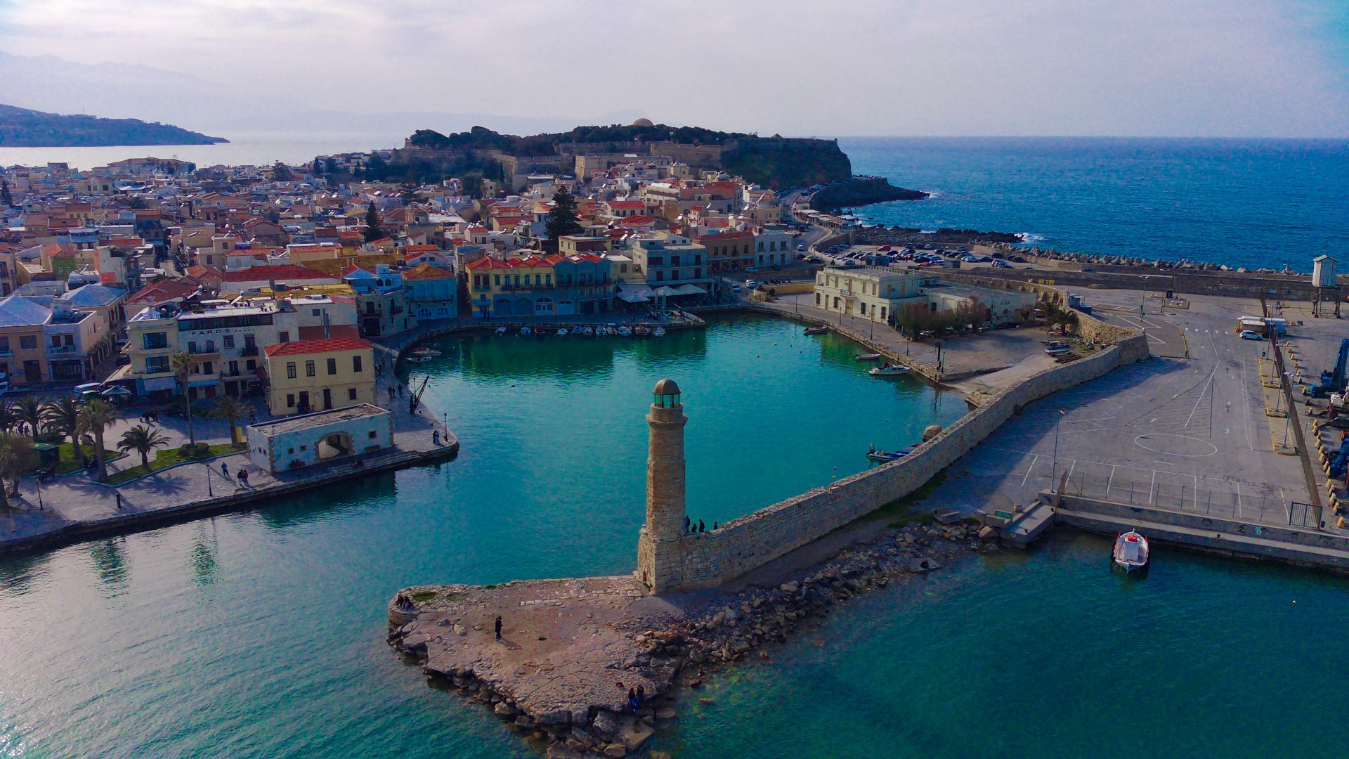
Rethymno is one of the finest surviving examples of a city shaped by the Cretan Renaissance, with a distinctive historic layout and architectural character. Rethymno is the third-largest city in Crete and the administrative centre of the municipality of the same name, which had 57,216 permanent residents according to the 2021 census. The modern city stands on the site of ancient Rhithymna, which was inhabited by the Archaic period and flourished particularly during Hellenistic times. Rethymno developed into a fortified settlement during the Byzantine period and became an important administrative, commercial and intellectual centre under Venetian rule. Its Old Town has largely preserved the urban layout formed during the Venetian and Ottoman periods. Venetian mansions, Renaissance doorways, fountains, Orthodox and Catholic churches, Ottoman mosques and houses with wooden projecting balconies stand side by side along its narrow streets. The city’s distinctive character is closely associated with the flourishing of the Cretan Renaissance, when Byzantine and local traditions interacted with the artistic and intellectual influences of Venice. A dynamic Greek urban and scholarly community developed here, while the wider Rethymno region was the birthplace of the important playwright Georgios Chortatzis, author of the tragedy Erophile. Dominating the Old Town is the imposing Fortezza, one of the most important and best-preserved Venetian fortifications in Crete. It was constructed mainly between 1573 and 1590 on Paleokastro Hill, the site of the acropolis of ancient Rhithymna. Its walls offer panoramic views over the city and the Cretan Sea. Other major attractions include the small Venetian Harbour and its lighthouse, the Venetian Loggia, Rimondi Fountain, the Municipal Garden, the Church of Our Lady of the Angels, the Historical and Folklore Museum of Rethymno, the Neratzes Mosque, the Church of Saint Francis, the Great Gate or Porta Guora, the Kara Musa Pasha Mosque and the Venetian mansions along Arkadiou Street. East of the modern port begins the long sandy beach of Rethymno, extending for several kilometres. The combination of its historic centre, architectural monuments, seafront and lively cultural scene makes Rethymno one of the most attractive cities in Crete. [widgetkit id=1328]

Agios Nikolaos town
Whitewashed houses and beautiful buildings rise above the waterfront, with the sea forming their natural backdrop. Agios Nikolaos, often called simply “Agios” by the Cretans, is a cosmopolitan coastal town and the main urban centre of the province of Mirabello. It is built at the site known as Mandraki, on the western side of the Gulf of Mirabello, and according to the 2021 census has 12,149 permanent residents. Its present name derives from the Byzantine Church of Saint Nicholas, located west of the town centre. In antiquity, the site of the modern town was occupied by Lato pros Kamara, the port of the ancient city of Lato, near Kritsa. During the Byzantine period, the area was known as the Diocese of Kamara, although the settlement remained relatively small for many centuries. Agios Nikolaos developed considerably during the 20th century and gradually became one of Crete’s best-known holiday resorts, while retaining its peaceful and picturesque character. The landmark of Agios Nikolaos is the picturesque Lake Voulismeni, a former lake in the centre of the town that is now connected to the sea by a narrow channel. Its deep waters have inspired numerous legends, including the belief that the lake is bottomless. According to a widespread local account, German forces disposed of military equipment in its waters before withdrawing from the area in 1944. A walk around the lake is one of the most enjoyable experiences in the town. Other attractions include the neoclassical buildings, the marina, the islet of Agii Pantes, which hosts a protected population of Cretan wild goats, and the waterfront area of Kitroplatia with its tavernas. The lively pedestrian streets are lined with shops and cafés, while the numerous stairways reflect the steep terrain on which the town was built. [widgetkit id=1329]
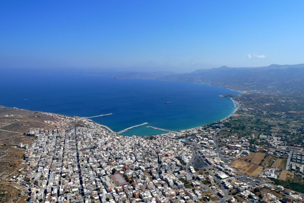
Sitia town
Sitia is the easternmost town of Crete, built amphitheatrically on the western side of the bay bearing the same name, in a region with a warm and dry climate. Sitia lies 64km east of Agios Nikolaos and is the principal urban and commercial centre of the province of Sitia. It has a port and the “Vitsentzos Kornaros” Airport, while road connections link it with Ierapetra, Agios Nikolaos and the settlements of eastern Crete. The local economy is based mainly on agriculture, commerce and tourism. In the town, visitors can swim at the long beach of Sitia, stroll around the harbour and along the waterfront or explore the older neighbourhoods with their traditional houses and picturesque courtyards. Rising above the town is the fortress of Kazarma, the most important surviving monument of medieval Sitia. The Archaeological Museum of Sitia is particularly interesting, displaying finds dating from approximately 3500 BC to the 5th century AD from across eastern Crete. The town also hosts the Folklore Museum of Sitia, whose collections present everyday life, traditional occupations and the cultural heritage of the province. The best-known local products include the award-winning olive oil, Sitia wine and the Cretan spirit tsikoudia. The area has been inhabited since the Neolithic period, while important Minoan buildings and sections of fortification have been excavated at Petras. The name of Sitia has been associated with the ancient city of Eteia or Siteia, although it has not been established that this ancient settlement stood on the exact site of the modern town. According to one ancient tradition, the Cretan city of Eteia was considered the birthplace of Myson, who was counted among the Seven Sages of antiquity. Ancient Eteia has also been associated with Praisos and is mentioned as one of its ports. During the Byzantine and Venetian periods, Sitia developed as a commercial harbour and was protected by fortification walls and the Kazarma fortress. The destructive earthquake of 1508 and the raid of Hayreddin Barbarossa in 1538 caused severe damage to the town and its fortifications. In 1651, the Venetians abandoned Sitia and demolished much of its defensive system so that it could not be used by the Ottomans. Modern Sitia was rebuilt in 1870 according to the urban plan of Avni Pasha and was named Avnie in his honour. The name was used mainly by the Ottomans, while the Greek inhabitants continued to call the town Steia or the Port of Sitia. The wider region is closely associated with the poet Vitsentzos Kornaros, who was born at Trapezonda in the province of Sitia in 1553. He wrote “Erotokritos”, one of the greatest works of Cretan literature. The religious drama “The Sacrifice of Abraham” has also traditionally been attributed to Kornaros, although this attribution is questioned by some modern scholars. [widgetkit id=1330]
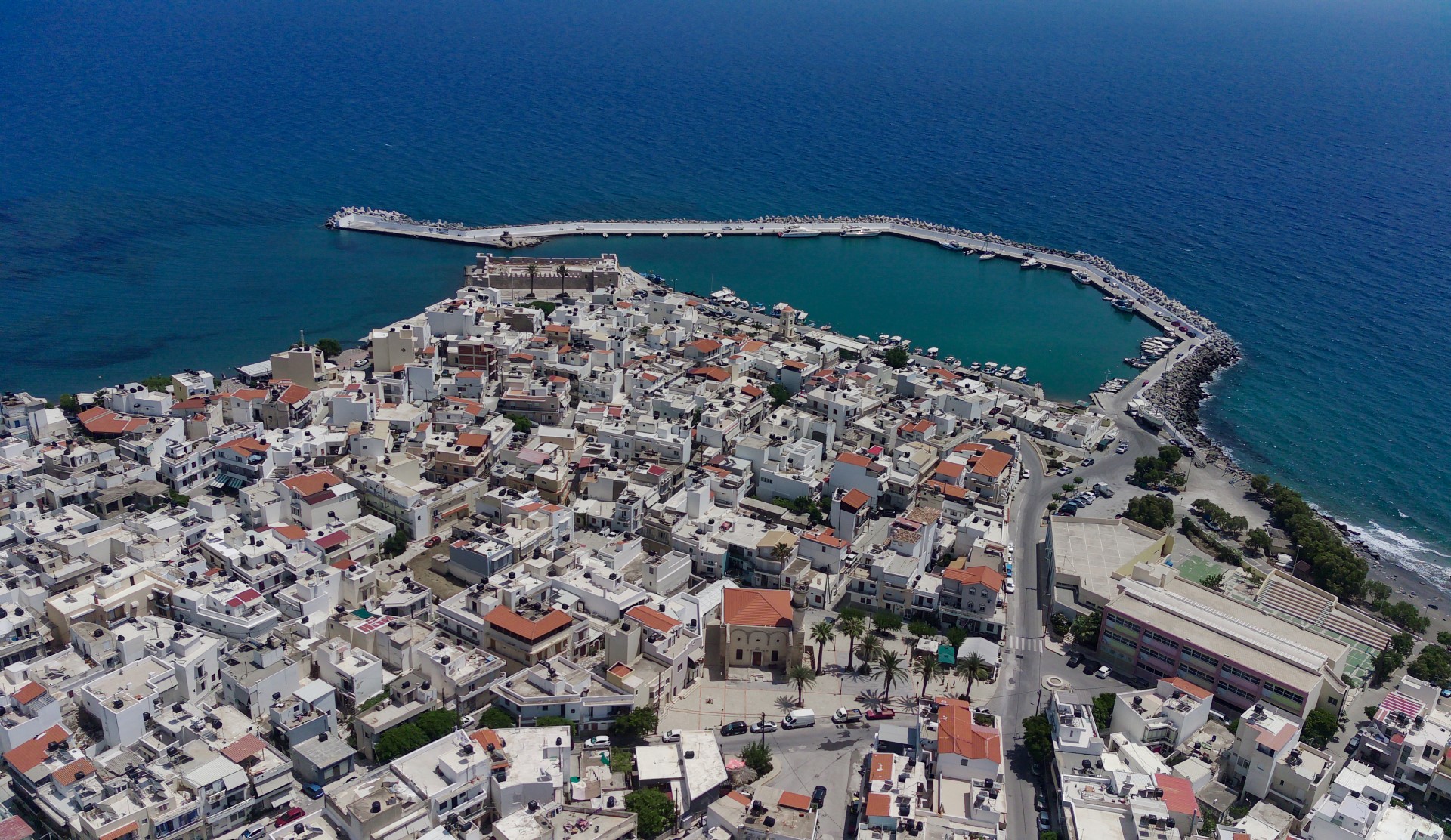
Ierapetra town
Ierapetra lies 30 km south of Agios Nikolaos, near the narrowest part of Crete, and is the southernmost town in Greece. Ierapetra is a modern and lively coastal town whose economy is based mainly on agriculture and tourism. The fertile plain surrounding the town produces large quantities of early-season vegetables, much of which are exported to European markets. Ierapetra also offers well-developed tourist facilities, with hotels of all sizes, restaurants, cafés and attractive beaches. Its seafront promenade is the liveliest part of the town, particularly on summer evenings. The modern town stands on the site of ancient Hierapytna. Throughout its long history, the settlement was associated with names such as Kyrva, Kamiros, Pytna and Hierapytna. Its strategic position near the narrowest part of Crete and opposite the coast of North Africa encouraged the development of trade and navigation. One of Hierapytna’s principal rivals in eastern Crete was Praisos, which it destroyed in 155 BC. The city gradually acquired one of the largest territories of any Cretan city-state, extending from the area of Tsoutsouras to Xerokambos. It later competed with the powerful city of Itanos, near present-day Vai. During the Roman period, Hierapytna flourished and became one of the most important cities in Crete. Its harbour was particularly significant because of its position on the maritime routes towards Egypt and the eastern Mediterranean. The town retained its importance during the First Byzantine period but later suffered destruction during the Arab raids. Under Venetian rule, its defences were strengthened and the fortress of Ierapetra was constructed. The best-known landmark of the town is the seaside Kales Fortress, situated at the entrance to the old harbour. Its origins date to the Venetian period, although the building underwent later alterations and additions. Today it is an important archaeological site and occasionally hosts cultural events. Visitors should also explore the small and picturesque Old Town in the district of Kato Mera. One of its most unusual landmarks is the so-called House of Napoleon. According to local tradition, Napoleon Bonaparte stayed there anonymously for one night in July 1798 while travelling to Egypt. The story claims that he left a note the following morning revealing his identity. Kato Mera is also home to an Ottoman mosque and its accompanying fountain. Near the Town Hall stands the former Ottoman School, built in 1899, which now houses the Archaeological Collection of Ierapetra. Its exhibits originate from ancient Hierapytna and the surrounding region and date from the Bronze Age to the 4th century AD.

Makrigialos Town
Makrigialos is one of the best-known seaside resorts in southeastern Crete, located approximately 58 km southeast of Agios Nikolaos and 23 km east of Ierapetra. It lies in the province of Sitia, within the area of the community of Agios Stefanos, on a sheltered section of the South Cretan Sea. The settlement stretches along a long sandy beach, from which its name derives, and has a picturesque harbour with fishing boats and small vessels. Modern Makrigialos essentially consists of two neighbouring settlements, Makrigialos around the harbour and Analipsi farther east, which have now merged. From a small and isolated coastal settlement in the 1950s, when the local road network was still very limited, it gradually developed into the principal tourist resort of southeastern Crete. Accommodation, tavernas, restaurants, cafés and shops can be found along the seafront. The long beach of Makrigialos has fine sand and usually calm, shallow water, as it is protected from the northern winds. This makes it especially popular with families. A short distance from the settlement is the exit of the lush Pefki Gorge. The gorge begins south of the traditional village of Pefki and ends near the settlement of Aspros Potamos, approximately 2 km north of Makrigialos. The route passes through pine trees, impressive rock formations and old watermills. The area is also of considerable archaeological interest. At Plakakia, west of the settlement, archaeologists have excavated a Minoan country house dating from the Neopalatial period. Its arrangement includes architectural elements resembling those of the Minoan palaces. Above the present harbour, at Katovigli, lie the remains of the Roman villa of Makrigialos, excavated in 1977. The luxurious complex developed around an elongated courtyard and contained dozens of rooms, baths, marble surfaces and mosaic floors. Makrigialos is also a convenient starting point for exploring the beaches of southeastern Crete, the traditional mountain villages of the province of Sitia, Orino Gorge and the Monastery of Kapsa. {loadposition nearestplaces}
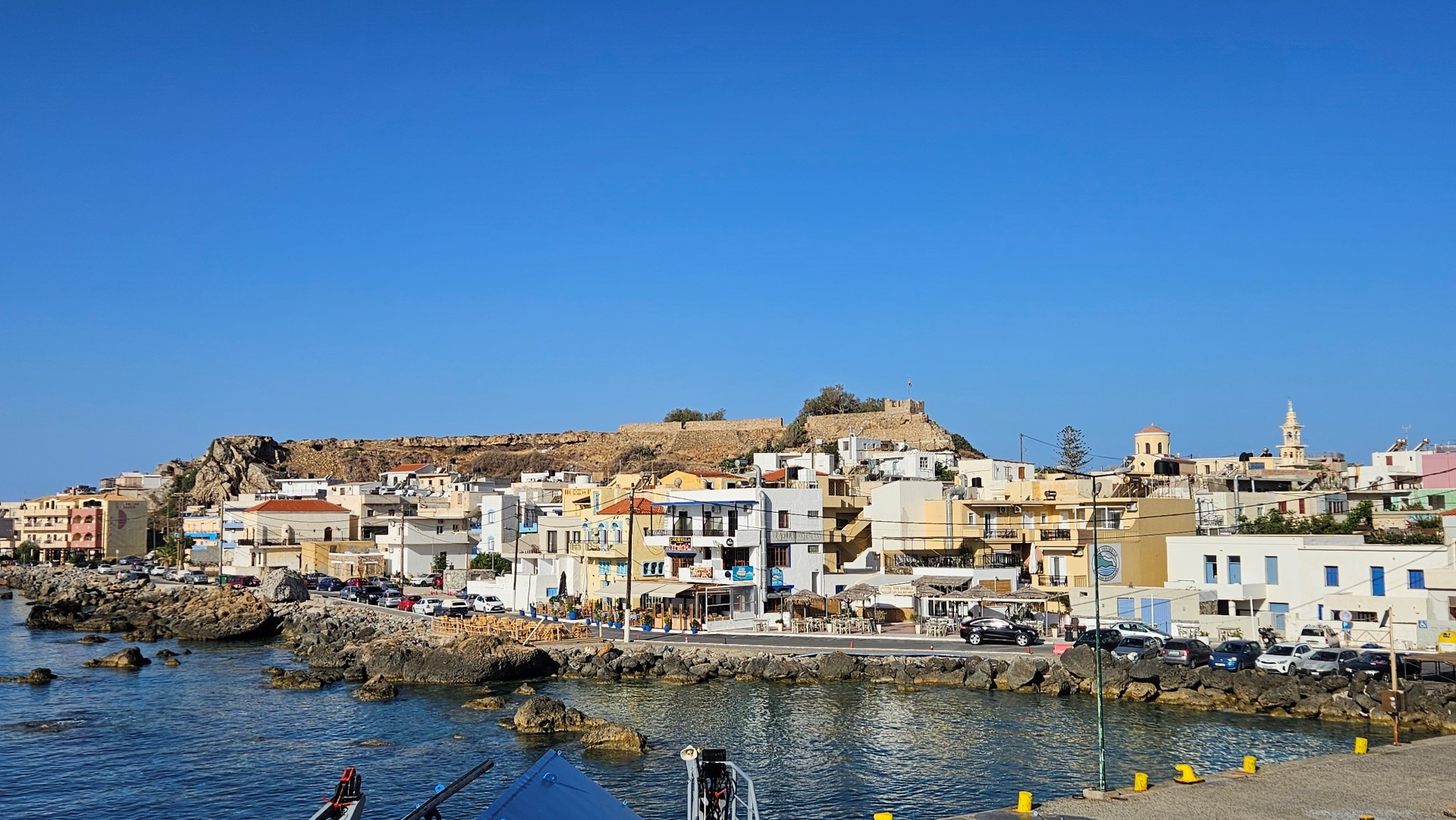
Paleochora Town
Paleochora is the main coastal town of the province of Selino, built on a narrow peninsula on the southwestern coast of Crete. Paleochora is located 77 km south of Chania, on a small peninsula approximately 700 m long and 400 m wide, overlooking the Libyan Sea. It is the main coastal town and one of the most important economic and tourist centres of the province of Selino. The local economy is based on tourism and agriculture, particularly the cultivation of early vegetables in greenhouses and the production of olive oil. Paleochora began developing as a peaceful holiday destination in the early 1970s, when it became popular with hippies and independent travellers. Despite its later tourist growth, it has largely retained its relaxed and unpretentious character. Along the approximately 11 km coastline surrounding the town are organised beaches as well as small secluded coves. The long sandy beach of Pahia Ammos lies on the western side of the peninsula, while the pebble beach of Halikia stretches along its eastern side. The beaches of Gialiskari, Anidri, Grammeno and Krios, together with numerous smaller shores, are also located nearby. Paleochora offers hotels, rooms, restaurants, tavernas, cafés, shops, a health centre, pharmacies and the basic services required by residents and visitors. During the tourist season, ferries connect its harbour with Sougia, Agia Roumeli, Loutro, Chora Sfakion and Gavdos. Timetables vary according to the season and weather conditions. History The ancient city of Kalamyde or Kalamydi is believed to have stood somewhere in the wider area, although its exact location has not been conclusively identified. Some researchers place it north of modern Paleochora, near Agia Triada, where rock-cut tombs and traces of ancient structures have been found. In 1282, the Duke of Crete Marino Gradonigo constructed Castel Selino at the southern end of the peninsula to strengthen Venetian control over the rebellious region. The name Selino was gradually adopted for the entire province. A small settlement of craftsmen and merchants developed around the fort and became the predecessor of modern Paleochora. The fortress was destroyed during the revolt of 1332 and rebuilt in 1334. It suffered further destruction during the raid of Hayreddin Barbarossa in 1539 and was subsequently repaired by the Venetians. In 1645 it was captured by the Ottomans, who modified it for their own defensive needs. By the early 19th century, the surrounding area was almost deserted and the fortress was already largely ruined. Modern Paleochora began developing again from 1866, mainly because a harbour was needed for the transport of agricultural products from the province of Selino. Merchants, sailors and families from the surrounding villages gradually settled near the old fortress. During the Battle of Crete in 1941, fighting took place in the area between German troops and Greek forces supported by members of the Cretan Gendarmerie. After the Second World War, families from Gavdos also settled in the old part of Paleochora, creating the neighbourhood still known as Gavdiotika. [widgetkit id=1345] {loadposition nearestplaces}
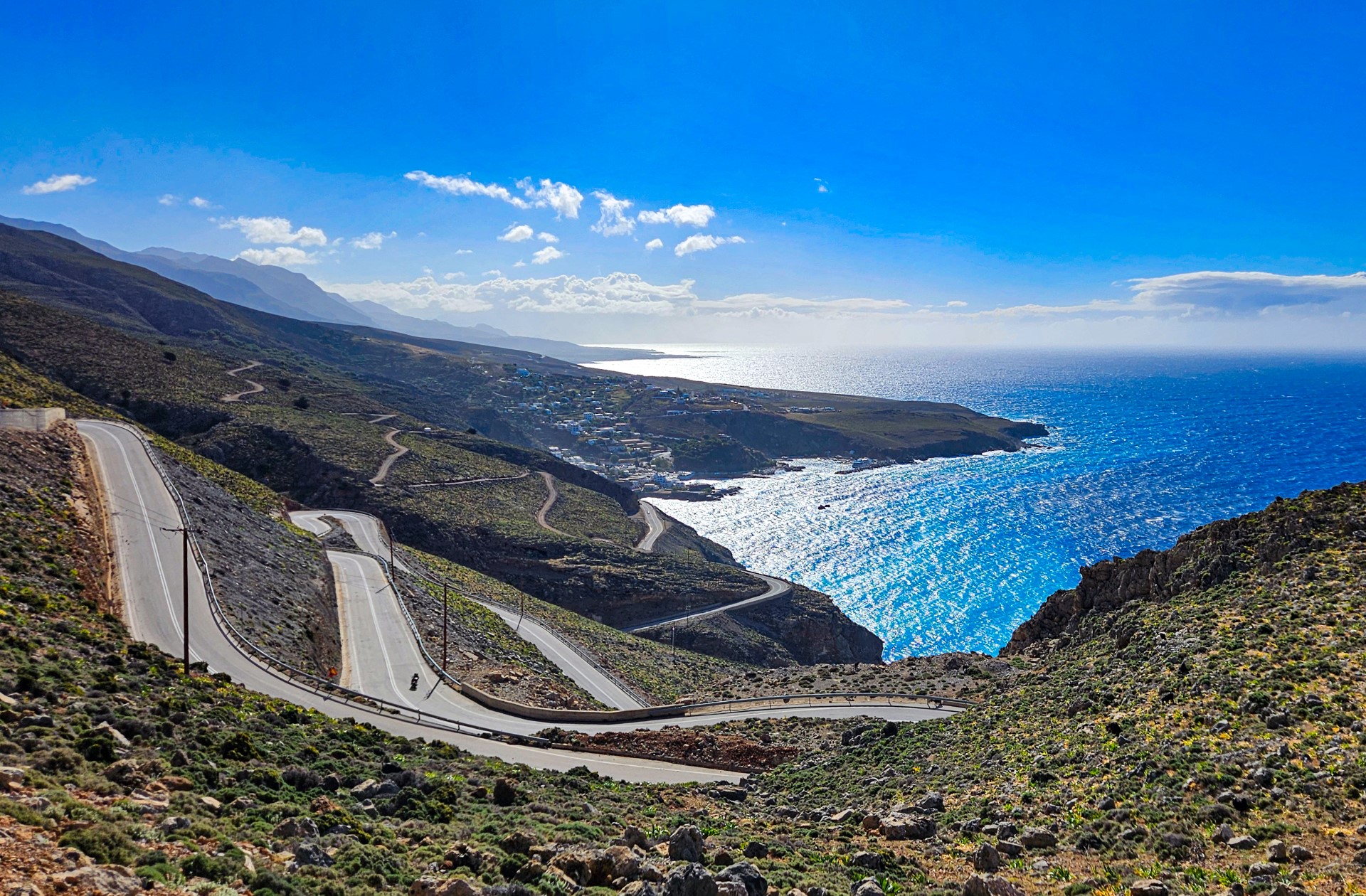
Chora Sfakion Town
Chora Sfakion, also known simply as Sfakia, is a small coastal town and the principal port of the remote and mountainous province of Sfakia. Chora Sfakion lies on the south coast of Crete, approximately 74 km south of Chania, near the exit of the Imbros Gorge. It is the main tourist and transport centre of the wider area and an important starting point for exploring the southern coast and the White Mountains. The town has two small harbours. Ferries operate mainly during the tourist season, connecting Chora Sfakion with picturesque Loutro and Agia Roumeli, at the exit of the Samaria Gorge. Depending on the season and the published timetable, services may also connect the port with Sougia, Paleochora and the island of Gavdos. Visitors should always check the current schedule before travelling. Chora Sfakion has tavernas, cafés, small shops and a range of accommodation in rooms, studios and apartments. It also provides basic services for residents and visitors, together with bus connections to Chania. The local economy is based mainly on tourism, fishing, livestock farming and olive oil production. The main beach of the town is Vrissi, located at its western end. Several other small pebbly beaches with clear water lie along the surrounding coast. The coastal section of the European E4 trail towards Loutro and Agia Roumeli also passes through the area. History Chora Sfakion developed as the port of the mountainous province and enjoyed considerable commercial activity during the Venetian and Ottoman periods. The Sfakians maintained a small fleet and traded with other ports of the eastern Mediterranean. According to local tradition, the town and its surroundings once contained a large number of churches. The rugged landscape of Sfakia and the nearby White Mountains encouraged the development of resistance movements and provided refuge for Cretan fighters during periods of foreign rule. Nearby Anopolis was the birthplace of Ioannis Vlachos, better known as Daskalogiannis, who led the Cretan revolt of 1770. During the Battle of Crete in 1941, Chora Sfakion became one of the principal evacuation points for Allied troops heading to Egypt. The area was heavily bombed, and several buildings in the town were destroyed or seriously damaged. [widgetkit id=1356] {loadposition nearestplaces}

Agia Galini Town
Agia Galini is one of the best-known seaside resorts on the southern coast of Crete. It lies in the province of Agios Vasilios, approximately 61 km southeast of Rethymno and 68 km southwest of Heraklion. The beaches of Agia Galini, its picturesque harbour and its sloping streets lined with tavernas and small shops attract many visitors. Before the tourism development of the 1960s and 1970s, Agia Galini was a small coastal settlement that served as the port of the nearby village of Melambes. During the 1960s, the village became a favourite destination for independent travellers and hippies looking for peaceful places along the southern coast of Crete. Many of those early visitors continued returning for years, helping Agia Galini acquire an international reputation. Today, Agia Galini offers accommodation, restaurants, cafés and the basic services required by visitors. The village is built amphitheatrically on the slopes of Lavrastos, with views over Messara Bay and the South Cretan Sea. East of the settlement is the mouth of the Platys River, also known as the Amarianos, which crosses the valley of Amari. Farther north rise the southern foothills of Mount Psiloritis, with their rugged slopes and traditional villages. The rocky coastline west of Agia Galini contains small caves and isolated coves, many of which are mainly accessible from the sea. One is known as the Cave of Daedalus, as local tradition associates it with the mythical craftsman Daedalus. During the tourist season, excursion boats depart from the harbour for nearby coasts and beaches, depending on schedules and weather conditions. Popular destinations include Agios Georgios, Agios Pavlos and the Paximadia islets. A small sheltered beach with pebbles and clear water lies on the southern side of the eastern islet. History Ancient Soulia stood at the site of present-day Agia Galini and served as the harbour of Sybrita. Ancient Sybrita was situated near the modern village of Thronos in the Amari valley and communicated with its harbour through the valley of the Platys River. Archaeological investigations have uncovered architectural remains, columns and traces of a sanctuary attributed to the goddess Artemis. A Roman shipwreck dating from the late 3rd century AD has also been identified in the waters near Agia Galini. Bronze figurines, lamps, busts and other objects have been recovered from the wreck area, with finds from the region kept at the Archaeological Museum of Rethymno. Ancient Soulia appears to have declined or been destroyed during the period of Arab raids and the conquest of Crete in the early 9th century. During the Christian period, the Monastery of Galinios Christos was established in the area, possibly near the remains of the ancient sanctuary. The old Church of the Dormition of the Virgin Mary, associated with the monastery, survives in the cemetery outside the village. On the high rock west of the harbour stands the modern monument to Daedalus and Icarus. According to local tradition, this was the point from which the two mythological figures began their flight to escape King Minos. Several traditions attempt to explain the name Agia Galini. The best known tells of a Byzantine princess whose ship encountered a severe storm while travelling towards the Holy Land. After finding refuge in the sheltered bay, she is said to have built a church in gratitude to the Virgin Mary and named it Panagia Galini, meaning Our Lady of Serenity. Another interpretation connects the name with the Greek phrase aei galini, meaning “always calm”. The form Agios Galinis also appears in older sources and maps. None of these explanations is considered conclusively proven, but they remain an important part of local tradition. Agia Galini can be reached by road from Rethymno through Spili and from Heraklion through Tymbaki. [widgetkit id=1346] {loadposition nearestplaces}
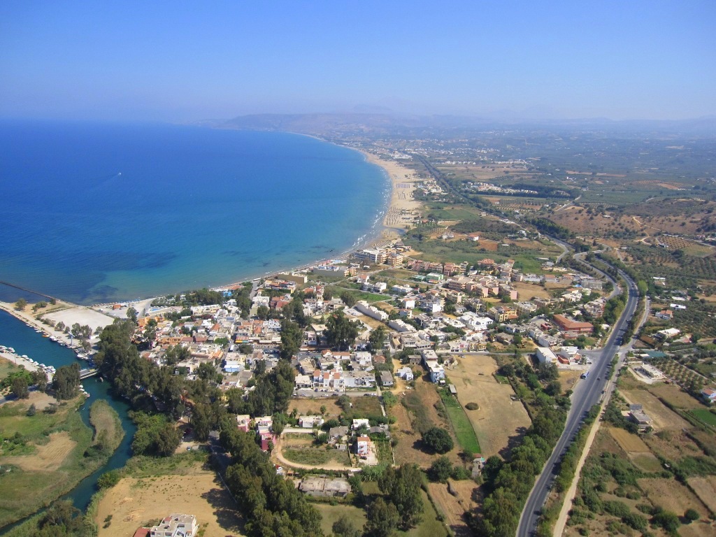
Georgioupolis Town
Georgioupolis is a popular seaside resort in the province of Apokoronas, approximately 38 km east of Chania and 21 km west of Rethymno. The small coastal town stands at the head of Almyros Bay, surrounded by a fertile green plain with rivers, springs and wetlands. The local economy is now based mainly on tourism, although agriculture and beekeeping remain important traditional activities. The Almyros River reaches the sea beside the town after passing through an important wetland with rich vegetation and birdlife. The river and the surrounding springs help the plain remain green even during the warmest months. One of the characteristic features of Georgioupolis is its central road and square, shaded by large eucalyptus trees. Tavernas, cafés and small shops surround the square, while the picturesque fishing harbour lies near the mouth of the Almyros River. The best-known landmark is the whitewashed chapel of Agios Nikolaos. The church was originally built on a small rocky islet, which was later connected to the shore by a long stone pier. Seen from a distance, the chapel appears to float on the sea and has become one of the most recognisable images of northern Crete. East of the town stretches the long sandy beach of Georgioupolis, continuing towards Kavros and the area of Kournas. Its length, shallow waters and organised facilities make it especially popular with families and visitors staying in the wider area. A short history The area has been inhabited since prehistoric times, as indicated by Minoan finds and a tomb discovered on Kastellos Hill. The ancient town of Amphimalla or Amphimallion later developed around the hill of Venou or Kefala. It is generally identified as the harbour of ancient Lappa, located at present-day Argyroupoli. Architectural remains and objects associated with ancient worship have been discovered in the surrounding area. During the Byzantine period, Saint John Xenos was active here and is associated with the foundation of the Monastery of Saint George at nearby Dramia, as well as with the development of viticulture and beekeeping. In the early 13th century, the Venetians recognised the strategic importance of the bay and its fertile plain and constructed two small forts. They were known locally as Kastellakia or Paliokastela and in Venetian sources as Castello dell’Almiro. At least one survived into the Ottoman period, until it was destroyed by Cretan revolutionaries in 1821. The Ottomans did not rebuild it. The establishment of the modern settlement began in 1880, when Miltiadis Papadogiannakis settled in the area and attempted to drain the marshes and transform them into cultivable land. The new settlement was initially named Armyroupoli or Almyroupoli after the Almyros River and began attracting more residents after 1893. Hundreds of eucalyptus trees and other species were planted during the development of the settlement, and several survive today. In 1899, Almyroupoli was renamed Georgioupolis in honour of Prince George of Greece, the first High Commissioner of the autonomous Cretan State from 1898 to 1906. [widgetkit id=1347] {loadposition nearestplaces}

Plakias town
Plakias is a popular seaside resort in the province of Agios Vasilios, approximately 36 km south of Rethymno, in a fertile valley opening onto the South Cretan Sea. The valley is crossed by the Kotsifos River, which descends from the surrounding mountains and reaches the sea near the settlement. Modern Plakias began developing as a small coastal village around the end of the 19th and the beginning of the 20th century. During the following decades, it grew into one of the best-known resorts on the southern coast of Rethymno. In the 1960s, the beaches of Yialia, as the long coastal front is locally known, became a favourite destination for hippies and independent travellers. Today, Plakias is an organised resort and a convenient base for exploring the natural and cultural attractions of southern Crete. What to see in Plakias The mountain villages of Myrthios, Sellia and Asomatos lie a short distance away. They preserve elements of their traditional architecture and offer panoramic views over Plakias Bay. Other important destinations include the beach and palm forest of Preveli, the monasteries of the area and the gorges of Kotsifos and Kourtaliotis. Plakias offers a wide range of accommodation and dining options, shops, organised beaches and centres for water sports and scuba diving. Its small harbour serves fishing and excursion boats, while the long main beach stretches eastwards from the settlement to the imposing rock of Paligremnos. An interesting attraction is the old watermill in the Kotsifos valley, approximately 1.5 km from the settlement. The route follows the river through a green landscape with plane trees and other water-loving vegetation. At the eastern end of Plakias Beach rises the impressive limestone rock of Paligremnos. The site is also known as Gonates, meaning “knees”, because local tradition claims that the legendary hero Digenis Akritas knelt here to drink water from a nearby spring. At the foot of the rock are the lignite transport tunnels of Plakias. Lignite from deposits near Myrthios was transported in small wagons along a narrow-gauge Decauville railway and loaded onto ships on the eastern side of the bay. The operation proved economically unviable and was eventually abandoned. During the German occupation, the tunnels were enlarged and adapted for supplying submarines. Plakias is also home to the Church of Zoodochos Pigi, built on the remains of an earlier religious structure. According to a local legend, two young women once took refuge in the church while being pursued by pirates. As the pirates waited outside, the southern wall miraculously opened, allowing the women to escape into the neighbouring olive grove. Historical background Modern Plakias was gradually established by fishing families and residents from the mountain village of Sellia who settled near the coast. The nearby villages of Sellia and Myrthios are considerably older, while remains of old roads and bridges show the long-standing connection between the upland settlements and the shore. Although the present settlement is relatively recent, the area was inhabited in antiquity. Finds dating mainly from the Roman period have been discovered, along with indications of earlier occupation. Some researchers have proposed identifying the area with ancient Lamon or with the Phoenix of the Lappaeans, but neither identification has been conclusively established. An extensive ancient cemetery containing numerous graves has been identified near Zoodochos Pigi. Many graves are missing their large covering slabs, which were probably removed and reused as building material. One interpretation associates the name Plakias with these numerous slabs, known as plakes in Greek, while another connects it with the natural stone slabs along the coast. [widgetkit id=1348] {loadposition nearestplaces}
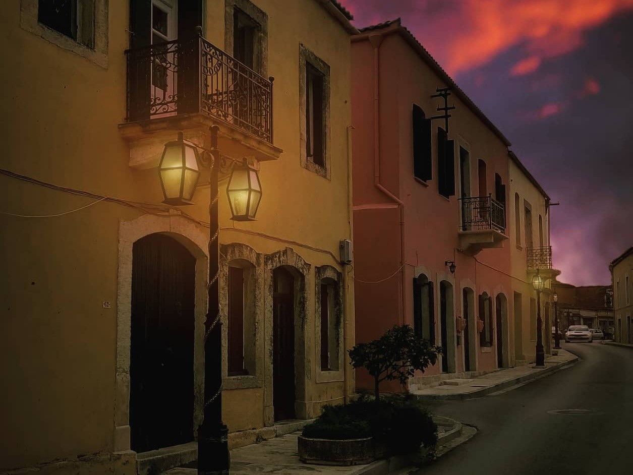
Archanes village
Archanes is a picturesque small town in the province of Temenos, built at an altitude of approximately 380 metres in a fertile basin between Mount Giouchtas and the hill of Kefala. The town lies approximately 14 km from Heraklion and only 7 km from the Minoan Palace of Knossos. The valley is crossed by the Kaeratos River, whose waters continue through the Knossano Gorge and reach the sea near Katsambas. Archanes is distinguished by its restored colourful houses, neoclassical buildings, courtyards and narrow streets. In 2000, it received an important distinction in the European Village Renewal competition, recognising its integrated and sustainable development and the successful preservation of its architectural heritage. Small museums and collections present the long history of the area, from the Minoan and Byzantine periods to more recent Cretan folk culture. Traditional houses, public buildings and numerous historic churches complete the character of one of Crete’s best-preserved settlements. The central square is the liveliest part of Archanes, lined with cafés and tavernas serving local dishes and traditional Cretan cuisine. The town is also particularly well known for its wine, as viticulture and winemaking have deep roots in the surrounding countryside. Old olive mills and wine presses preserve evidence of the traditional methods once used to produce olive oil and wine. South of Archanes, the Minoan country house at Vathypetro contains one of the oldest surviving Minoan wine presses on Crete, demonstrating the area’s exceptionally long association with winemaking. During summer, Archanes hosts cultural and agricultural events, several of which are connected with the grape harvest, wine and the products of the Cretan land. Local celebrations offer visitors an opportunity to experience the traditions and everyday life of the settlement. The surrounding countryside offers many opportunities for walking and exploration. West of the town rises the sacred Mount Giouchtas, whose highest summit reaches 811 metres. Its outline resembles a human face lying on its back and was associated with the ancient tradition that the tomb of Zeus was located here. Marked walking trails cross Giouchtas, passing important archaeological remains, the Minoan peak sanctuary and the Church of Afentis Christos. Hikers can also follow sections of the European E4 trail, including the routes from Profitis Ilias to Archanes and from Archanes towards Myrtia. Other rewarding excursions include the Archanes or Knossano Gorge and the wooded hill of Fourni. Here visitors can walk through the Fourni Wood and visit the Minoan necropolis of Fourni, one of the most important prehistoric cemeteries in Crete. [widgetkit id=1344] {loadposition nearestplaces}
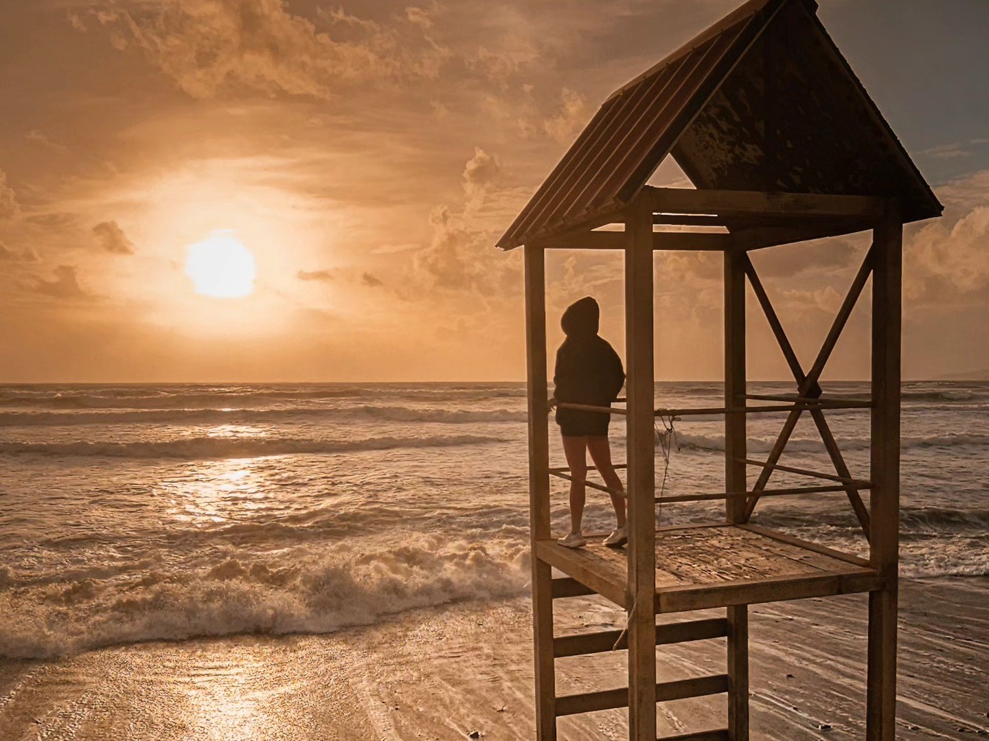
Tymbaki Town
Tymbaki is a busy agricultural town on the Messara Plain, in the historic province of Pyrgiotissa, close to important beaches, wetlands and archaeological sites. Tymbaki lies approximately 65 km southwest of Heraklion, on the western side of the Messara Plain. It is one of the main agricultural centres of southern Crete, surrounded by extensive olive groves, vegetable fields and greenhouses. A significant part of the produce grown in the area is distributed throughout Greece or exported abroad. The beach of Kokkinos Pirgos is only a short distance away, while the Minoan Palace of Phaestus and the Minoan villa of Agia Triada are also easily accessible. The large Church of Saint Titus stands near the centre of the town, around which much of its commercial activity is concentrated. Tymbaki during the Second World War The modern appearance of Tymbaki is closely connected with the events of the German occupation. In early 1942, the German forces ordered the evacuation of the settlement, forcing its families to seek shelter in the surrounding villages. Most of the houses were demolished, and building materials taken from them were used in the construction of the nearby military airfield. The airfield was intended to support Axis operations in North Africa and the Mediterranean. Forced labour from the wider area was employed during its construction, while the installations were repeatedly targeted by Allied bombing. After the war, Tymbaki had to be largely rebuilt, which explains why relatively few older buildings survive in the town today. Geropotamos and Katalyki The Geropotamos River, the principal river of the Messara Plain, reaches the sea near Tymbaki. Close to its mouth and Kokkinos Pirgos lies the small Katalyki wetland, an important stopover for waterbirds and migratory birds. In earlier times, the marshes of the area encouraged the spread of malaria and restricted the development of the coastal settlements. [widgetkit id=1349] {loadposition nearestplaces}

Arkalochori Town
Arkalochori is located approximately 33km south of Heraklion, at an altitude of about 400m. It is one of the main residential and commercial centres of the Heraklion hinterland and the historic province of Monofatsi. The local economy is based mainly on agriculture, livestock farming, commerce and services for the surrounding villages. An open-air market is held in the centre of Arkalochori every Saturday, continuing a tradition whose roots reach back to the Ottoman period. The town’s exhibition centre also hosts the Pan-Cretan Agricultural and Livestock Exhibition, presenting products, machinery and services associated with the primary sector. According to the most widespread folk interpretation, the town’s name derives from the word “arkalos”, the Cretan dialect word for the badger. An alternative explanation connects the name with Arkoleontas or the older form Arkoleochori. The settlement is recorded in Venetian sources from the late 14th century. Archaeological sites The most important archaeological monument in the area is the Sacred Cave of Arkalochori, on Profitis Ilias Hill. An exceptionally large collection of metal offerings was discovered inside, including bronze swords and daggers, copper ingots and double axes made of bronze, gold and silver. The most renowned find is the inscribed Arkalochori Axe, bearing fifteen symbols that have not yet been deciphered. The most important finds are displayed at the Archaeological Museum of Heraklion. Traces of the ancient town of Arkalochori survive on the summit and slopes of the same hill. The site was occupied for a long period and preserves rock-cut building foundations, cisterns and remains of other installations. Further north, at Kefala near Galatas, stands the Minoan Palace of Galatas, an important palatial complex of the Minoan period. On 27 September 2021, the area was struck by a strong earthquake that caused extensive damage to houses, public buildings and monuments. The chapel of Profitis Ilias, above the sacred cave, collapsed and was subsequently rebuilt. [widgetkit id=1350] {loadposition nearestplaces}

Hersonissos Town
The Port of Hersonissos is one of Crete’s best-known tourist resorts, located about 28 km east of Heraklion, in the province of Pediada. The area combines busy and quieter beaches, water parks, entertainment venues and important archaeological monuments. A short distance inland are the traditional villages of Ano Hersonissos, Piskopiano and Koutouloufari, which retain a very different character from the coastal resort. A short tour of Hersonissos Before the development of tourism, the Port of Hersonissos was a small coastal settlement serving the local fishing community and the commercial needs of the surrounding area. It gradually expanded around the old harbour and developed into one of the largest tourist centres in Crete. On the western side of the coastal zone is Cape Sarandaris, with the picturesque chapel of Saint George. From here begin the successive coves of Sarandaris, a series of protected bays with sandy or rocky beaches. Hotels, restaurants and cafés are found along much of the coast. East of the coves rises Kastri Hill, beside the present harbour. Its summit preserves the ruins of an important Early Christian basilica with mosaic floors. On the eastern side of the hill stands the picturesque chapel of Agia Paraskevi, part of which is built into the rock. The site overlooks the harbour and its lighthouse. The lively seafront road begins at the harbour and is lined with shops, restaurants, cafés and nightlife venues. Directly below it stretches the central beach of Hersonissos. During the tourist season, excursion boats operate from the harbour along the surrounding coast and, according to their scheduled routes, towards the island of Dia. Farther east are the busy beaches of eastern Hersonissos and the area’s large hotels. The buildings gradually become less dense towards Cape Drapano. Nearby is the Lychnostatis Open-Air Museum, dedicated to traditional Cretan life, vernacular architecture and old rural occupations. History The area has been inhabited since at least the Minoan period. Traces of Minoan settlements have been identified at Kastri and Anissaras, while the naturally sheltered harbour encouraged the continuous development of the settlement. During the Classical and Hellenistic periods, ancient Chersonesos developed into an important harbour town. It maintained close relations with the powerful city of Lyttos and was later joined to it in a political federation. Chersonesos issued its own coins, often bearing maritime symbols that reflected its close association with trade and the sea. Remains of earlier buildings and a possible sanctuary of Artemis Britomartis have been found at Kastri, together with coins, pottery and figurines. Sections of the ancient fortification can still be identified around the hill. A cemetery containing pottery, jewellery and coins has also been excavated in the wider area. Chersonesos flourished particularly during the Roman period. It possessed an organised harbour, a theatre, baths, fish tanks and other public buildings. The theatre no longer survives, as much of its stone was reused in later structures. Near the seafront stands Sarakinos, a Roman building with mosaic decoration that is generally identified as a monumental fountain. During the Early Christian period, Hersonissos remained an important urban and ecclesiastical centre. The three-aisled basilica on Kastri Hill, one of the largest in Crete, was constructed in the late 5th century over earlier buildings. Its architecture followed eastern Mediterranean models, and parts of its elaborate mosaic floors survive. A second important Early Christian basilica has been identified about 2 km east of the harbour, at the site of the present Church of Agios Nikolaos. Some of its remains lie very close to the sea, while mosaic floors with geometric, floral and animal motifs are still preserved. During the Ottoman period, the harbour was used for transporting products from the province of Pediada, especially olive oil and carobs. During periods of revolt, it also served as a supply point for the Cretan insurgents. [widgetkit id=1351] {loadposition nearestplaces}
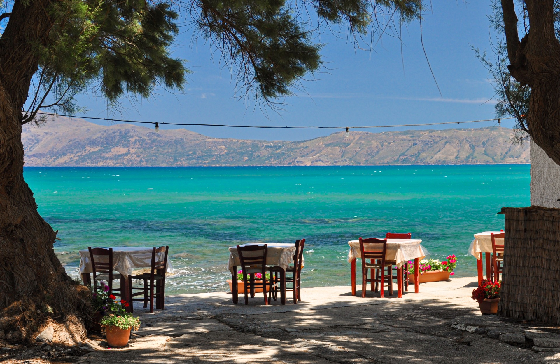
Kissamos Town
Kissamos, also known as Kastelli, is the main town of the province of Kissamos and lies at the head of Kissamos Bay, 36 km west of Chania. Kissamos, still widely known by its former name Kastelli, is the economic and commercial centre of the province of Kissamos. The community of Kastelli had 4,321 permanent residents in the 2021 census. Its economy is based on agriculture, especially the production of olive oil and wine, as well as commerce and tourism. Despite the growth of tourism, Kissamos has largely retained the character of a living Cretan town. Visitors can experience local everyday life, traditional cuisine and the customs of the province, while using the town as a convenient base for exploring western Crete. Kissamos has shops, public services, a health centre, restaurants and a pleasant waterfront promenade. Ferry services connect its port with Antikythera, Kythera, Gythio and Piraeus, depending on the season and the current timetable. During the tourist season, excursion boats also depart for Gramvousa Island and the celebrated Balos Lagoon. Sightseeing Along the seafront lies Telonio Beach, beside the pedestrian promenade lined with cafés and restaurants. Farther west is the sandy beach of Mavros Molos, one of the most popular beaches in Kissamos. The Archaeological Museum of Kissamos is housed in the listed former administrative building on Stratigou Tzanakaki Square. Its exhibition presents the history of the region from prehistory to the Early Christian period. Its most impressive exhibits include the remarkably preserved mosaic floors from the Greco-Roman villas of ancient Kissamos. Skalidi Street, the town’s old market, retains several traditional buildings with arches among its small shops and cafés. About 1.5 km from the centre is Limni, the picturesque old fishing harbour with its fish tavernas. Between the fishing harbour and the main port stands the small rock-cut church of Agios Ioannis Damialis. A short passage beneath the road leads to Damialis Beach, a small pebbly cove with clear water. History The modern town occupies the site of ancient Kissamos, whose pre-Greek name survived through the centuries. Pliny referred to it as Cisamon, while Ptolemy recorded it as the city of Kissamos. The settlement flourished particularly during the Roman period, when it became an important port of western Crete. Numerous remains of Roman Kissamos have been discovered beneath the modern town, including baths, villas with mosaic floors, workshops, cemeteries and sections of an aqueduct. In the late 16th century, the Venetian traveller and antiquarian Onorio Belli recorded the ruins of a theatre and an amphitheatre. Earlier remains have also been found in the wider area, while local tradition associated certain sites with Agamemnon and the Mycenaeans. Kissamos retained its importance during the First Byzantine period and became the seat of a bishopric. During the Second Byzantine period, the episcopal seat was transferred inland to present-day Episkopi, probably to provide greater protection from maritime raids. During Venetian rule, a settlement known as Kastelli developed around Castel Chissamo. The fortress had an irregular pentagonal plan and included barracks, prisons, churches and a well. It was repeatedly damaged by raids and earthquakes and continued to be used during the Ottoman period. Kissamos and the surrounding province actively participated in the Cretan revolutions against Ottoman rule. The inhabitants also made an important contribution to the resistance against the German occupation during the Second World War. [widgetkit id=1352] {loadposition nearestplaces}

Malia Town
Malia is one of Crete’s best-known tourist towns, combining long sandy beaches and lively nightlife with one of the island’s most important Minoan palaces. Malia lies 35 km east of Heraklion, on the fertile coastal plain below the slopes of Mount Selena, in the province of Pediada. According to a widely accepted interpretation, its name derives from the word omalia, meaning a flat or level area. The plain of Malia has abundant underground water and has been an important farming district for centuries. Numerous windmills once pumped water to irrigate the fields. The area became particularly known for its potatoes, early vegetables, olives, bananas, watermelons and other agricultural products. Until the middle of the 20th century, Malia retained the character of a small agricultural settlement. Rapid tourist growth gradually expanded the town towards the coast and the surrounding countryside. Today it is one of the busiest resorts on the northern coast of Crete, particularly known for its long sandy beaches and lively nightlife. The main tourist district extends along the road connecting the old settlement with the coast and contains numerous hotels, restaurants, bars and entertainment venues. The old quarter of Malia, around the Church of Saint Nektarios, presents a different atmosphere, with narrow streets, traditional houses, small squares and quieter restaurants. Sightseeing The most important monument in the area is the Minoan Palace of Malia, located approximately 3 km east of the modern town. It is the third-largest known Minoan palace on Crete, after Knossos and Phaistos. The ancient name of the city that developed around it remains unknown, although mythology associates the palace with Sarpedon, son of Zeus and Europa and brother of Minos. The first palace was constructed near the beginning of the second millennium BC and was destroyed around 1700 BC. A new palatial complex was built on the site and was itself destroyed around 1450 BC. An extensive Minoan town, including houses, workshops, streets and public buildings, has been excavated around the palace. About 500 m northeast of the palace lies the funerary complex of Chrysolakkos. The celebrated gold pendant depicting two bees was discovered there. It is one of the finest surviving works of Minoan jewellery and is now displayed in the Heraklion Archaeological Museum. The old village is worth exploring for its narrow streets and historic churches. Of particular interest is the Church of Panagia Galatiani, a three-aisled church whose different sections were constructed in separate periods. According to local tradition, shepherds donated milk for the preparation of its mortar, giving the church its distinctive name. Other notable churches include Saint John the Baptist, the Archangels, Saint Demetrios, the Annunciation, Saint Pelagia and Saint Sabbas. East of the town, at Loutres, stands the frescoed Church of Saint George, which is associated with old local traditions concerning fairies and supernatural beings. Opposite the main beach of Malia is a small islet crowned by the Chapel of the Transfiguration, one of the most characteristic features of the local coastline. Visitors seeking a quieter beach can continue east to Potamos, close to the archaeological site and the Malia wetland. A pleasant excursion into the countryside leads to the traditional village of Krasi, approximately 10 km southwest of Malia. Its central square is dominated by the enormous monumental plane tree of Krasi, whose trunk measures approximately 24 m in circumference. Nearby are stone fountains supplied with running water, while the surrounding landscape is rich in evergreen oaks and carob trees. [widgetkit id=1353] {loadposition nearestplaces}
Anogia village
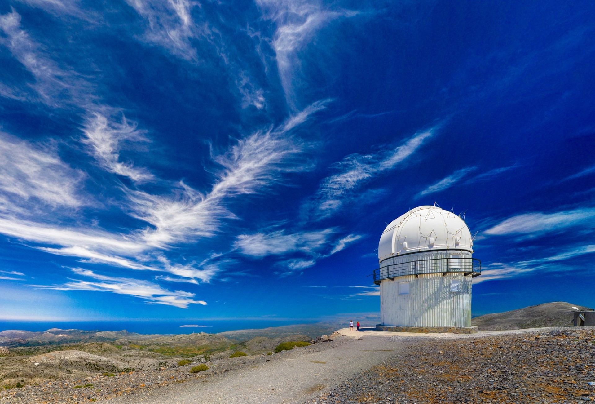
Anogia is one of Crete’s most historic mountain towns, closely associated with Mount Psiloritis, pastoral life, traditional music and the island’s struggles for freedom. Anogia lies in the historical province of Mylopotamos, approximately 36 km west of Heraklion and 52 km southeast of Rethymno, at an altitude of about 750 metres. It extends across several levels along the Armi ridge, on the northern slopes of Mount Psiloritis. Its name is associated with its elevated mountain location. Life in Anogia remains closely connected with the mountain. Livestock farming, cheese making, weaving and other traditional activities continue to form an important part of the local economy and identity. In the town’s squares, cafés and tavernas, visitors can discover its distinctive dialect, local cuisine and renowned musical tradition. Sights and culture Among the historic churches of Anogia are those dedicated to Saint George, Saint Demetrius, the Dormition of the Virgin Mary and Saint John the Baptist. The latter preserves damaged but important frescoes dating from the early 14th century. Anogia has made an exceptional contribution to Cretan music and culture. Several distinguished lyra players, singers and poets were born here, the best known being Nikos Xylouris, often called the “Archangel of Crete”. The house of Nikos Xylouris stands in the neighbourhood of Perachori. The area also hosts the annual Yakinthia, a series of cultural events devoted to music, poetry and the meeting of different traditions. Weaving is another important element of the local heritage. Traditional textiles with distinctive geometric patterns are still produced in Anogia and can be found in workshops and shops around the town. Psiloritis and the Nida Plateau Anogia is one of the main gateways to Mount Psiloritis. The road from the town leads to the Nida Plateau, the stone-built shepherds’ huts known as mitata, and the Ideon Cave. According to one of the best-known versions of ancient tradition, Zeus was raised inside this sacred cave. Along the route lies Zominthos, an important Minoan mountain complex associated with the management of livestock and agricultural production, as well as with the route to the Ideon Cave. The mountain landscape around Anogia is also ideal for hiking and for discovering the natural and pastoral heritage of Psiloritis. History The wider area of Anogia had considerable religious and economic importance as early as the Minoan period, as demonstrated by the Ideon Cave and Zominthos. The exact date on which the present settlement was founded has not been established. Some traditions place its origins in the Second Byzantine period, while more reliable written references to Anogia appear in Venetian censuses of the 16th century. During Ottoman rule, Anogia played an active role in the Cretan revolts. Its mountainous location provided shelter for revolutionaries but also brought severe reprisals. The town was destroyed in 1822 and again in 1867. During the German occupation of Crete, Anogia became an important centre of resistance. Resistance groups operated in the area, while guerrillas and British agents found shelter here. The abductors of the German general Heinrich Kreipe also passed through Anogia during their escape. On 13 August 1944, General Friedrich-Wilhelm Müller issued an order for the complete destruction of Anogia. The stated reasons included the town’s support for the resistance, the sheltering of guerrillas, the events at Damasta and its connection with the abduction of General Kreipe. German forces executed residents, looted the houses and destroyed almost the entire settlement. The operation continued until early September 1944 and became known as the third Holocaust of Anogia. [widgetkit id=1354] {loadposition nearestplaces}

Neapolis Town
Neapolis is a historic town in the province of Mirabello, built in a fertile valley of dense olive groves, old churches, neoclassical buildings and attractive gardens. Neapolis is located approximately 54 km east of Heraklion and 15 km west of Agios Nikolaos, in the green basin of Mirabello. Its position on the natural passage connecting central and eastern Crete contributed considerably to its economic and administrative development. During the Venetian period, the area was associated with a small settlement known as Kares, while the later settlement became known as Kenourgio Chorio or “New Village”. This name was already recorded in Venetian sources of the 16th century. In 1868, Adosidis Pasha established the administrative seat of Lasithi here and renamed the settlement Neapolis. The town remained the capital of Lasithi until 1904, when the administrative seat was transferred to Agios Nikolaos. Exploring Neapolis The administrative past of Neapolis is reflected in its old public and neoclassical buildings, including the courthouse, the former secondary school, the hospital and the offices of the Metropolis of Petra and Cherronissos. The Historical and Folklore Museum of Neapolis is housed in the building of the town’s first secondary school and presents the daily life, history and traditions of Upper Mirabello. The town is also home to the Iliakios Municipal Library. The imposing Metropolitan Church of Megali Panagia, the largest church in eastern Crete, dominates the central square. Around the square are cafés and shops where visitors can also taste soumada, the traditional sweet almond drink served in Crete on festive occasions. It is also worth walking through the narrow streets of the Agios Dimitrios neighbourhood to see the old aqueduct and the Tower of Maslum Karakasis, locally known as the Seraglio of Adosidis Pasha. A short distance southwest of the town lies the Pashaligo Grove, a lush setting with flowing water and ruined watermills. The remains of the tower of the Venetian lord Filippo Pasqualigo also survive in the area. Near Neapolis stands the church known as Agios Georgios the Bloodstained. Its name is connected with a local tradition according to which, in 1770, during the revolt of Daskalogiannis, Ottoman forces entered the church during vespers and killed the priest and members of the congregation. Ancient Dreros About 2 km northeast of Neapolis, on Mount Kadistos near the chapel of Saint Anthony, lie the remains of ancient Dreros.The most important monument at Dreros is the Temple of Apollo Delphinios or Pythios, one of the earliest known Greek temples. Inside it archaeologists discovered the celebrated “Dreros Triad”, three hammered bronze figures dating from the 8th century BC and identified as Apollo, Artemis and Leto. They are now exhibited in the Heraklion Archaeological Museum. Dreros has also yielded important legal inscriptions, including some of the earliest surviving examples of written Greek legislation. The Church of Megali Panagia The old Monastery of Megali Panagia existed before the Ottoman conquest of eastern Crete. In 1819, Bishop Ioakim Klontzas of Petra secured permission to rebuild its ruined church. The small single-naved church of Megali Panagia Fermalina, which survives beside the present cathedral, was constructed at that time. A local tradition associates its construction with a three-member committee that travelled to Constantinople to request permission to build the church. According to the story, the men were imprisoned in Heraklion but escaped execution when the executioner died shortly before the appointed day. They were then granted permission to complete the church within forty days. Christians from the surrounding provinces reportedly gathered to help, passing building stones from the quarry from hand to hand. The present monumental cathedral is a later structure. Its foundation stone was laid in 1889, construction continued over the following decades and the church was completed in 1927. It should therefore not be confused with the small church of 1819 to which the tradition of the forty days refers. [widgetkit id=1355] {loadposition nearestplaces}
Spili town
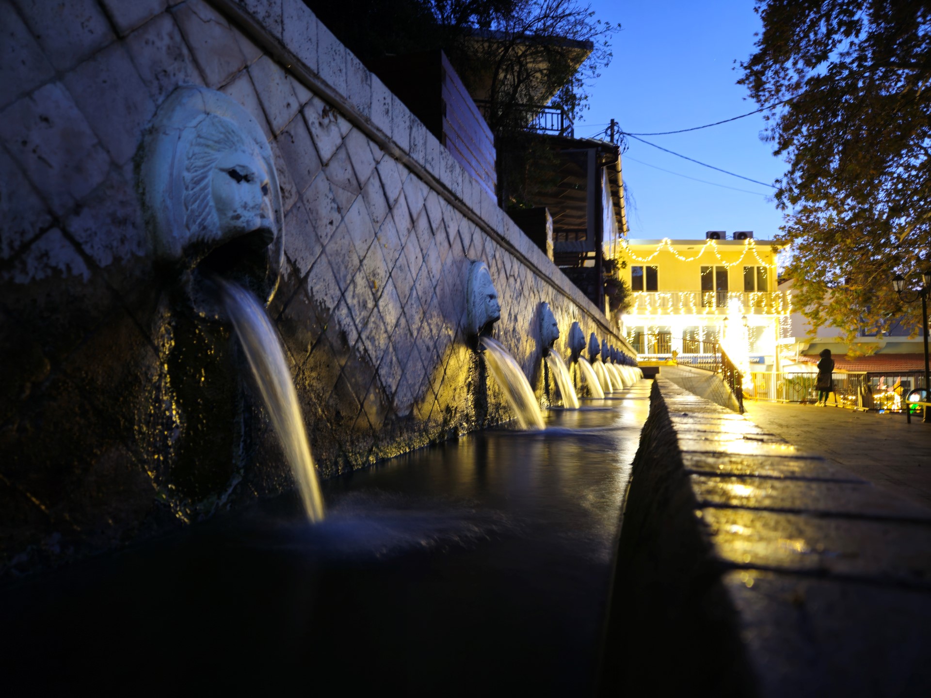
Spili is a leafy small town in the historic province of Agios Vasilios, renowned for its lion-headed fountains, abundant springs and rich historical and religious heritage. Spili lies approximately 30 km south of Rethymno, at an altitude of about 430 metres, at the foot of Mount Vorizis. Its position on the main route connecting Rethymno with the southern coast has made it an important transport, commercial and administrative centre of the historic province of Agios Vasilios. Agriculture, livestock farming and trade have traditionally supported the local economy, while tourism has also become increasingly important. Spili is also the seat of the Holy Metropolis of Lambi, Syvritos and Sfakia. The town has a health centre, shops, restaurants and other essential facilities serving the wider region. The Kefalovrysi fountains At the heart of the town, beneath the shade of large plane trees, stands the celebrated Kefalovrysi
Elounda Town
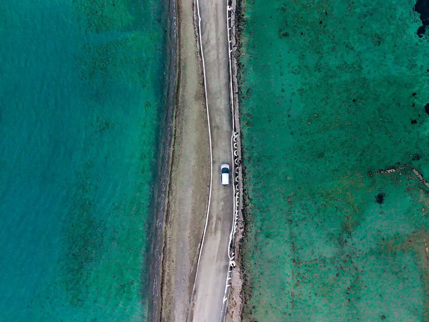
Elounda is one of Greece’s best-known luxury resorts, set within a remarkable natural and historical landscape around Korfos Bay and the ancient city of Olous. Elounda lies 10 km north of Agios Nikolaos, on the northwestern side of the Gulf of Mirabello, in the province of Mirabello. The wider area has developed into one of Greece’s best-known holiday destinations, with luxury hotels and visitors from around the world. Beyond its cosmopolitan character, Elounda offers an exceptional combination of natural scenery and historical monuments. The coastal settlement, known locally as Schisma, stands at the edge of the sheltered Korfos Bay, which is often called the lagoon of Elounda. The Spinalonga Peninsula extends opposite the town, while the fortified islet of Kalydon, known internationally as Spinalonga, guards the entrance to the bay. A short tour of Elounda The first panoramic view of Elounda appears at Lenika, along the road from Agios Nikolaos. From here, visitors can see the Gulf of Mirabello, the sheltered waters of Korfos, the Spinalonga Peninsula and, in the distance, the picturesque village of Plaka and the island of Spinalonga. Schisma is home to the harbour, waterfront square, shops, cafés, tavernas and a wide selection of accommodation. Excursion boats depart from the harbour for Spinalonga and tours around the Gulf of Mirabello, with services varying according to the season. Following the coastal road eastward leads to the old salt pans of Elounda. Salt production was already an important activity during Venetian rule, and the local salt was distributed to markets on Crete and abroad. The abandoned salt pans are now an ecologically important wetland that attracts many bird species, including herons and, at certain times of the year, flamingos. A short distance farther on are the old stone windmills and the bridge at Poros. Beneath the bridge passes the narrow Poros Canal, connecting the Gulf of Mirabello with Korfos Bay. The modern canal was cut in 1897–1898 under the French administration, improving access for small vessels and effectively turning the large peninsula into an island. The road continues onto the Spinalonga Peninsula, also known in some sources simply as Nisi, meaning “island”. Abandoned fields, dry-stone walls and old farm buildings can still be seen across the landscape. Near the Chapel of Saint Luke, a short path leads to Kolokytha Beach, known for its clear turquoise water. The small islet of Kolokytha lies directly opposite the beach. Farther north are the remains of an Early Christian basilica dating from the 5th–6th centuries, while the remote northern part of the peninsula is home to the Church of Saint Phocas. Reaching the more isolated sites requires hiking and particular care during the hot summer months. History The ancient city of Olous stood in the area of Poros and formed the urban centre of an important city-state of eastern Crete. The site had already been inhabited in Minoan times, but Olous flourished particularly during the Archaic, Classical, Hellenistic and Roman periods. Part of its ruins is now submerged in the shallow waters around Poros and can be seen when the sea is calm. The economy of Olous was based on maritime trade, fishing, olive cultivation, mercenary service and the quarrying and export of whetstone, known in antiquity as “Naxian stone”. The quarries were located on the surrounding hills, particularly in the area opposite Oxa. The city’s coins probably depicted Zeus Tallaios and the nymph Britomartis. According to Pausanias, a sanctuary at Olous contained a wooden cult statue of Britomartis made by the mythical craftsman Daedalus. Inscriptions and archaeological finds demonstrate the city’s relations with other Cretan cities, mainland Greece and the islands of the Aegean. Settlement continued during the Roman and Early Byzantine periods. Near Poros stands the three-aisled Early Christian basilica of Olous, dating from the 5th century and built over the remains of an earlier structure. From the 7th and 8th centuries onward, insecurity along the coast and maritime raids gradually forced the population to move to more defensible inland positions, including the fortified heights of Oxa. During Venetian rule, from 1211 to 1669, the salt pans of Elounda acquired considerable economic importance. To protect the bay, the salt works and the sea routes, the Venetians constructed the powerful fortress of Spinalonga in the late 16th century. In 1897–1898, during the presence of the international forces on Crete, the French administration completed the modern Poros Canal. Between 1928 and 1939, the sheltered waters of Korfos Bay were used as a landing and refuelling station for Imperial Airways seaplanes travelling on routes towards the East. During the Second World War, the area was occupied and fortified by Axis forces, while parts of the coast were mined to prevent an Allied landing. After the war and the clearance of the minefields, tourism gradually began to develop. From the final decades of the 20th century, Elounda became internationally established as one of Greece’s best-known luxury destinations. [widgetkit id=1357] {loadposition nearestplaces}

Mires town
Mires is located approximately 50km south of Heraklion, in the heart of the fertile Messara Plain. It is the principal administrative and commercial centre of the historic province of Kenourgio and serves many of the villages of central and western Messara. The local economy is based mainly on agriculture, livestock farming, commerce and services. According to the most widely accepted interpretation, the name Mires derives from the Greek word mires, meaning shares or portions of land. During the Venetian period, plots in the area are believed to have been granted to refugee families from Monemvasia and Nafplio after parts of the Peloponnese were conquered by the Ottomans. A notarial document of 1636 records the settlement under the name Megali Mira. Mires developed considerably because of its central position in the Messara Plain. Today, the town has numerous shops, restaurants, schools, public services and other essential facilities. Narrow streets and buildings recalling the earlier settlement can still be found in its older quarters. The Saturday market Every Saturday, Mires hosts one of the largest and oldest open-air markets in Crete. Producers, merchants and visitors arrive from across the Messara region, making the market an important part of local commercial and social life. Its history reaches back at least to the Ottoman period, when the central location of Mires established the settlement as a meeting and trading point for the surrounding villages. Excursions from Mires Mires is a convenient base for exploring southern Crete. Within a short drive are ancient Gortys, the Minoan Palace of Phaestus and the Royal Villa of Agia Triada. Visitors can also explore the villages on the southern slopes of Mount Psiloritis, the landscape of the Asterousia Mountains and the beaches of the Messara region. [widgetkit id=1358] {loadposition nearestplaces}

Agia Roumeli village
Agia Roumeli is a small and secluded seaside village in the historic province of Sfakia, approximately 56km south of Chania. It is situated on a wide bay at the exit of the imposing Samaria Gorge, surrounded by the wild mountain landscape of the White Mountains. The village has tavernas, cafés, small shops and several accommodation options. Agia Roumeli is not connected to the road network of Crete. It can be reached by seasonal ferry services from Chora Sfakion, Loutro, Paleochora and Sougia, or on foot. The village lies along the E4 trail leading to Loutro and Chora Sfakion and the E4 trail leading to Sougia. During the operating season of Samaria Gorge, the village welcomes hikers completing the famous crossing. After the afternoon ferries depart, however, Agia Roumeli returns to its peaceful rhythm. In front of the settlement stretches the main beach of Agia Roumeli, while several quieter beaches can be found along the surrounding coastline. What to see in Agia Roumeli The Samaria Gorge is one of the best-known and most impressive hiking gorges in Europe. Visitors who do not wish to complete the full crossing can enter the gorge from Agia Roumeli, pass through the old village and continue towards the famous narrow passage known as the Iron Gates. Modern Agia Roumeli stands in the area of ancient Tarra, an important city of southern Crete. West of the village, at a site where an ancient sanctuary and later an Early Christian basilica probably stood, visitors can see the Byzantine church of Panagia Kera. On the hill above the village stands the ruined Ottoman fortress of Agia Roumeli, offering impressive views over the village and the South Cretan Sea. Higher on the mountain are the remains of a second fortress known as Kouledaki. When visibility is good, the islands of Gavdos and Gavdopoula can be seen on the horizon. Near the eastern side of the gorge lies the chapel of Saint Anthony, built inside a natural cavity in the rock. Further north, within the gorge, is the old village of Agia Roumeli. The settlement was abandoned after the severe floods of 1954, and its residents moved to the present coastal location.[widgetkit id=86]
Pahia Ammos village
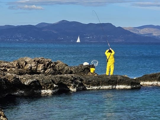
Pacheia Ammos is a seaside village in the province of Ierapetra, situated on the Gulf of Mirabello near the narrowest part of Crete. Pacheia Ammos is located approximately 20km east of Agios Nikolaos and 13km north of Ierapetra, on the main road connecting Agios Nikolaos with Sitia. The village stands on the northern side of the Isthmus of Ierapetra, at the edge of a fertile plain covered with olive groves. Its position between the principal towns of Lassithi, the beach of Pacheia Ammos and the important archaeological sites of the surrounding area have contributed to the village’s mild tourist development. Visitors will find tavernas, cafés, small hotels and rooms for rent. The name of the village refers to the coarse sand that once covered much of its long seafront. The location is mentioned as early as the 17th century, although the modern settlement developed mainly during the 20th century. The name is also written as Pahia Ammos, Pachia Ammos or Pacheia Ammos. Archaeological sites and attractions The wider area has been inhabited since antiquity and has traditionally been associated with the ancient town of Minoa, although its precise identification is not considered certain. Pacheia Ammos is home to the INSTAP Study Center for East Crete, which supports archaeological research, the study of finds and the conservation of ancient sites throughout eastern Crete. Approximately 2km west of the village lies the Minoan town of Gournia, one of the best-preserved settlements of Minoan Crete. Its ancient name remains unknown. The town developed on a low hill and preserves houses, workshops, paved streets, storage rooms, a small palace and a public shrine. It flourished particularly during the Late Minoan period and is now one of the most important archaeological sites in eastern Crete. Further west, the historic Monastery of Panagia Faneromeni is built on a steep hillside overlooking the Gulf of Mirabello. South of Pacheia Ammos, visitors can explore the Early Minoan settlement of Vasiliki, which developed at a strategic position on the Isthmus of Ierapetra. Near Vasiliki lies the village of Monastiraki, known for its old watermills. Above the area rises the imposing Ha Gorge, one of the most spectacular technical canyons in Crete. The small islet of Konida can be seen opposite the village. Further east lie the archaeologically important islet of Pseira and the islet of Mochlos, also known as Agios Nikolaos.
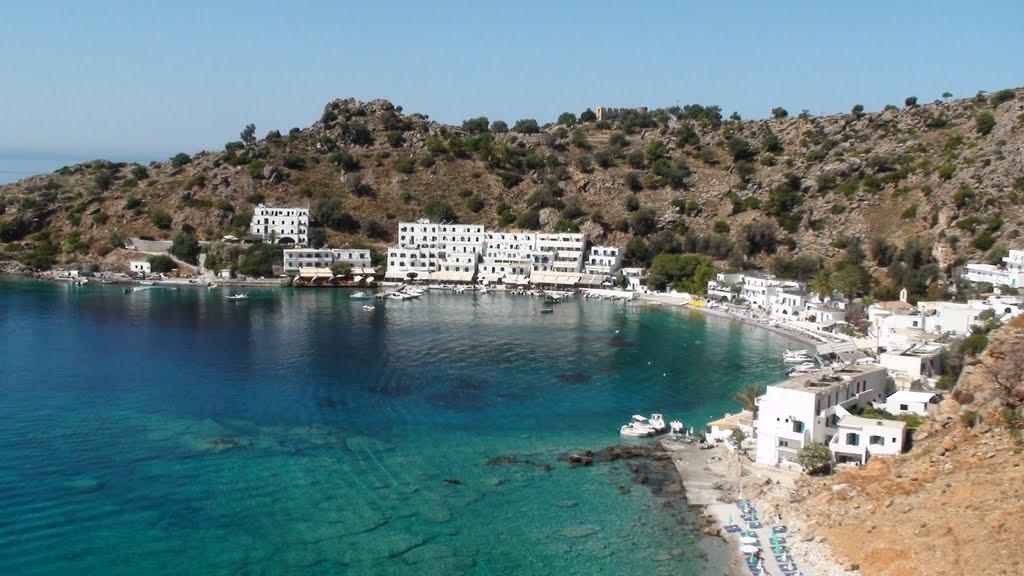
Loutro in Sfakia
Loutro is a small seaside village on the southern coast of the historic province of Sfakia, approximately 71km south of Chania. It stands inside a sheltered bay near Cape Mouri and has no road connection. The village can be reached by ferry from Chora Sfakion or on foot along the coastal trail. The modern village occupies the area of ancient Phoenix or Katopolis, which served as the harbour of ancient Anopolis. Its naturally protected bay provided a safe anchorage for vessels over many centuries. The name Loutro, meaning “bath” in Greek, is traditionally associated with ancient bathing installations discovered in the area. The small beaches of Yialos and Keramos lie directly in front of the settlement and are described on the page about the beaches of Loutro. Other nearby destinations that can be reached on foot or by small boat include Glyka Nera, Timios Stavros and Pervolaki, Likos and Finikas and Marmara Beach. The absence of cars, the whitewashed houses surrounding the harbour and the steep landscape of Sfakia give Loutro its peaceful atmosphere. The village has small hotels, rooms, tavernas and cafés. Ferry services are mainly seasonal and connect Loutro with Chora Sfakion and other coastal settlements of southern Crete. [widgetkit id=82] What to see in Loutro Above the village stand the remains of the Ottoman fort of Loutro, which overlooked the bay and the surrounding sea routes. The old school and the Church of Panagia are situated near the waterfront. In 1821 Loutro became the seat of the Chancellery of Sfakia, while a hospital for wounded revolutionaries operated in the area. Hikers can follow the coastal section of the European E4 trail or climb towards Anopolis along the steep old mule trail from Loutro. Farther west lies the impressive Aradena Gorge.
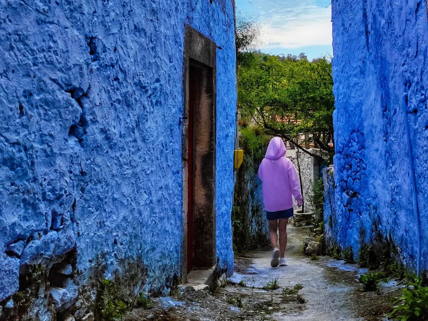
Asites village
Ano Asites and Kato Asites are two neighboring villages in the historic province of Malevizi, approximately 22km southwest of Heraklion. They are built on the green eastern foothills of the Psiloritis range, in an area with vineyards, olive groves, springs and small gorges. Agriculture, livestock farming and the production of wine and olive oil have traditionally supported the local economy. According to the prevailing interpretation, the name Asites is associated with soldiers of Nikephoros Phokas who came from Assos in Mysia and settled in the area after the Byzantine recapture of Crete from the Arabs in 961 AD. The villages are mentioned in Venetian records as early as 1394. Visitors can walk through the lanes of both settlements, stop at the traditional coffee shops and visit the Folklore Museum of Ano Asites. Several old churches survive in the area, including Saint Paraskevi and the Church of Christ in Kato Asites, together with traditional houses preserving features of the local architecture. Asites is also a good starting point for exploring the surrounding countryside. Near the villages are the Agios Antonios Gorge and the Agios Charalambos Gorge, both characterized by vegetation, springs and small caves. Above Kato Asites stands the historic Monastery of Saint George Gorgolainis, surrounded by a cool and verdant landscape. Higher on Psiloritis is the Prinos mountain refuge, which serves as a base for hiking and mountaineering routes. [widgetkit id=2684]
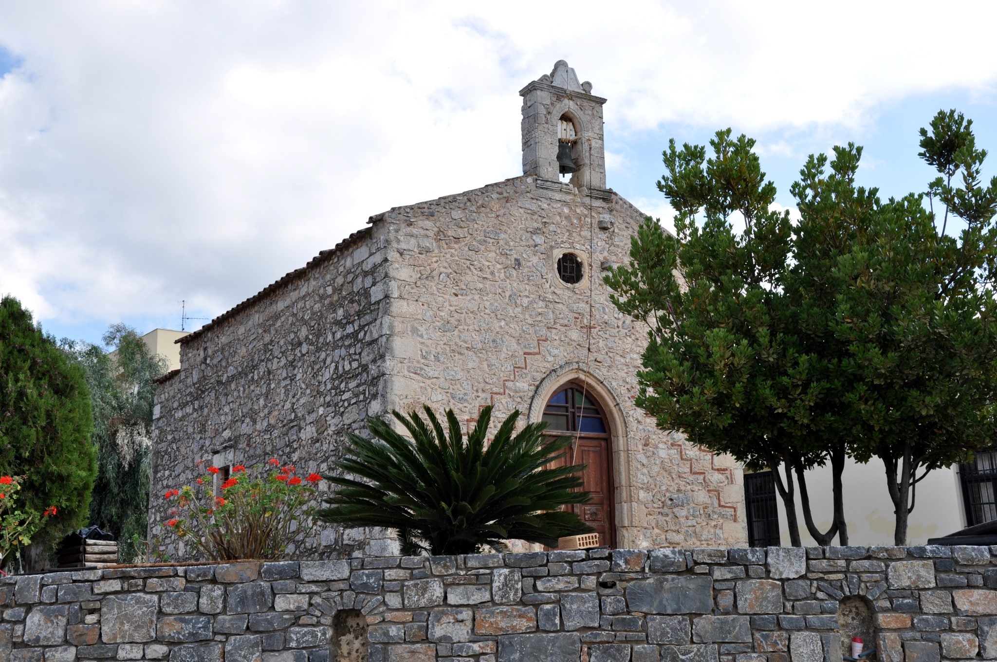
Kastelli Town (Pediada province)
Kastelli Pediada is a small town in the Heraklion hinterland and the historic centre of the province of Pediada. It is located approximately 36km southeast of Heraklion, at an altitude of about 350 metres, in one of the most fertile regions of Crete. The local economy has traditionally been connected with the cultivation of olives, vines and vegetables. For centuries Kastelli served as the commercial and administrative centre of the surrounding region and still hosts the weekly open-air market of Pediada. The town provides shops, public services, traditional cafés and tavernas for residents of the wider area. The name Kastelli derives from the Castel Pediada fortress, around which the settlement developed. During the Venetian period, the fortress was the seat of the local castellany and housed administrative and military authorities. Nothing substantial survives today, as newer buildings occupy its former site. The history of the area extends much further into the past. In the centre of the town, near Saint George Square, archaeologists have uncovered remains of the Minoan settlement of Kastelli. The finds indicate habitation from the Neolithic period, while the settlement developed significantly during the Minoan era. Several Byzantine churches with old frescoes also survive in the wider region. A military airfield operates beside Kastelli, while the new Heraklion International Airport is being constructed in the surrounding area. The new airport is intended to replace the existing “Nikos Kazantzakis” Airport and is expected to have a major influence on the future development and character of the region. [widgetkit id=2393] {loadposition nearestplaces}
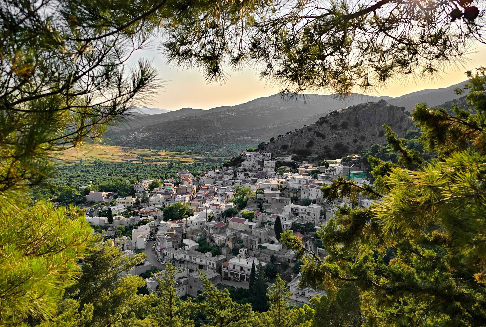
Ano Viannos village
Ano Viannos, usually known simply as Viannos, is a historic small town and the administrative centre of the province of Viannos in southeastern Heraklion. It is built at an altitude of approximately 550 metres, on the southern slopes of the Dikti range, overlooking a fertile region with olive groves and small mountain villages. The local economy is mainly connected with agriculture, olive oil production and livestock farming. A short distance west of the modern town stood the ancient city of Viennos, from which Viannos takes its name. The ancient city minted its own coins, depicting the goddess Artemis and a flower together with the inscription VIANI. Viannos was destroyed during the revolutions of 1822 and 1866. The most tragic chapter in its history was written in September 1943, when the Nazi occupation forces carried out mass executions and destroyed villages in the provinces of Viannos and western Ierapetra. Between 14 and 16 September, 401 civilians were murdered, while the total number of victims in the villages of Viannos during the occupation reached 461. The history of the Viannos Holocaust is presented at the memorial and museum at Seli of Amiras. Visitors can walk through the narrow lanes of Ano Viannos and stop at the central square beneath its large plane tree. The town was the birthplace of the writer and journalist Ioannis Kondylakis, who is regarded as the father of the Greek newspaper chronicle. Near the square are the restored watermill and the Folklore Museum of Viannos. Numerous old churches survive within and around the town. Particularly important is the Church of Agia Pelagia, with remarkable frescoes dating from the 14th century. Other churches include Michael the Archangel, the Virgin Mary, Agia Marina, Agia Aikaterini and Agios Dimitrios. A short distance outside Viannos stand the historic monastery of Agia Moni and the frescoed Church of Agios Georgios. [widgetkit id=2426] {loadposition nearestplaces}

Zaros village
Zaros is a picturesque small town on the southern slopes of Mount Psiloritis, approximately 46km southwest of Heraklion. The area is renowned for its abundant springs, running water and fertile valley. According to local tradition, even the name of Zaros is associated with the abundance of water. The valley has been inhabited since antiquity. A Minoan settlement has been identified at Kourtes, while remains of the large aqueduct that supplied Roman Gortyn with water survive at several locations. The village's long relationship with water can also be seen in its old watermills, springs and picturesque Lake Votomos. Water continues to support the local economy through agriculture, bottling facilities and trout farming. Several important religious monuments are located around Zaros, including Vrontissi Monastery, the Monastery of Agios Nikolaos, Varsamonero Monastery and the hermitage of Saint Efthymios. Zaros is also an excellent starting point for hiking. A trail beginning at Lake Votomos crosses the Gafaris Gorge and leads to the Rouvas Forest. Routes belonging to the European E4 trail cross the wider area, while the Faneromeni reservoir lies farther south. {loadposition nearestplaces}
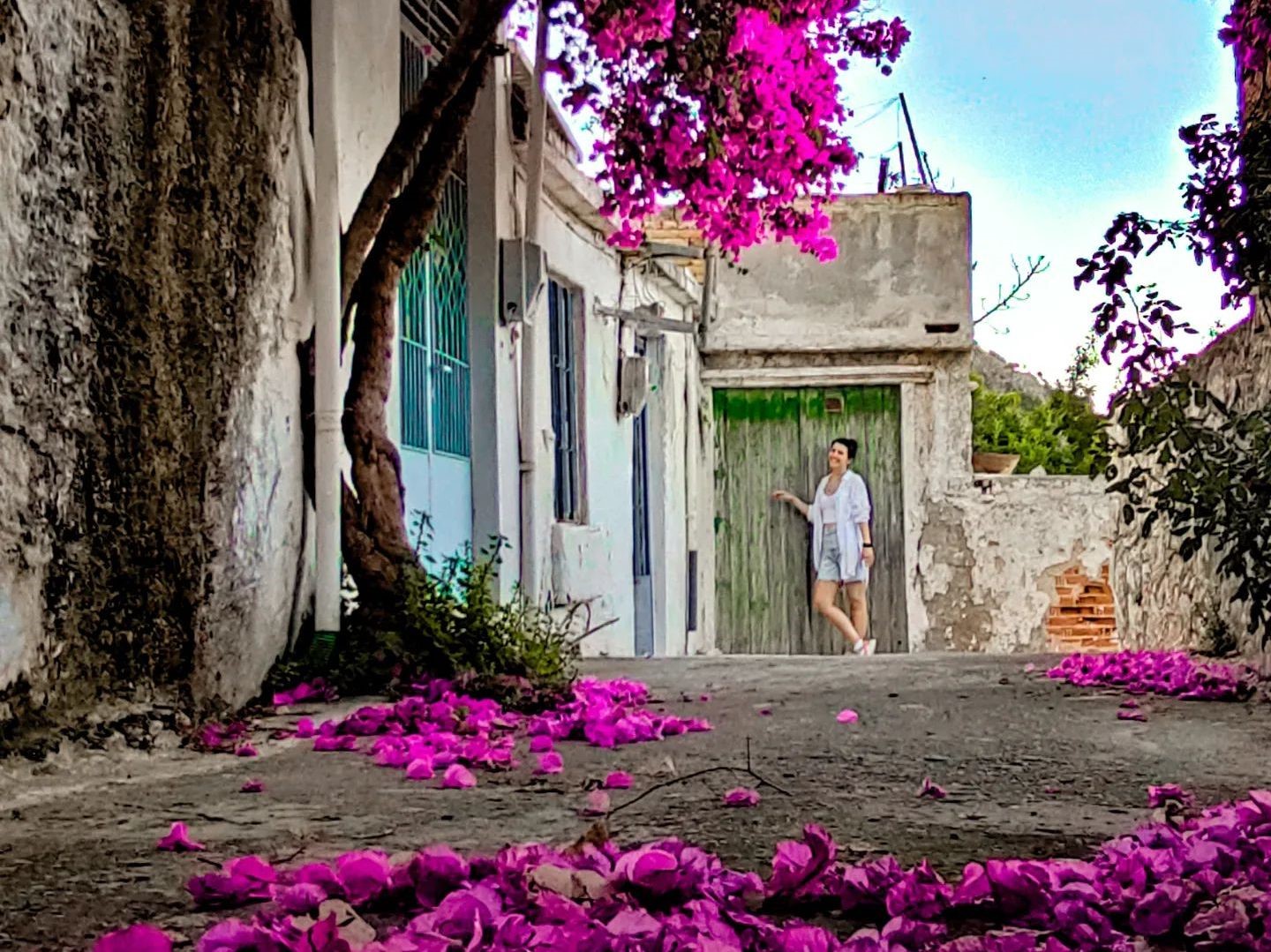
Kritsa village
Kritsa is one of the best-known traditional towns of East Crete. It is built at an altitude of approximately 350m, below Kastellos Hill and within a short distance of Agios Nikolaos. What makes Kritsa special is the survival of many elements of traditional Cretan life and architecture. Its narrow uphill lanes, flower-filled courtyards, old houses, traditional coffee shops, Cretan textile workshops and small folklore collections create the atmosphere of a living open-air museum. Kritsa also has a long tradition in weaving and folk art, which is still preserved by local craftspeople. The settlement is historically associated with nearby ancient Lato, one of the most important Dorian cities of Crete. It is believed that part of Lato's population gradually moved towards the site of present-day Kritsa. Several explanations have been suggested for the origin of the village's name. One connects it with an early settler named Kritsas, while another considers it a corruption of the Greek word for Christ. Kritsa played an important role in the Cretan struggles against Ottoman rule. In January 1823, the Battle of Kritsa took place near ancient Lato and was followed by the burning of the settlement. The village is also associated with the legendary Kritsotopoula, Rodanthi, who according to local tradition joined the rebel group of Captain Kazanis and was killed in battle. Among the most important attractions in the area is Panagia Kera, one of Crete's most significant Byzantine churches, renowned for its exceptional frescoes. Visitors interested in hiking can explore Kritsa Gorge, whose narrow and imposing entrance is located just outside the village. Kritsa's distinctive character has also attracted filmmakers. Scenes from the Greek film “I Neraida kai to Palikari” were filmed in the village, as were scenes from Jules Dassin's film adaptation of Nikos Kazantzakis' novel “Christ Recrucified”. [widgetkit id=2468] {loadposition nearestplaces}

Vrysses (Apokoronas)
Vrysses is a green and picturesque small town in the province of Apokoronas, within a relatively short distance of Chania and close to the main road connecting Chania with Rethymno. The area is known for its abundant springs, running water, plane trees and fertile countryside. Local economic activity is based mainly on agriculture, livestock farming, commerce and tourism. Although Vrysses developed as an organised settlement in more recent times, the wider area has been inhabited since antiquity. The ancient cities of Amphimalion and Philippos have been associated with the region, while the Boutakas River is crossed by the ancient bridge known as the Elliniki Kamara, one of the oldest surviving bridges in Crete. During the 19th century, Vrysses became an important centre of revolutionary activity. The area was associated with the conflicts of the Cretan Revolution of 1866–1869 and with the Transitional Committee that confronted the Ottoman authorities in 1895. In May 1941, the settlement suffered extensive damage from German bombardment during the Battle of Crete. A distinctive feature of the town is the flowing water of the Boutakas River and the Vrysianos, which meet in the centre of Vrysses. Tavernas and cafés stand beside the riverbanks, beneath large plane trees, offering visitors a peaceful place to enjoy local food or coffee beside the running water. Vrysses is a convenient starting point for exploring the province of Apokoronas, its traditional inland villages and the nearby beaches of Georgioupolis and Kalyvaki. The springs and dense riverside vegetation keep the centre of the settlement pleasantly cool even during the summer. [widgetkit id=2587] {loadposition nearestplaces}

Zakros
Ano Zakros is a small and peaceful town at the easternmost edge of Crete, approximately 38km from Sitia. It is the centre of the community of Zakros in the historic province of Sitia, while its coastal settlement and harbour is Kato Zakros. The abundant freshwater springs played a decisive role in the development of Zakros. Their waters irrigate a remarkably green area with extensive olive groves amid the dry landscape of Eastern Crete. The village developed into an important settlement of watermills that served the needs of the entire province of Sitia. Unlike other parts of Eastern Crete, where windmills prevailed because of the scarcity of running water, Zakros was primarily known for its watermills. Watermills, fulling mills and traditional olive presses once operated along the watercourse, processing grain, woollen textiles and olives. Three of the old watermills have been restored and now house the Museum of Water and Hydraulics in Zakros. Zakros lies within the Sitia UNESCO Global Geopark and along the European E4 trail. The most important attractions in the area include the Gorge of the Dead, the beaches of Kato Zakros and Xerokambos, the Minoan Palace of Zakros and the numerous caves of the wider region. The village also hosts the Natural History Museum of Zakros, presenting the flora, fauna and geological heritage of the Sitia Geopark. [widgetkit id=2597] {loadposition nearestplaces}
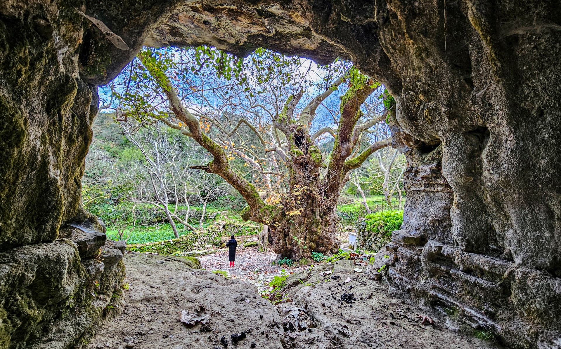
Argyroupoli village
Argyroupoli is a small historic town in the province of Rethymno, built at an altitude of approximately 260 metres above the valley of the Mouselas River. The traditional settlement preserves many architectural features of its rich past, including old mansions, stone arches and narrow lanes. Argyroupoli stands on the site of ancient Lappa, an important city of western Crete. Scattered remains from the Roman, Byzantine and Venetian periods reflect the long history and strategic importance of the area. It is worth walking through the narrow lanes of the village to discover traces of mosaic floors, frescoed Byzantine churches and Venetian mansions. Nearby lies the necropolis of ancient Lappa, with its rock-cut Greco-Roman tombs, as well as the monumental plane tree and the church of Pente Parthenes. The best-known attraction in the area is the Springs of Argyroupoli, which form a lush green landscape just below the settlement. The water emerges from the cave of Agia Dynami, flows among old watermills and small waterfalls and eventually reaches the bed of the Mouselas River. Traditional tavernas operate around the springs and the old watermills. [widgetkit id=2627] {loadposition nearestplaces}

Asimi town
Asimi is a small town in the historic province of Monofatsi, built on a fertile plain between the southern foothills of Mount Kasteriotis and Mount Kofinas in the Asterousia Mountains. Watercourses formed in the wider area feed the Geropotamos River and the Livaditis River. The town developed as an economic and commercial centre for the villages of the eastern Messara Plain. The local economy is based mainly on agriculture, particularly olive and grape cultivation, as well as livestock farming. According to local tradition, Asimi was named after a young woman from the Peloponnese called Asimina. The settlement is mentioned in written sources as early as 1280, indicating its long presence in the region. Asimi is home to the churches of Agios Titos, the patron saint of the town, Zoodochos Pigi, Agios Georgios, Agia Paraskevi, Agios Charalambos and the Transfiguration of the Saviour. The older part of the settlement is particularly interesting, with its narrow lanes, traditional houses and the fountain of Agios Titos. [widgetkit id=2656] {loadposition nearestplaces}

Bali village
The seaside resort of Bali is located in the historic province of Mylopotamos, in a large bay approximately 30km east of Rethymno and 43km west of Heraklion. The main road connecting Heraklion and Rethymno passes close to the village, making access particularly easy. The coastline of Bali forms four successive coves with sandy beaches and greenish-blue waters. Most of the coves are protected from strong winds, so the sea is usually calm. The beaches are organised and suitable for families, while freshwater springs in the area help keep the sea relatively cool. The modern village probably occupies the site of ancient Astali, which served as the harbour of ancient Axos. The area was also associated with Talos, the mythical bronze giant of Crete, after whom the Talean Mountains south of the village are traditionally believed to have been named. During the Venetian period, the name of the area appeared as Atali, a form preserved in the name of the nearby Monastery of Attali. Different explanations have been suggested for the modern name Bali. One connects it with the Turkish word ballı, meaning “with honey”, and the former presence of many beehives. Another associates it with the word balık, meaning “fish”. Today Bali offers hotels, apartments, tavernas, restaurants, cafés, small shops and diving centres. Excursion boats depart from the harbour and follow the impressive coastline with its sea caves and rock formations. Important religious monuments in the wider area include the Monastery of Attali and the church of Panagia Charakiani.

Sougia village
Sougia is a small seaside village on the southern coast of the historic province of Selino, approximately 75km southwest of Chania. It lies near the exit of the lush Agia Irini Gorge and is an excellent destination for peaceful holidays. The village offers rooms, tavernas, cafés, small shops and the basic services required by visitors. In front of the village stretches the long beach of Sougia, with coarse sand, pebbles and deep, clear water. It begins near the small harbour, at the exit of Lissos Gorge, and extends eastwards. Seasonal ferry services connect Sougia with Paleochora, Agia Roumeli, Loutro, Chora Sfakion and the island of Gavdos. What to see in Sougia Modern Sougia stands in the area of ancient Syia, which served as a harbour of the powerful Doric city of Elyros. The name Syia has traditionally been associated with the ancient Greek word “sys”, meaning hog, possibly referring to pig farming in the oak-covered landscape. Near the village of Moni, visitors can also see an unusual rock-cut pyramidal tomb. West of Sougia lies the ancient city of Lissos, another harbour of Elyros, renowned for its Asclepeion, sacred spring and important archaeological remains. Lissos can be reached on foot by following the western section of the E4 trail. The sheltered cove below the archaeological site contains the small beach of Lissos. Another important monument is the church of Saint Panteleimon, west of the village. It was built on the site of an Early Christian three-aisled basilica, parts of whose mosaic floors survive, decorated with scenes inspired by nature. Following the E4 trail from Sougia to Agia Roumeli, hikers encounter the secluded chapel of Saint Anthony. The wider area is also home to the legendary Cave of Polyphemus, which local tradition associates with the one-eyed Cyclops from Homer’s Odyssey.
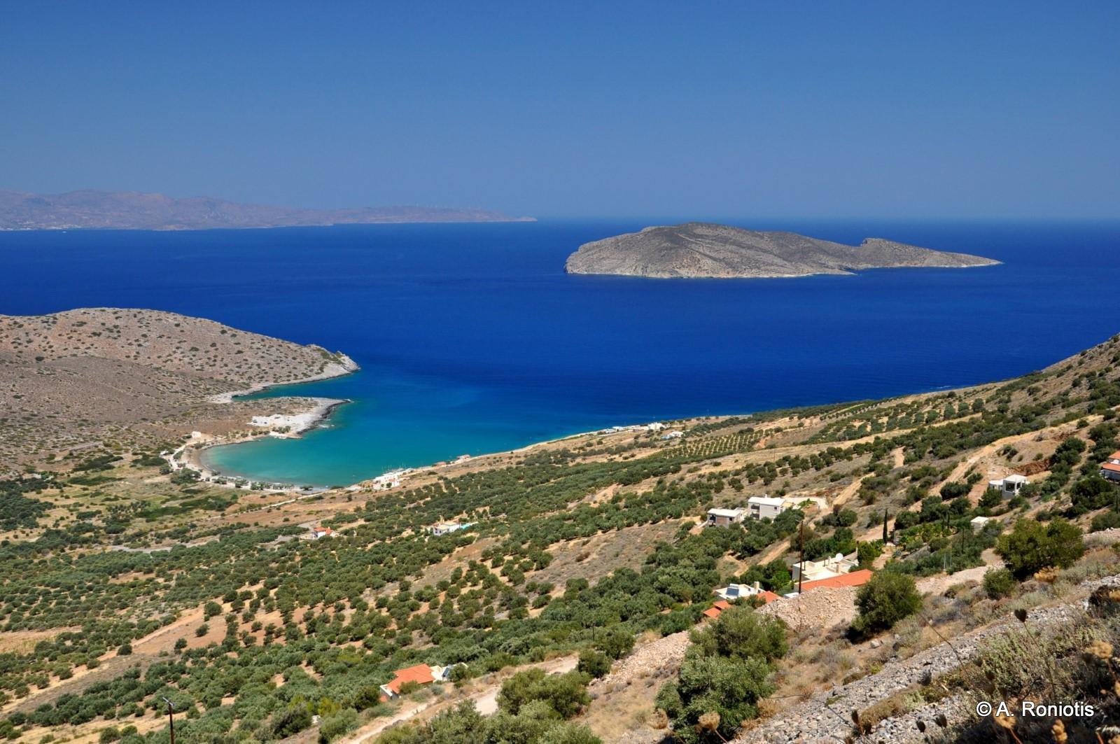
Kavousi village
Kavousi is located approximately 26km east of Agios Nikolaos, on the northern coast of the historic province of Ierapetra. The village is built in a fertile valley covered with olive groves, below the mountains of Thripti. The surrounding area is especially interesting for its archaeological sites, natural monuments, old churches, gorges and traditional settlements. Streams carry water from the surrounding mountains through Havgas Gorge and Mesonas Gorge. Tourism remains relatively low-key, making Kavousi a suitable destination for peaceful holidays, countryside excursions and hiking. Tholos Beach and Psira Island The best-known beach in the area is Tholos Beach, north of the village. Freshwater springs emerge near the coast and occasionally give the sea a distinctive pale-blue colour. Opposite the beach lies Psira Island, where an important Minoan settlement has been excavated. Large stone warehouses survive near the coast of Tholos. They were used for storing goods and loading them onto ships, particularly before the development of the modern road network. The small church of Panagia also stands near the beach, while the frescoed chapel of Saint Anthony is situated a little further west. Psira was an important harbour during the Minoan period and maintained close connections with the Kavousi area. Excavations have revealed an extensive settlement, while important finds and relief frescoes from the site are exhibited at the Archaeological Museum of Heraklion. Seasonal excursion boats to Psira operate from nearby Mochlos. What to see in Kavousi Visitors can walk through the narrow streets of the old village and reach the central square, where the church of Saint George is located. Within a short distance stands the frescoed Church of the Twelve Apostles, one of the important religious monuments in the area. Next to the archaeological site of Azorias, east of the village, stands the monumental olive tree of Azorias. It is considered one of the oldest olive trees in Crete and is particularly impressive because of its enormous trunk. A branch from the tree was used to make the wreath awarded to the winner of the Women’s Marathon at the Athens Olympic Games in 2004. The wider area also contains the ancient settlements of Vrondas and Kastro at Kavousi. Both were established in elevated, naturally fortified positions offering impressive views over Mirabello Bay and Psira Island. Near the coast lies the Minoan copper workshop of Chrysokamino, an important metallurgical site. In the same rugged area is Theriospilios Cave, which shelters colonies of bats.
Tris Ekklisies village
Tris Ekklisies is a small seaside settlement approximately 64km south of Heraklion, in the heart of the wild landscape of the Asterousia Mountains. It belongs to the area of the village of Paranymfi, in the historic province of Monofatsi. The settlement is reached from Paranymfi by an asphalt road with numerous bends and impressive views of the South Cretan Sea. The route crosses a rugged landscape of steep slopes, gorges and carob trees before descending to the coast. Tris Ekklisies is situated near the exit of the imposing Ambas Gorge, which forms one of the highest seasonal waterfalls in Crete. Archaeological remains and traces of Early Christian churches indicate that the wider area has been inhabited since antiquity. The name Tris Ekklisies means “three churches” and refers to the churches of the Transfiguration of the Saviour, Saint George and the Annunciation of the Virgin Mary. A small monastic establishment dedicated to the Virgin Mary operated at the site for many years. Nature and beaches The mountains surrounding Tris Ekklisies form an important habitat for the birds of prey of Crete. Griffon vultures and the rare bearded vulture live in the area, while extensive stands of carob trees grow on the surrounding slopes. The village is a useful base for exploring the rugged coastline of the Asterousia Mountains, where small beaches, sea caves and isolated coves are formed. Many parts of the coast can be reached only by boat or by demanding hiking routes. The easiest beach to reach is the central beach of Tris Ekklisies, with coarse sand and deep water. Rooms, tavernas and cafés operate in the settlement, particularly during the main visitor season. [widgetkit id=2712] {loadposition nearestplaces}

Lendas
Lendas is a picturesque seaside village located 74km south of Heraklion, on the southern slopes of the Asterousia Mountains. It belongs to the community of Miamou and has developed into a quiet tourist destination, well suited to relaxing holidays beside the South Cretan Sea. Lendas is reached through the mountainous road network of the Asterousia range. The route crosses a rugged landscape and offers panoramic views of the sea and the southern coast of Crete. The surrounding area has several quiet beaches and small coves. West of the village lies Dyskos beach, while the beach of Lendas, directly in front of the settlement, is the busiest and best-organised beach in the area. The present harbour is located farther east, at Loutra. The modern village is built on the site of the ancient city of Levena, which flourished during the Hellenistic and Roman periods as the harbour of Gortyn. Levena became particularly renowned for its sanctuary of Asclepius, established near a healing spring and developed into an important therapeutic centre of the ancient world. Near the archaeological site stands the Byzantine church of Saint John the Theologian, built partly with materials taken from earlier buildings of the ancient city. The landscape around Lendas is distinguished by unusual rock formations. The cape west of the village resembles the head of a lion, a rock near Cape Psamidomouri looks like an elephant, and farther east Cape Trafoulas resembles a crocodile. According to a local legend, the three petrified animals remained behind to guard the area forever.
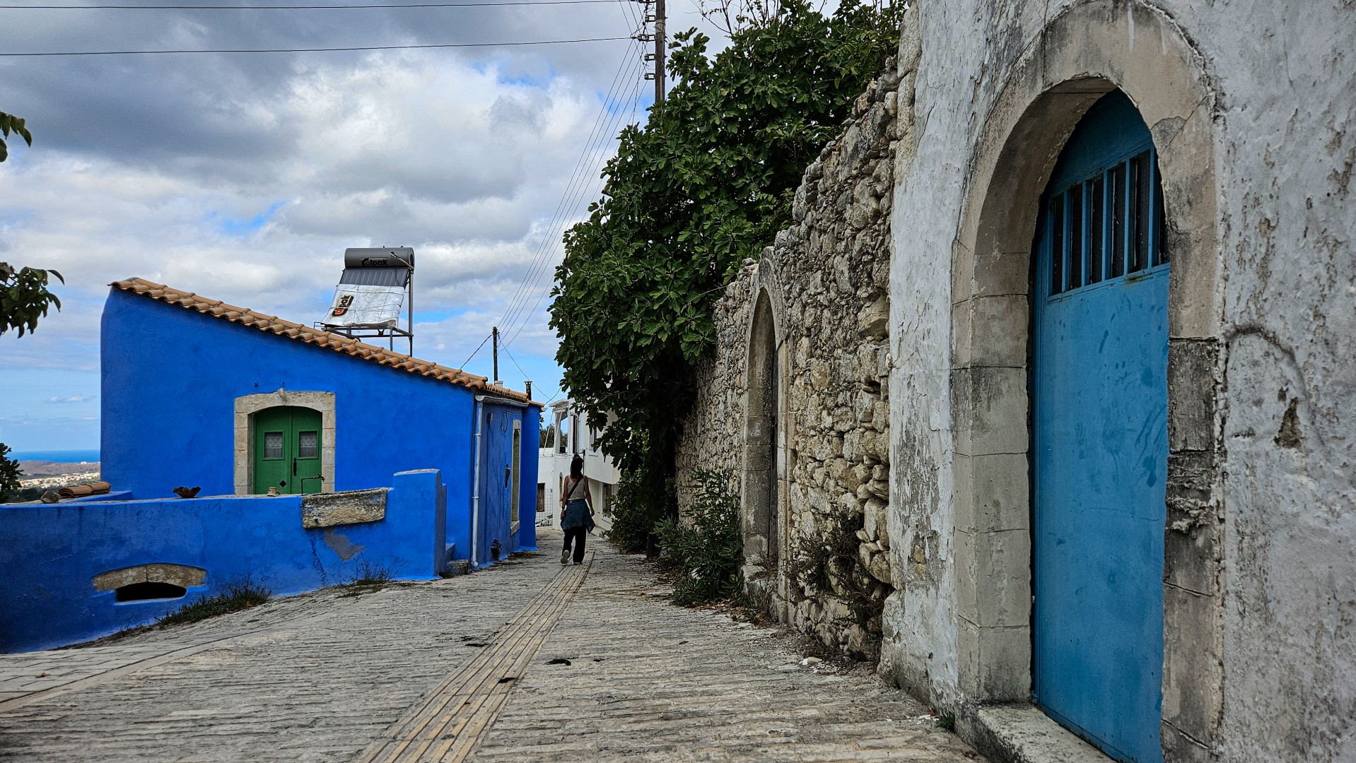
Margarites village
Margarites, in the historic province of Mylopotamos, is one of the most beautiful traditional villages in Crete. It occupies a panoramic position at an altitude of approximately 300 metres, above green ravines and the surrounding countryside. Its colourful stone houses, historic churches and picturesque alleys create a particularly attractive architectural ensemble. Within a short distance of the village are Ancient Eleftherna and the Archaeological Museum of Eleftherna. Margarites is therefore an ideal place to stop for food, take a walk and discover the traditional architecture and crafts of Mylopotamos. The village has a long tradition of pottery. Its workshops and shops display large storage jars, flowerpots, plates and many other decorative or practical ceramic objects. The techniques used by local potters have deep roots and have been passed down through generations. Together with Thrapsano in Heraklion, Margarites is regarded as one of the most important pottery centres in Crete. The history of the village is also reflected in its numerous churches. Among the most important are Saint John the Theologian, with frescoes dating from 1383, Saint John the Baptist, dating from the 15th century, the Dormition of the Virgin Mary, with its impressive bell tower, and Saint Nicholas. On a hill above the village stands the Monastery of the Transfiguration of the Saviour and Saint Gideon. Margarites was destroyed by the Venetians in 1333 because of the revolutionary activity of its inhabitants. During the Ottoman period, it became an administrative centre of the province of Mylopotamos. In 1829 it served as the seat of the Cretan Council, while in 1879 it became the seat of the Municipality of Margarites. [widgetkit id=2715] {loadposition nearestplaces}
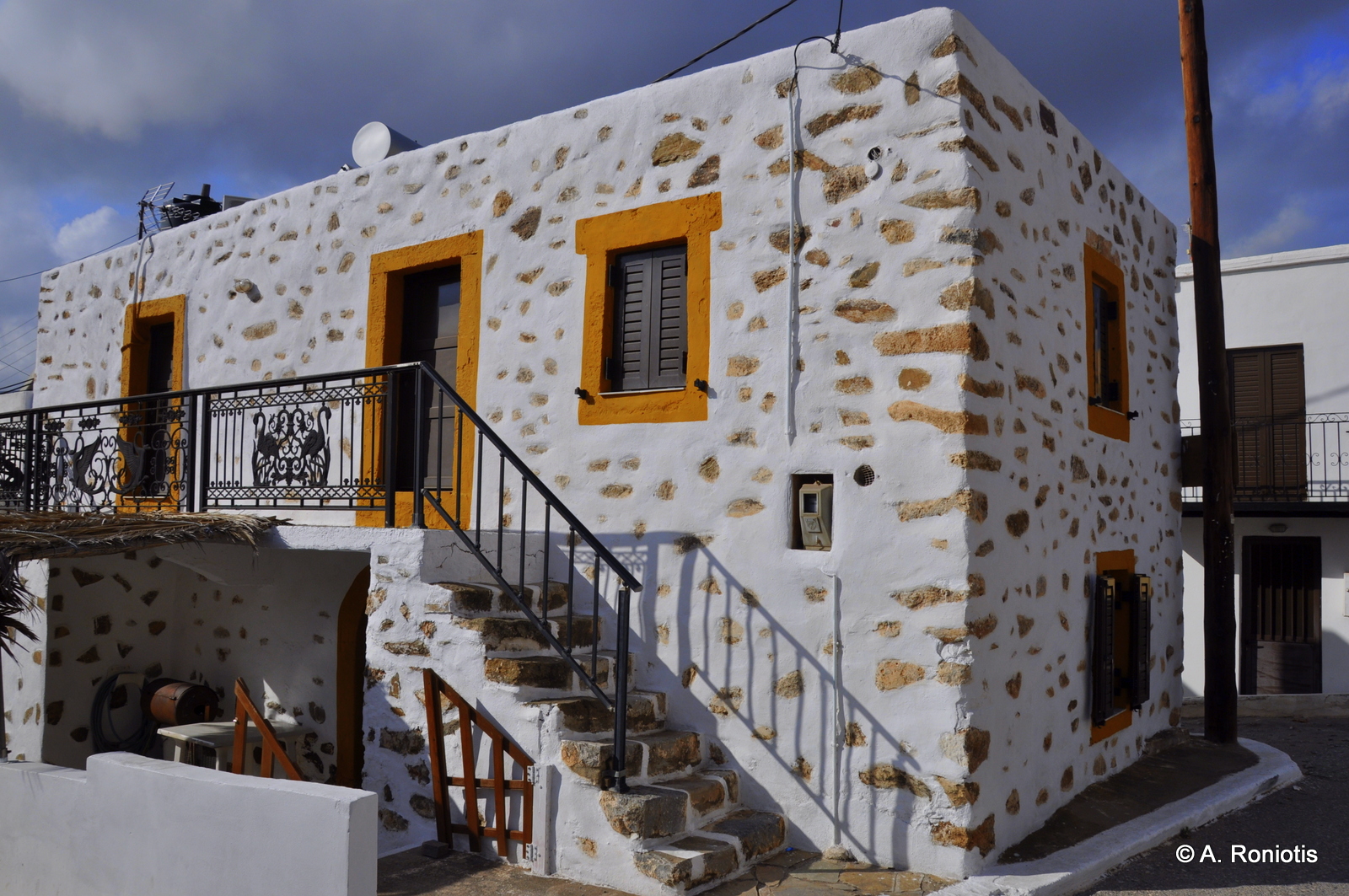
Palekastro town
Palekastro is the easternmost small town in Crete, located approximately 20km east of Sitia. It is the economic and commercial centre of a fertile region where agriculture, olive oil production and tourism are the main activities. Its location makes it an ideal base for exploring the easternmost part of Crete. The town retains the peaceful character of the Cretan countryside and offers accommodation, tavernas, cafés and essential services. The surrounding region is especially rich in historical, archaeological and natural attractions, including beaches, ancient sites and largely unspoilt landscapes. The name Palekastro derives from the ruined Paleo Castro fortress, which stood on the nearby Kastri Hill. The hill separates the beaches of Kouremenos and Hiona, approximately 1.5km east of the settlement. Kouremenos is particularly well known for its strong winds and excellent windsurfing conditions. Near Hiona lies the important archaeological site of Roussolakos, where a large Minoan town has been excavated. One of the most remarkable discoveries from the site is the gold and ivory statuette known as the Palaikastro Kouros, now exhibited at the Archaeological Museum of Sitia. [widgetkit id=2337] {loadposition nearestplaces}

Panormo village
Panormo is a picturesque seaside village in the province of Mylopotamos, approximately 20km east of Rethymno. Built around a natural harbour on the northern coast of Crete, it has developed as a popular holiday destination while preserving much of its traditional character. The village offers accommodation, tavernas, cafés and small shops and is easily accessible from the main northern road of Crete. Several sheltered coves and sandy beaches of Panormo can be found within and around the village. The central beach lies beside the harbour and is protected from the winds, while another sandy beach and several smaller rocky coves are situated west of the settlement. History of Panormo The area has been inhabited since antiquity and is traditionally identified with ancient Panormus. An important monument of its long history is the Early Christian Basilica of Agia Sofia, located south of the modern village. The large three-aisled basilica was built during the Early Christian period and is one of the most significant monuments of its kind in Crete. During the Middle Ages, Panormo became known as Castel Milopotamo or Roumeli Kastelli. In the early 13th century, the Genoese Enrico Pescatore constructed the fortress of Castel Milopotamo, which later passed into Venetian hands. A settlement developed around the fort and gradually evolved into modern Panormo. Only a few traces of the fortifications survive near the harbour today. In more recent times, Panormo served as an important port for the agricultural products of Mylopotamos, particularly olive oil and carob. The restored carob mill survives as a reminder of the village’s commercial past and is now used as a venue for cultural events. Visitors can walk through the narrow streets, see the traditional houses and churches, visit the small harbour and enjoy the sheltered beaches. Panormo is also a convenient base for exploring the countryside and traditional villages of the wider Mylopotamos region.[widgetkit id=2700]

Gavalochori village
Gavalohori is a traditional village in the historic province of Apokoronas, built in a fertile landscape of olive groves, vineyards and cypress trees between Chania and Rethymno. The village has preserved much of its traditional character, with stone-built houses, arches, old courtyards and narrow streets. The area appears to have been inhabited since the Late Minoan period and continued to develop throughout antiquity. Archaeological research has uncovered tombs, coins, pottery and other finds that indicate a long history of human presence. The name of the village is traditionally associated with the Gavalas family, which settled in Crete during the Byzantine period. Gavalohori developed further during the Venetian period and the following centuries, acquiring many of the architectural features still visible today. What to see in Gavalohori One of the most interesting sights is the Gavaliana Wells, an impressive group of old stone-built wells. They supplied water to the residents and their animals and are a characteristic example of traditional water management in the region. The village is also home to the Historical and Folklore Museum of Gavalohori, housed in a remarkable traditional building. Its collections present everyday rural life, local architecture, agriculture, pottery, woodcarving and the textile traditions of Apokoronas. Other landmarks include the old primary school, the village churches and the former fabrika, or traditional olive press. Gavalohori is particularly known for kopaneli, a delicate form of bobbin lace that is still produced by women of the village. Gavalohori is ideal for a peaceful walk through its narrow streets, where visitors can see old mansions, arched entrances, stone cisterns and many other characteristic elements of the traditional architecture of Apokoronas.[widgetkit id=2711]


