Explore the Mount

Kedros

Rethymnon

Mount Kedros

Mount Kedros, also known as Kentros, is located in central Rethymnon, southwest of the Psiloritis Range. The fertile Amari Valley extends between the two mountain ranges. Its highest summit reaches an altitude of 1,776 metres, and the small chapel of the Ascension stands nearby. According to one interpretation, the mountain’s name is associated with its conical shape, which resembles a pointed sting when seen from a distance.

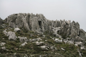
Kedros is a rugged, predominantly limestone mountain with bare rocky slopes, steep passages, deep ravines and small gorges. Despite its seemingly sparse vegetation, it supports exceptionally rich biodiversity, and the wider area forms part of the Natura 2000 network of protected areas.

Rare and endemic plants grow on its slopes, including Dianthus pulviniformis and Cerastium brachypetalum subsp. doerfleri, along with anemones, orchids, hyacinths and other wildflowers. A particularly important species is the red Cretan tulip, Tulipa doerfleri, which grows almost exclusively on the small Gious Kambos Plateau at the foot of the mountain. In spring, the plateau is covered by thousands of red tulips and other flowers, attracting nature lovers and botanists.

The steep and inaccessible slopes of Kedros provide refuge for important birds of prey. Falcons, griffon vultures, bearded vultures, Bonelli’s eagles and golden eagles can be observed in the area, using its rocky outcrops and ravines for feeding and nesting.

Although the summit and upper slopes have a dry and rocky character, dozens of springs emerge around the mountain. During the rainy months, numerous high seasonal waterfalls are formed, the most characteristic being the Gre Dafni Waterfall near Krya Vrysi.

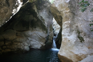
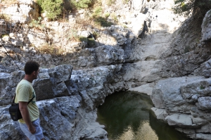
To the northeast, between the main massif of Kedros and Mount Samitos, lies the Smiliano Gorge, also known as Kalamafka. The Smilianos River flows through the gorge, collecting water from the surrounding mountain area.

Numerous historic villages of Amari and Agios Vasilios are situated around Kedros, retaining close links with livestock farming, agriculture and the traditional life of the Cretan countryside. The mountain offers several hiking and mountaineering routes that require good physical condition and caution, as the terrain is often rocky and shade is limited.

One of its most important routes is the section of the European E4 trail from Spili through Kedros to Gerakari. The Krya Vrysi mountain refuge is also located on the southern slopes. It belongs to the Rethymnon Mountaineering Club, and prior arrangement is required for visits or overnight stays.

  • 1
  • 2
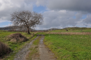
Gious Kambos Plateau

Gious Kambos Plateau

1 1 1 1 1 1 1 1 1 1 Rating 3.40 (5 Votes)
Amari valley is formed between the Mountains Kedros and Psiloritis, at an altitude of 400-500m and is 25km long. It is the natural passage from the north to south Rethymno and Messara Plain. For its central location, it was the theater of several historical events, especially during the Ottoman rule.

Read more ...

Smiliano Gorge (Kalamafka)

Smiliano Gorge (Kalamafka)

1 1 1 1 1 1 1 1 1 1 Rating 4.15 (17 Votes)
Gorge Smiliano or Kalamafka is located north of the village Ano Meros, about 100km southwest of Heraklion city. Through the gorge runs the Lygiotis river which is supplied by the valleys of Gerakari and the slopes of Samitos Mount. The canyon has a lot of water in winter and crossing it, by any means, is very tough.

Read more ...

Gre Dafni Waterfall at Krya Vryssi

Gre Dafni Waterfall at Krya Vryssi

1 1 1 1 1 1 1 1 1 1 Rating 3.88 (8 Votes)
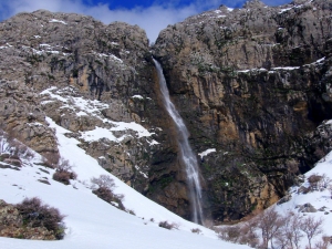
Gre Dafni waterfall, known locally as Rechtas or Rechtara, lies above Krya Vrysi in the province of Agios Vasilios, Rethymnon, on the southern slopes of Mount Kedros. With a drop of approximately 95 metres, it is one of the mountain’s highest waterfalls.

Read more ...

Digenis Rehtara Waterfall at Platanes

Digenis Rehtara Waterfall at Platanes

1 1 1 1 1 1 1 1 1 1 Rating 5.00 (2 Votes)
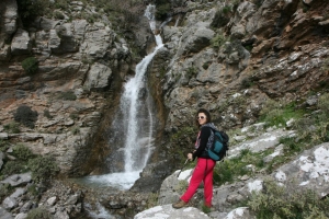
Digenis Rehtara waterfall lies at the locality of Rechtres, above the village of Platanes in the province of Agios Vasilios, Rethymnon, on the southern slopes of Mount Kedros. It forms within Platanes Gorge and consists of two successive drops with a combined height of approximately 70 metres.

Read more ...

Orne Pond

Orne Pond

1 1 1 1 1 1 1 1 1 1 Rating 4.00 (5 Votes)
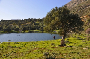
The pond of Orne village is located at an altitude of 300m at the southeastern slopes of Mount Kedros, only 500m northeast of the village Orne. The distance from Rethymnon is about 50km.

Read more ...

Trail E4 Spili - Kedros- Gerakari

Trail E4 Spili - Kedros- Gerakari

1 1 1 1 1 1 1 1 1 1 Rating 4.00 (7 Votes)
The route starts from Spili, reaches the spring of Agia Fotia, and then ascends to Kissos. It comes above the Monastery of the Holy Spirit and climbs to the summit of Mount Kedros (1776 m.). From there we go back and meet the trail that leads to the Church of the Prophet Elijah and descends to Gerakari. This route is a part of the European E4 trail.

Read more ...

Selinara Falls

Selinara Waterfalls

1 1 1 1 1 1 1 1 1 1 Rating 3.33 (3 Votes)
The Selinara waterfalls lie near the village of Orne in the province of Agios Vasilios, Rethymnon, on the southern slopes of Mount Kedros. They form a series of successive drops along the same stream rather than a single waterfall.

Read more ...

Kissos Gorge

Kissos Gorge

1 1 1 1 1 1 1 1 1 1 Rating 3.20 (5 Votes)
Kissano Gorge is located 1km north of Kissos village, in Amari valley, and 34km southeast of Rethymnon, connecting the village το the small plateau of Gious Kambos. It is a short, but beautiful gorge, crossed by the rural road of the area.

Read more ...

  • 1
  • 2
Download Free Premium Joomla Templates • FREE High-quality Joomla! Designs BIGtheme.net