








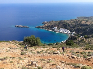
A very demanding trail due to very high slope is the old mule track that once linked the picturesque harbor of Loutro with the town of Anopolis. It can, however, be much easier if you start from Anopolis and go down to Loutro. In any case the panoramic view to the sea and to Loutro is breathtaking.
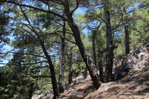
The forest village of Agios Ioannis at Sfakia province is the starting point of one of the most beautiful and best marked trails of Chania prefecture, the trail of Kormokopos. The word Kormokopos means place where trees are cut, due to the dense forest of the area.

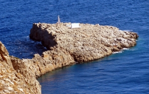
The church and lighthouse of Agios Sozon is located on a steep site, at the tip of Cape Stavros, at the northernmost point of the entire central Crete. The Cape of Zeus (Dios Akron) of the Venetian maps is believed to have hosted a sanctuary dedicated to Zeus in the ancient past.
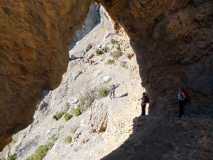
The wild Gigilos top at an altitude of 2080m at the Mount Sapimenos dominates above Omalos plateau. From Xyloskalo (1200m altitude) we follow the steep path that from afar seems very difficult because of the flimsy grounds of the mountain, however it is generally well marked and visible.
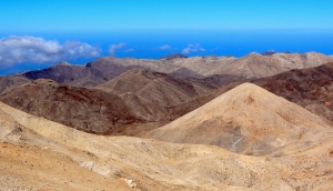
The easiest way for someone to conquer the highest peak of the White Mountains and the second in Crete, Pachnes at an altitude of 2453m, is to follow the dirt track of Madara that starts from Anopolis and enters the Mountain Desert of Sfakia crossing the eerie landscape at Ammoutsera and terminating at Mavra Gremna. The ascent from Mavra Gremna to the peak Pachnes lasts about 1:30.
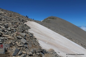
The imposing Ida Range has the highest peak of Crete, Timios Stavros at 2546m altitude. For reaching Timios Stavros, there are many ways from both north and south sides. Since ancient times, many people ascended to the peak to leave some relics at the peak sanctuary, at the side where today we meet the chapel of Timios Stavros (Holy Cross). The chapel is built of stones, without any other material.
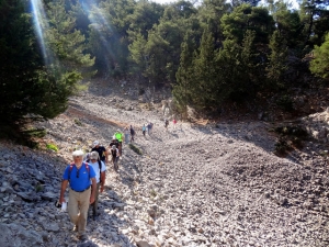
From Agios Ioannis, province Sfakia, starts the amazing path that reaches Krousia plateau at an altitude of 1200m., below the imposing peak of Zaranokefala. From Krousia start two paths, one towards Zaranokefala and the second to cave Drakolakki, which is presented here.
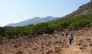
One of the nicest and easiest paths in Asterousia Range is the one connecting the settlement of Agios Ioannis by Kapetaniana to the monastery Koudoumas. We originally start from Agios Ioannis, we pass the beach Elygia at the exit of the gorge Valachas and via a piney seaside trail we reach the majestic cave of St. Anthony, with the small temple surrounded by stalactites and stalagmites.
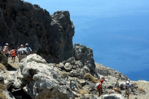
Asterousia Mountains are characterized by the wildness and the eerie landscapes causing awe to anyone attempting to discover them. A trail that offers countless emotions is the ancient path that connects the village Paranimfi to Tris Ekklisies and runs on the edge of the cliff.
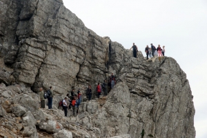
Kofinas can be reached with a short, but very steep and majestic trail, which starts near the church of Panagia in the northern foothills of the peak. The church can be reached via a dirt road starting from Kapetaniana or Sternes. The views over the top is excellent and walking in the trail is not recommended for those with fear of heights.
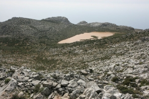
The path from Achentrias to Agios Nikitas and then to Tsoutsouras is one of the most authentic routes on the island, offering unique views of the wild coast of South Crete, the sharp and steep rocks of Asterousia Range with low vegetation.
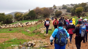
3500 years ago the Minoans ascended to the sacred cave of Ideon Andron in plateau Nida to submit their offerings to their gods. To climb Psiloritis, they walked through the canyon of Krousonas, reached Zominthos and from there they walked to Nida. We can walk in the same trail even today and feel like modern Minoans.
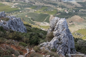
Climbing on Giouchtas is very easy because there is a very nicely marked and visible trail that crosses the mountain from one side to the other. Giouchtas has amazing and unobstructed views towards all directions, although it is quite low (its highest peak reaches 811m altitude). The trail that crosses the mountain starts right next to very famous archaeological site of Anemospilia and ascends to the south having panoramic views across the north side of the city of Heraklion, the Cretan Sea.
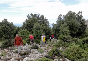
This route runs through a well designated path that starts from wood Chamoprina near Malia. Initially we climb a steep slope with unique views to the north coast. The trails leads to the beautiful forest of Azilakes (i.e. holm oaks). There is another road reaching Azilakodasos from Krassi.
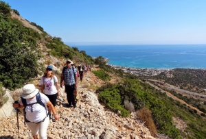
During the First World War, Bulgarian war captives were brought to Crete to reconstruct the path connecting Stalis to Mohos. Thus, they built a wider path with an average width of 2m, which for its time was a project of enormous importance. Of course, after the main road was built in the 20th century, the use of the trail virtually disappeared and now attracts only hikers.
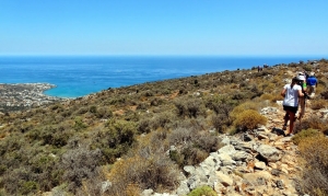
The trail starts from the picturesque village of Mochos, crosses the village's soccer field and soon starts climbing near the old mill park where once the locals used the windmills for grinding their grain. After reaching the highest point of the route that has a unique sea view, we start the relaxing descent through a 2m wide stone paved path to Malia.

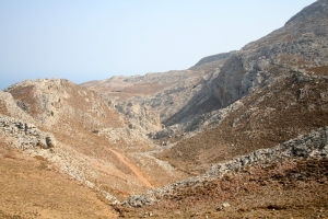
Ligiofarago is one of the few canyons of East Asterousia range that one can walk down to the sea without needing technical equipment. Recently the path has been signed, connecting Achendrias to Maridaki, running through the gorge.
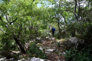
From the lush mountain village of Gerakari, Amari province, in Rethymno starts one of the trails that climbs Mount Kentros and attracts many walkers. But there is a second mountain trail unknown to most, the path leading from the village to the historic cave Chainospilios. This path was cleaned with an exemplary manner, while an explanatory sign that describes the path has been placed at its starting point.
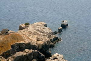
One of the most beautiful trails in Crete that one may attempt in the area of Western Asterousia is the path from Matala to Vathy beach. The route is mostly along the coast, but requires good physical condition due to long distance (11 km), lack of a marked trail and it definitely required good sun protection
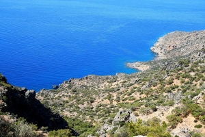
This route connects Kapetaniana with Agios Ioannis and then heads west to the beach of Salamias. The first part to Agios Ioannis on the side of the wild gorge of Goula is fairly steep and instable in some places. Then we meet the village of Agios Ioannis and the cavernous temple of the old monastery of Saint John.
- 1
- 2
Also read:
- Home
 Beaches
 Nature
 Past
Past Destinations
 Highlights
 West Crete
- Central Crete
- East Crete
- Towns
- Chania Prefecture
- Chania
- Paleochora
- Kissamos
- Georgioupolis
- Chora Sfakion
- Loutro
- Rethymnon Prefecture
- Rethymnon
- Agia Galini
- Plakias
- Spili
- Anogia
- Heraklion Prefecture
- Heraklion
- Hersonissos
- Malia
- Matala
- Agia Pelagia`
- Archanes
- Kokkinos Pirgos
- Lassithi Prefecture
- Agios Nikolaos
- Elounda
- Sitia
- Ierapetra
- Makrigialos
- Palekastro
- Zakros
- Lassithi Plateau
- Get Prepared


