")


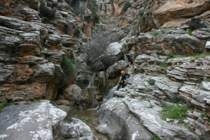
Λίγα μέτρα ανατολικά του Φαραγγιού του Τσούτσουρα ανοίγεται σαν μία στενή μαχαιριά στο μέτωπο της γης το μικρότερο, αλλά εξίσου εντυπωσιακό φαράγγι της Τρούλας. Είναι εξίσου εντυπωσιακό με πολλούς και όμορφους καταρράκτες στο διάβα του που ο μεγαλύτερος έχει ύψος 15 μέτρων ενώ ακολουθούν ακόμα 15 μικρότεροι.

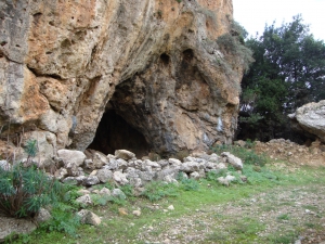
Ο Ατζιγανόσπηλιος βρίσκεται σε κοντινή απόσταση από το χωριό Αδριανός (10 λεπτά), στη θέση Νοτικό Χλαμπούτι στις Κουκίστρες. Απέχει 25km περίπου από τον Άγιο Νικόλαο και ανήκει στην κοινότητα των Ζενίων, την οποία συναντούμε κατά την άνοδο μας προς το Οροπέδιο Λασιθίου από την Νεάπολη.

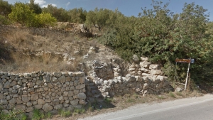
At the road connecting Piskokefalo and Sitia we meet the remains of an excavated two-storey Minoan mansion. We can still discern the remnants of rooms, stairs and the protective boulders coming from the neighbouring river of Pantelopotamos or the sea.

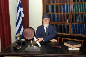
The museum is one of two wax museums that exist in Greece and is an idea of the sculptor Dionysis Potamianos. It is located at Zoniana, at the northern foothills of Psiloritis Mount.

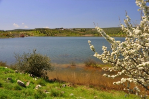
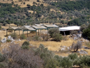
The dam of Ini – Mahera is located 38km south of Heraklion and next to Mahera and Ini villages. It was constructed in 2004 and has a capacity of 1750000 cubic meters.

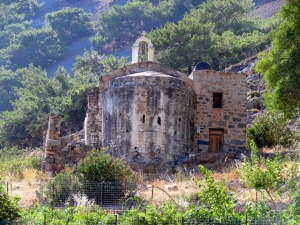
One of the most important Byzantine monuments is located in the gorge of Samaria, at the site of a former a temple of town Tarra (1st century AD). The initial church was a three-nave basilica and today what we see is the Byzantine church that was built in place of the initial.

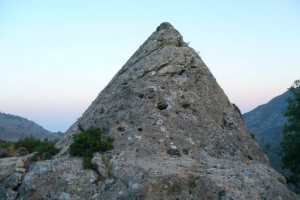
В километре от деревни Мони, следуя по дороге от кафе слева, вы найдете знаменитую «пирамиду» Ханья. Это древний каменный конус, с длиною окружности около 16 метров и высотой почти 5 метров. Внутри есть вырубленная камера, в которую можно попасть с центрального входа.

Дворец Монастираки находится на холме с видом на долину Амари на юго-востоке от города Ретимно и недалеко от деревни Монастираки, от которого он получил свое название. Минойское название комплекса не известно. Монастираки является одной из наиболее важных раскопок на острове Крит ближнего минойского периода.


