")


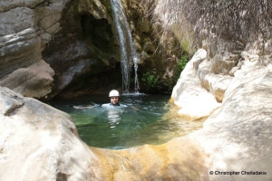
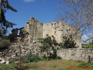
Στο μικρό και σχεδόν έρημο σήμερα χωριό Χορδάκι στην επαρχία Αμαρίου συναντάμε το μικρό αλλά πολύ όμορφο φαράγγι που δημιουργείται στην περιοχή Κυνηγόσπηλιος κάτω από το χωριό και προς τα νότια του. Βρίσκεται σε εντελώς κρυφό σημείο και δε φαίνεται από πουθενά και αυτός είναι και ο βασικός λόγος που παραμένει άγνωστο.

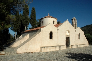
История церкви Девы Марии ‘Панагия Кера’ началась по крайней мере в XIII в. Сначала был построен центральный неф, поддерживающий массивную сводчатую крышу и тяжелый плоский купол, затем достроили боковые нефы и западный вход, который используется сегодня, а последними были сооружены колокольня и опоры для церкви.

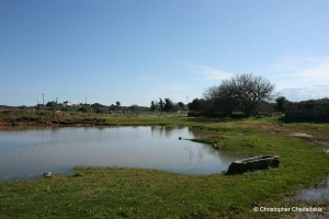
In the heart of Province Mirabello, prefecture Lassithi, which the most arid region all over Crete one would not expect to meet a natural freshwater lake. However, at village Kourounes we meet one. Specifically in the area named Limni (lake) at the south entrance of the village and next to the first houses of the small village we find the lake of Kourounes.

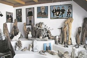
Το μουσείο είναι αφιερωμένο στον λαϊκό καλλιτέχνη Αλκιβιάδη Σκουλά ο οποίος έζησε από το 1902 έως το 1996, πατέρας του μεγάλου καλλιτέχνη Βασίλη Σκουλά.

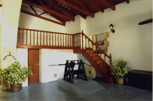
Στην κεντρική πλατεία του Χρωμοναστηρίου βρίσκεται η παλιά φάμπρικα, ελαιόμυλος του Πρινάρη, πλήρως ανακαινισμένη, με όλο τον παλιό της εξοπλισμό, που μπορεί να δουλέψει και σήμερα, λειτουργεί ως Κέντρο Εκπαίδευσης και Ενημέρωσης για τον Πολιτισμό της ελιάς, του λαδιού και των Μύλων.

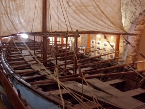
Στα Χανιά μην παραλείψετε να δείτε, στα νεώρια του ενετικού λιμανιού, το Μουσείο Αρχαίας και Παραδοσιακής Ναυπηγικής με την αναπαράσταση του Μινωικού πλοίου «Μινώα» του 16ου-15ου αιώνα π.Χ., το οποίο καθελκύστηκε το Δεκέμβριο του 2003 και το 2004 έκανε το παρθενικό του ταξίδι από τα Χανιά στον Πειραιά.

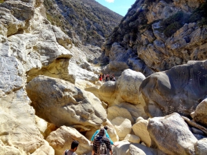
Το φαράγγι του Αναποδάρη σχηματίζεται στο τελικό τμήμα του μεγαλύτερου ποταμού της Κρήτης, του Αναποδάρη που συλλέγει τα νερά του κεντρικού νομού Ηρακλείου και της νότιας Δίκτης.