")


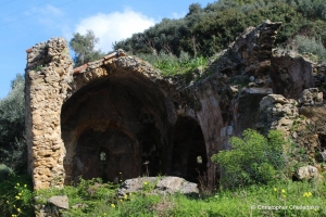
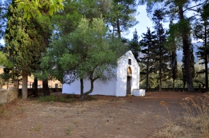
Ο Γαρίπας Κυδωνίας Χανίων πέρα από την φυσική ομορφιά που διαθέτει κρύβει και 2 ερειπωμένες σήμερα κατάγραφες βυζαντινές εκκλησίες. Μία από αυτές είναι ο δίκλιτος ναός του Αγίου Γεωργίου και του Αγίου Νικολάου που βρίσκεται σχεδόν πάνω στο δρόμο της περιοχής.

Λίγα χιλιόμετρα νοτιοδυτικά της Νεάπολης, στη βόρεια κλιτύα του όρους Καβαλαράς, υπάρχει το πανέμορφο δάσος του Πασχαλίγο. Το δάσος έχει πάρει το όνομα του από τον Ενετό φεουδάρχη Fillipo Pasqualigo, στρατιωτικό διοικητή του Χάνδακα (1592-1600), ο οποίος διατηρούσε πύργο στην περιοχή.
Πριν να οχυρωθεί η σημερινή νησίδα της Σούδας, το νησάκι φιλοξενούσε το Καθολικό μοναστήρι του Αγ. Νικολάου και γι' αυτό λεγόταν Φραρονήσι (Φράροι ή Φλώροι είναι οι καθολικοί μοναχοί). Ο επιβλητικός ναός του Αγίου Νικολάου υπάρχει ακόμη στο νησί και είναι επισκέψιμος.

Ο μικρός ναός των Αγίου Κωνσταντίνου και Ελένης βρίσκεται δυτικά του Αβδού, στα όρια με το φράγμα Αποσελέμη, όπου έχει διαμορφωθεί ειδικός χώρος με τοιχία για την προστασία του από τα νερά του φράγματος. Είναι μονόχωρος καμαροσκέπαστος ναός που φέρει εξαιρετικές τοιχογραφίες των γνωστών αγιογράφων Μανουήλ και Ιωάννη Φωκά, που θεωρούνται πρόδρομοι της Κρητικής Σχολής.

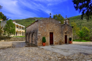
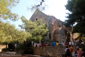
The church of Panagia Almyri (Salty Virgin Mary) belongs to the parish of Megali Vrissi and is one of the largest pilgrimages of Messara Plain. Especially, on the celebration day of the church (feast of Ascension) hundreds of people flock from all corners of Crete.


Το Μινωικό μέγαρο στο Σκλαβόκαμπο ανακαλύφθηκε τυχαία το 1930, κατά τη κατασκευή του κεντρικού δρόμου προς Ανώγεια και μέρος του καταστράφηκε από τα έργα. Είναι ένα πολυώροφο κτίριο με κεντρική αίθουσα, όπου βρέθηκε πήλινο κεφάλι βοδιού, ένα αγγείο της Υστερομινωικής ΙΒ περιόδου και ένα λίθινο ρυτό. Το κτήριο είχε τουλάχιστον 17 δωμάτια.

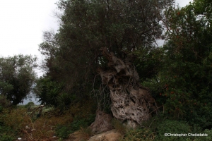
The olive of Saint George at Kamara Deliana is aged over 2000 years and is not the only case of monumental trees in the area. Not too far from St. George we meet a whole cluster with monumental olive trees.

На мысе Суда, над святыней на пляже Агии Пелагеи находятся следы раскопок, проводимых Стилианосом Алехиу. Здесь он обнаружил самый важный участок для археологических раскопок, Пританей элленистического Аполлония (или Панормос). Город находился на месте сегодняшней Агия Пелагея.


