")


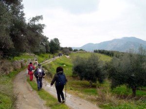
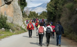
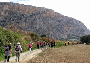
The E4 European Long Distance Path encompasses a large network of trails with special cultural, natural and historical value. It is marked by the European Ramblers Association and crosses the island from Kissamos to Zakros, after crossing all major Mountain Ranges in Crete (White Mountains, Kedros, Ida Range, Dikti and Thripti). Hikers have the opportunity to explore a wide range of landscapes of great diversity. Apart from the E4, there are plenty of options for majestic mapped routes.
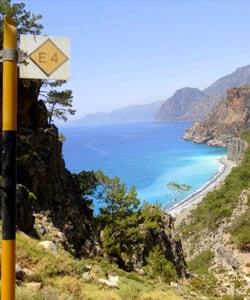
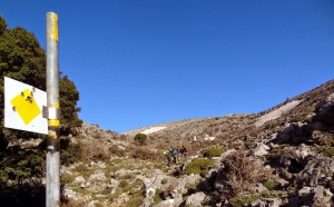
The colors of the E4 trail signing are yellow and black
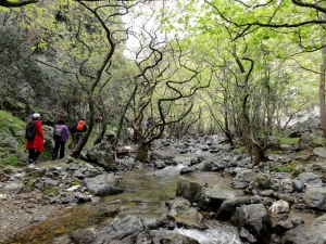
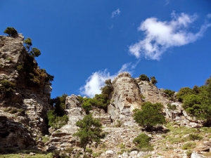
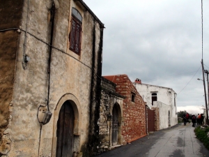
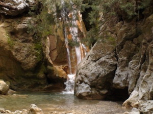
Kollita Gorges, i.e. Twin Ravines are located nearby the picturesque village Argyroupolis, about 22km southwest of Rethymnon city. They are named so, as they consist of two parallel canyons that end near Kato Poros settlement. Here we refer to the easternmost gorge of Moundros.
The area of Moundros hosts two different trails which are parts of the E4 European trail. The one heads to the east and after crossing the position Nifis Potamia heads to the village Agouseliana. The entire trail is via paved and dirt track, being an ideal cycling route.
This trail starts from Agouseliana, comes north of the villages Katsogrida and Atsipades, passes through Koxare, meets the upper entrance of Kourtaliotiko Gorge, crosses Mixorouma and Dariviana, and stops at Spili. It is very easy, as it is mostly on paved and unpaved roads.
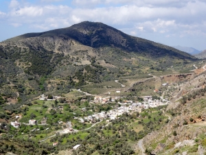
The route starts from Spili, reaches the spring of Agia Fotia, and then ascends to Kissos. It comes above the Monastery of the Holy Spirit and climbs to the summit of Mount Kedros (1776 m.). From there we go back and meet the trail that leads to the Church of the Prophet Elijah and descends to Gerakari. This route is a part of the European E4 trail.
From Gerakari the European E4 trail continues for Elenes and then to Amari. Then it comes through the villages Opsigias, Petrohori, Vizari and Fourfouras. From there it ascends to Psiloritis Mount, via road (up to 760m. altitude) and trail, to reach the mountain shelter of Toumbotos Prinos. The route runs through a wooded and rough landscape, with mainly oak trees.
This route offers some nice views of the fertile hinterland of Rethymnon, mainly using dirt and paved roads. The route starts from Agios Konstantinos, crosses Kalonihtis and Ano Valsamonero, before reaching Monopari, then Kastelos, and finishes at Armeni Minoan necropolis.
This part of the European trail connects Armeni to Arkadi, with its highlights being the Minoan Peak sanctuary of Vrissinas, the valley of Potami dam and Prasses gorge and finally the historical monastery of Arkadi. Due to being quite long, the route an be divided in two parts, from Armeni to Prasses and from Prasses to Arkadi.
This part of the E4 trail starts from the historical monastery of Arkadi, heads to antiquities of the ancient town Eleftherna and then concludes at the village Margarites. The highlights of the route include the monastery of Arkadi, the ancient necropolis and the Roman cisterns in Eleftherna and the traditional houses of Margarites.
The part of the E4 trail that starts from Margarites and finishes at Houmeri is mostly along the main road connecting the villages of the area (Pigouniana, Orthes, Kalandare, Kalamas, Pasalites). The highlights of the route include the ceramic centre of Margarites village, the well preserved samples of the tradional house architecture and some important churches.
From Houmeri, the European E4 path reaches Garazo, after coming through the villages Agios Syllas and Dafnedes. The path offers good views to the lush olive groves of Milopotamos province, the river of Geropotamos and the nice square of Garazo. However, the most striking highlight is the abandoned mill-house of Mousses.
This part of the European trail E4 starts from Garazo and reaches Zoniana through the bed of the river Oaxis, which is the extension of Zoniana gorge. It then ends at Anogia through the paved road. Most of the route meets the typical Cretan landscape, with olive groves, limestone rocks and low vegetation.
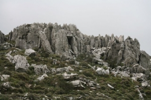
This part of the E4 European trail starts from Anogia, arrives at ancient Zominthos and finishes at Nida Plateau. Due to being quite long, it is used to split the trail into two parts (Anogia - Zominthos and Zominthos - Nida). The route offers a very good experience of the typical rocky terrain of the Range Psiloritis. During winter, it is very possible to meet snow.
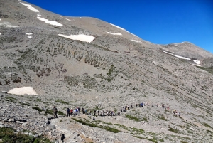
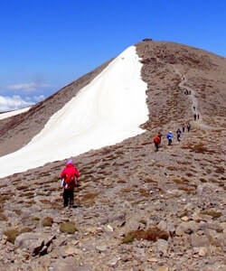
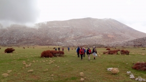
This is one of the most popular and well signed parts of the E4 European Trail, ascending to the highest peak of Crete, Timios Stavros (2456m). The course offers amazing views to almost entire island, as in clear days, we can see even Gavdos island. We usually meet snow from early winter months to early summer.
This is one of the most popular and well signed parts of the E4 European Trail, ascending to the highest peak of Crete, Timios Stavros (2456m). The course offers amazing views to almost entire island, as in clear days, we can see even Gavdos island. We usually meet snow from early winter months to early summer.
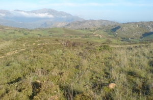
The E4 part connecting Kamares to Zaros is mainly signed with red marks and most of it runs along dirt and paved roads. The route offers nice views to the south outskirts of Psiloritis Range and the historical importance of the villages we come through is high.
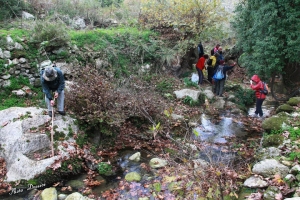
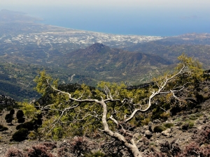
This part of the E4 European Long Distance trail connects Nida plateau to the the church of Agios Ioannis in the core of Rouvas Wood. It offers amazing views to the largest oak wood in Crete and is usually combined with the descending the amazing gorge of Gafaris, also a E4 part, which is the most important canyon in Heraklion prefecture.
The gorge of Agios Nikolaos, Gafaris or Rouvas is bounded by the peaks of Ambelakia from east and Samari from west. This is the most important gorge of Psiloritis and central Crete and took its name from the homonymous Byzantine church in the south entrance. This is an ecosystem with rich flora and fauna, smaller canyons and interesting geological formations and cliffs of rare beauty.
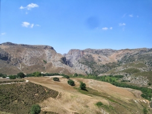
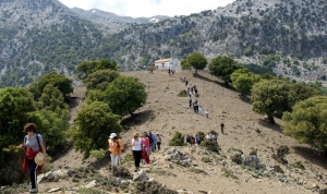
This part of the E4 trail connects the core of Rouvas Wood to the east outskirts of Psiloritis mount and gives its position to the next trail crossing the fertile valleys of Heraklion prefecture. It is quite tiring, as it ascends from altitude 950m to 1779m and then descends to 490m. The route offers a great experience of the oak wooded forest of Rouvas, the bare peaks of East Priloritis and, if you are lucky, a nice stay in the shelter of Prinos.
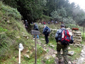
This part of the E4 trail is quite easy and offers some nice views to the fertile valleys and vineyards of Heraklion prefecture. The route starts from Ano Asites and firstly meets the cavernous church of Saint Anthony and finishes at Prifitis Ilias. Note that there are long parts along roads, thus you could split the route into smaller parts and overcome some with a car or bike.
From Profitis Elias, the E4 European Trail runs along a dirt road that passes north of the fortress Roka (Temenos) and via a network of dirt roads, through vineyards and oliveyards, reaches the western slope of Mount Youchtas, near the village Karnari. Then, through asphalt road, we bypass Youchtas from the south side and follow the dirt road that climbs to the Youchtas and soon we enter the trail to Archanes.


