")


 Portela Gorge

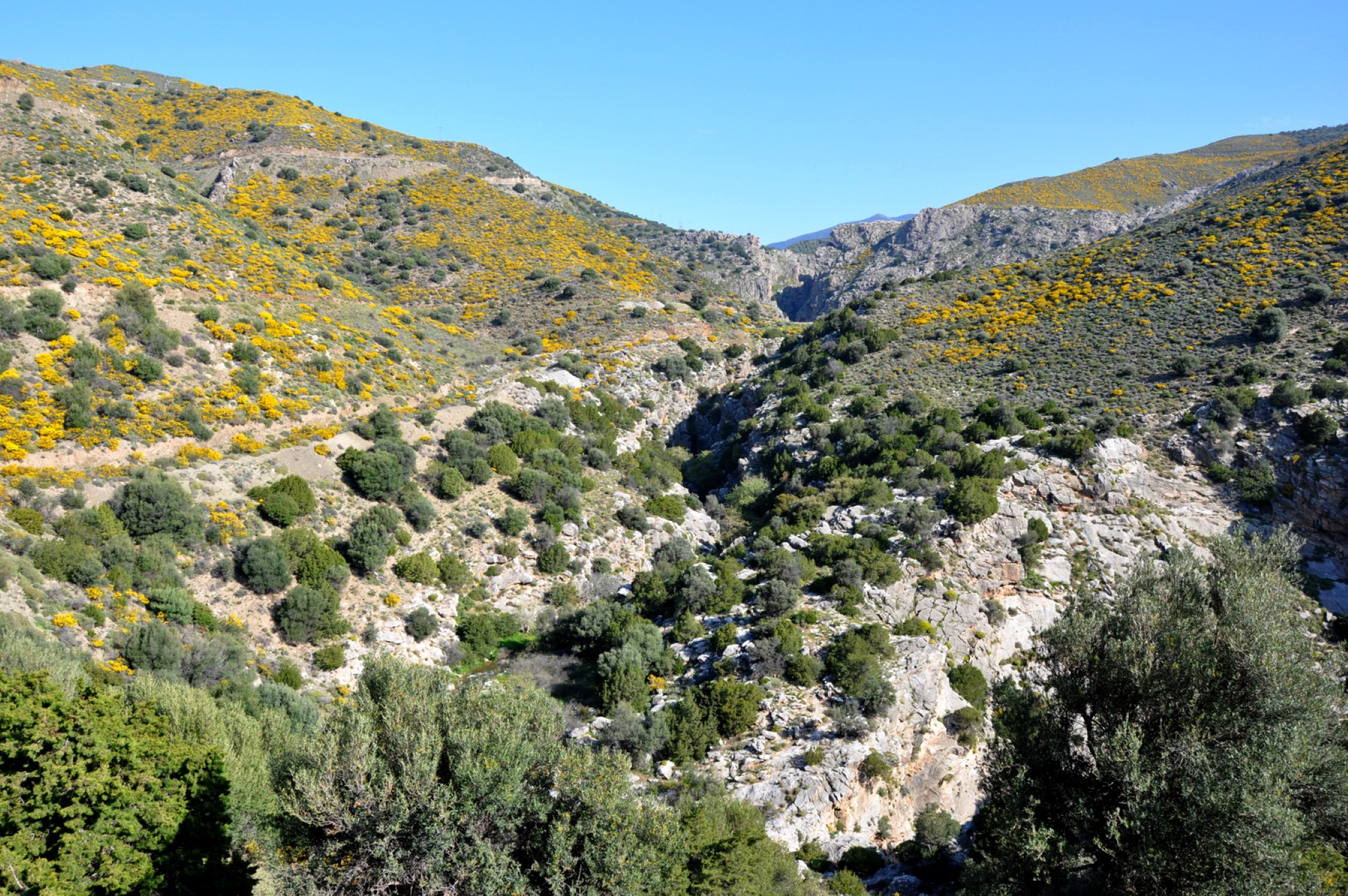
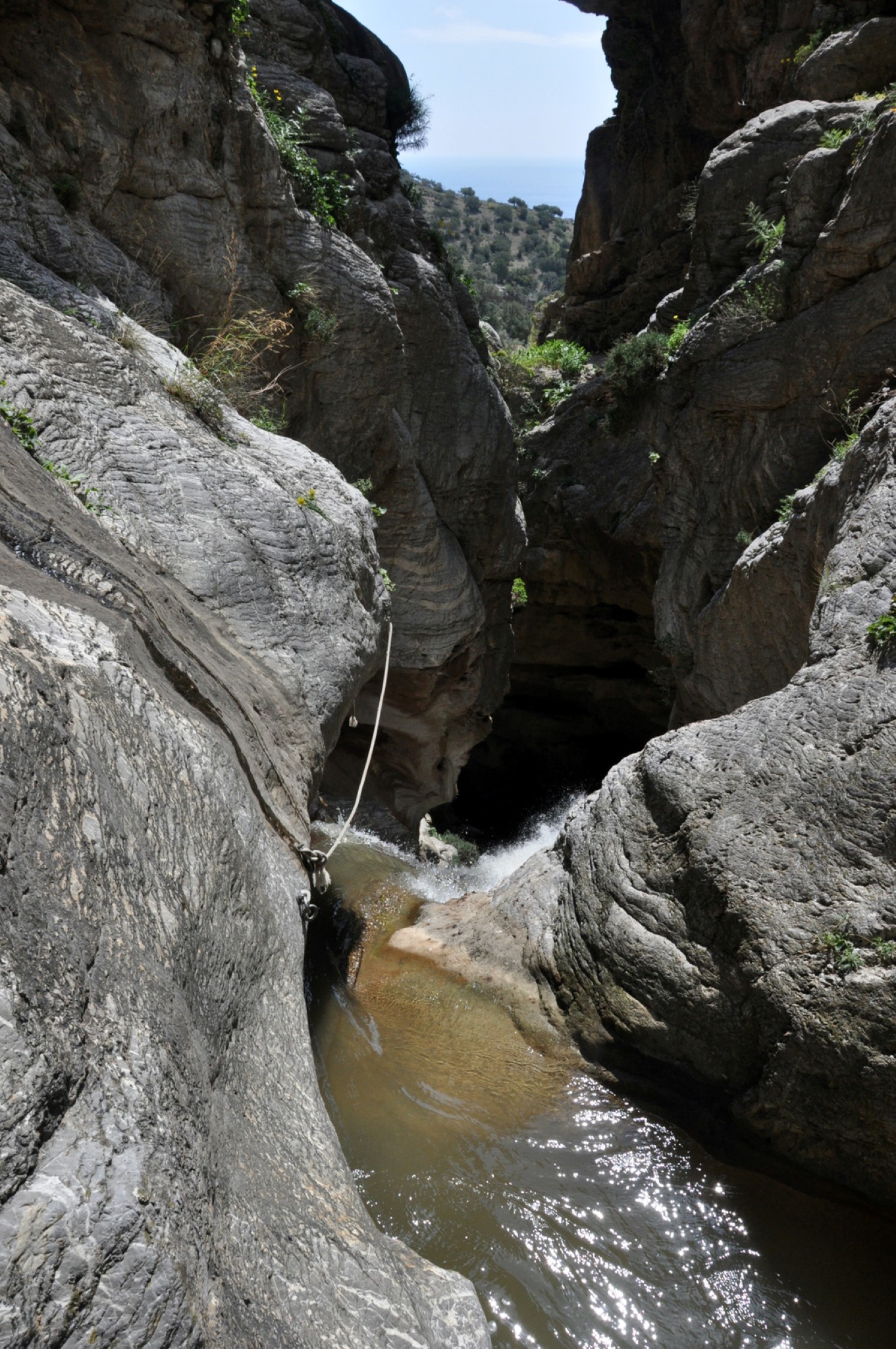
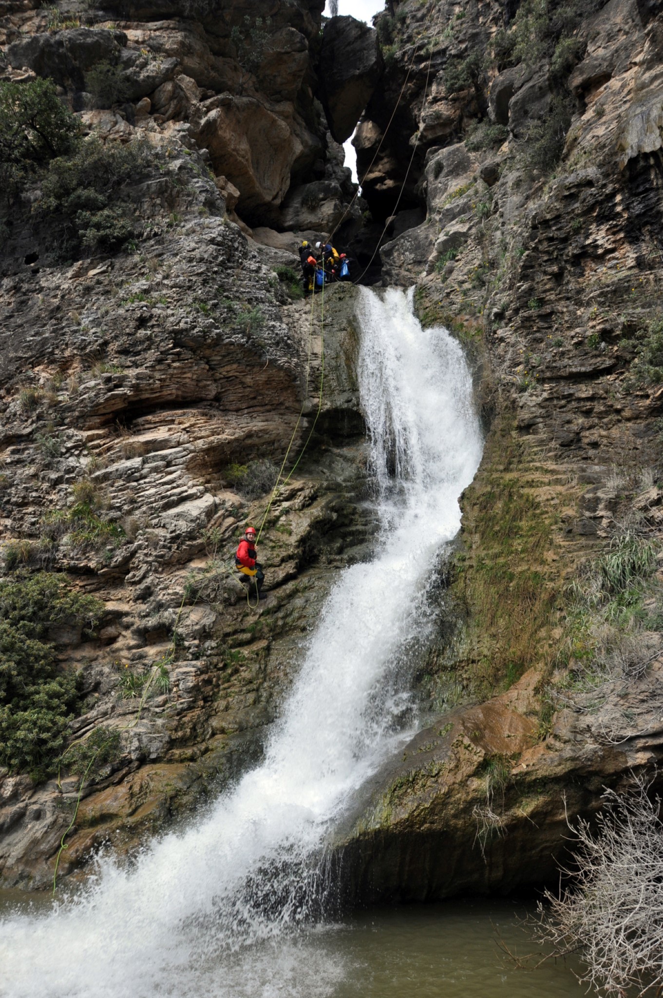
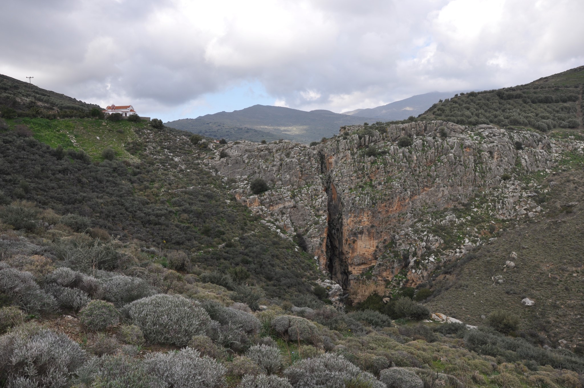
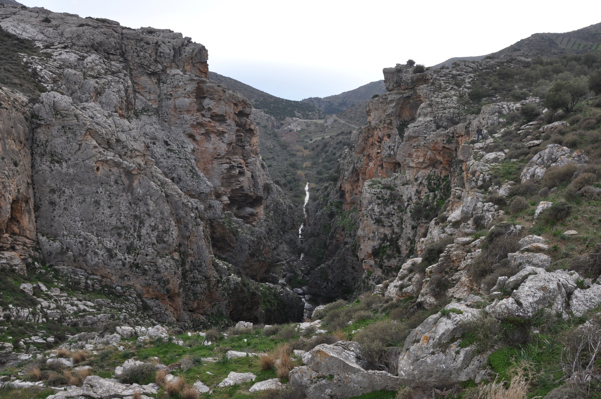
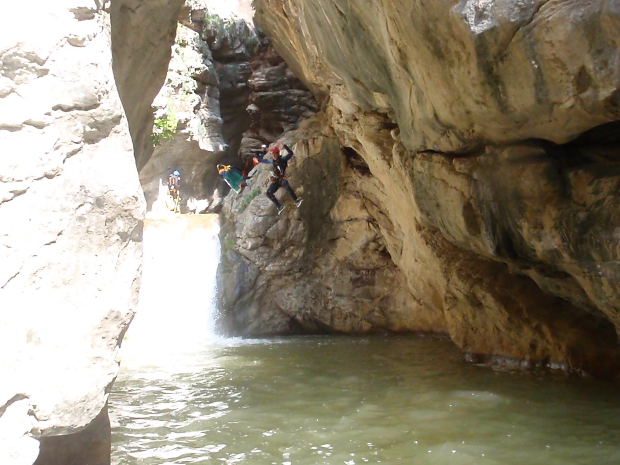
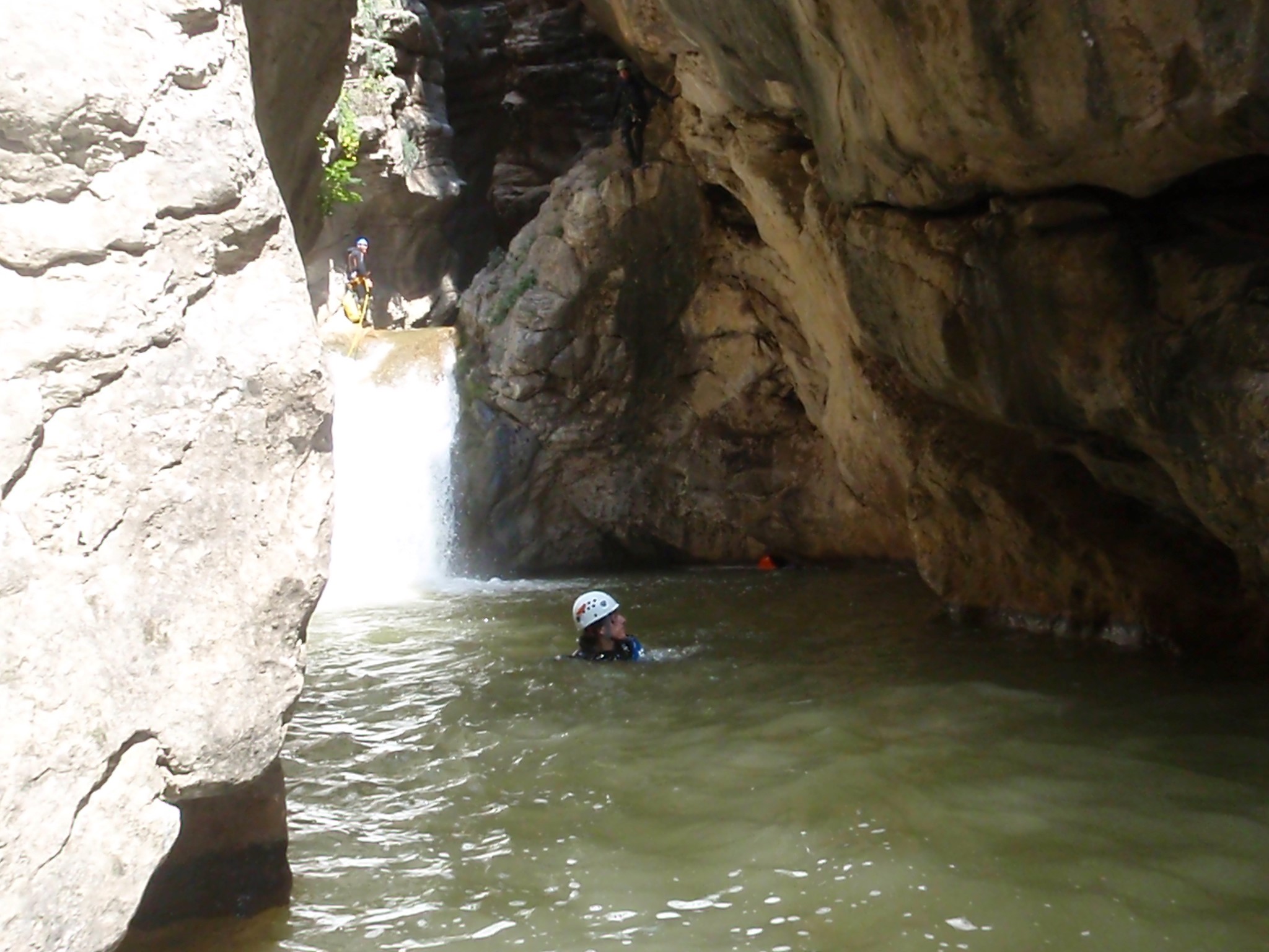
Portela Gorge is located at the south of the prefecture of Heraklion and the stream coming in it drains the basin of Ano Viannos and transfers water to the South Cretan Sea. The canyon entrance is located at Hondros village and its exit is at Keratokambos. It is one of the most dangerous canyons in Greece and only experienced canyoners can cross it. Especially after rainfall, visiting the gorge can turn fatal. However, there is a walkable trail and road running aside the gorge, that runs from Hondros to Keratokambos, but its beauty cannot be compared with the inner part of the canyon.
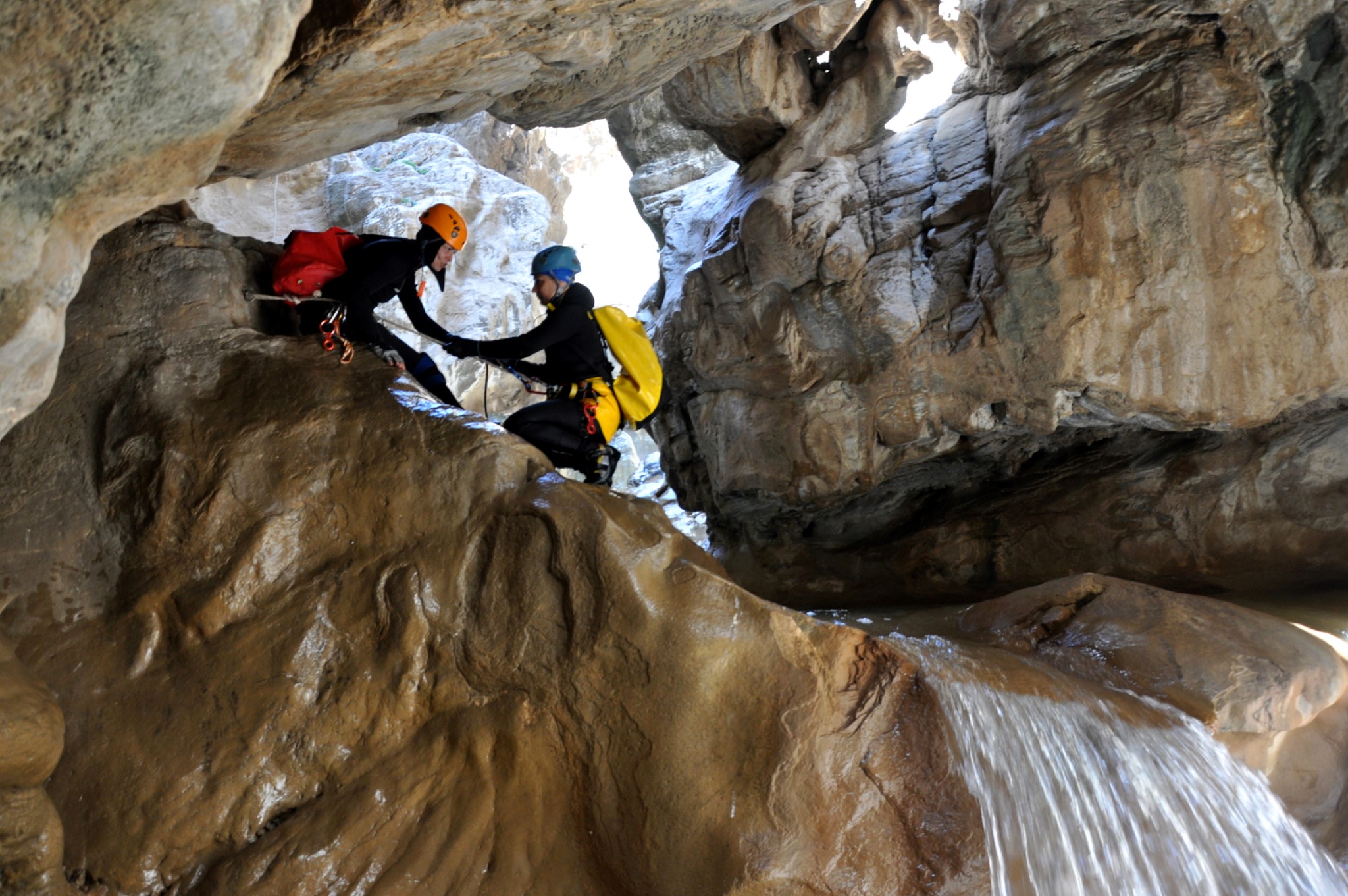
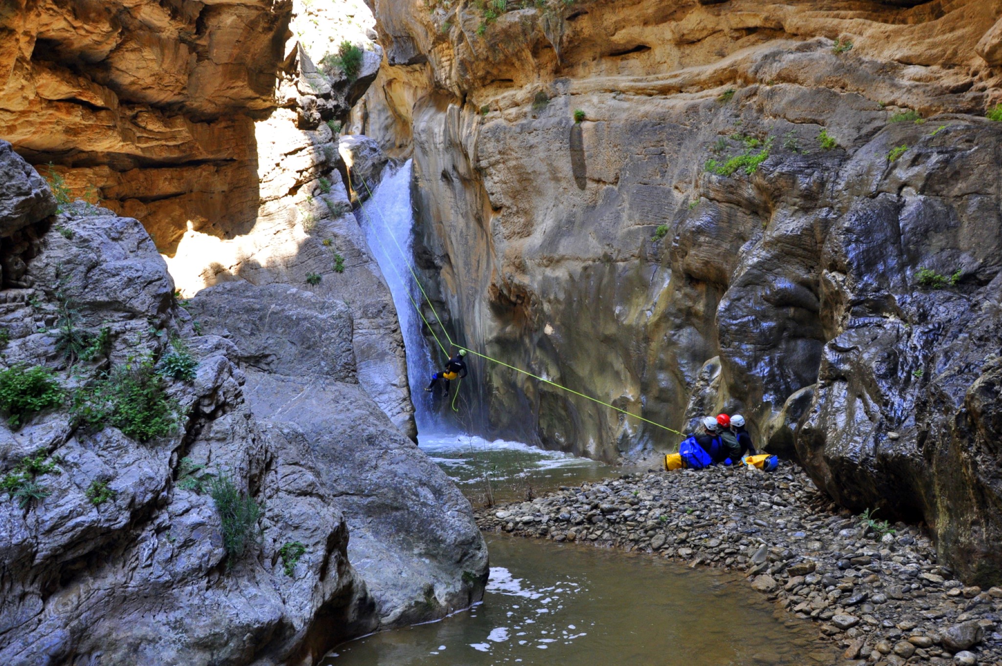
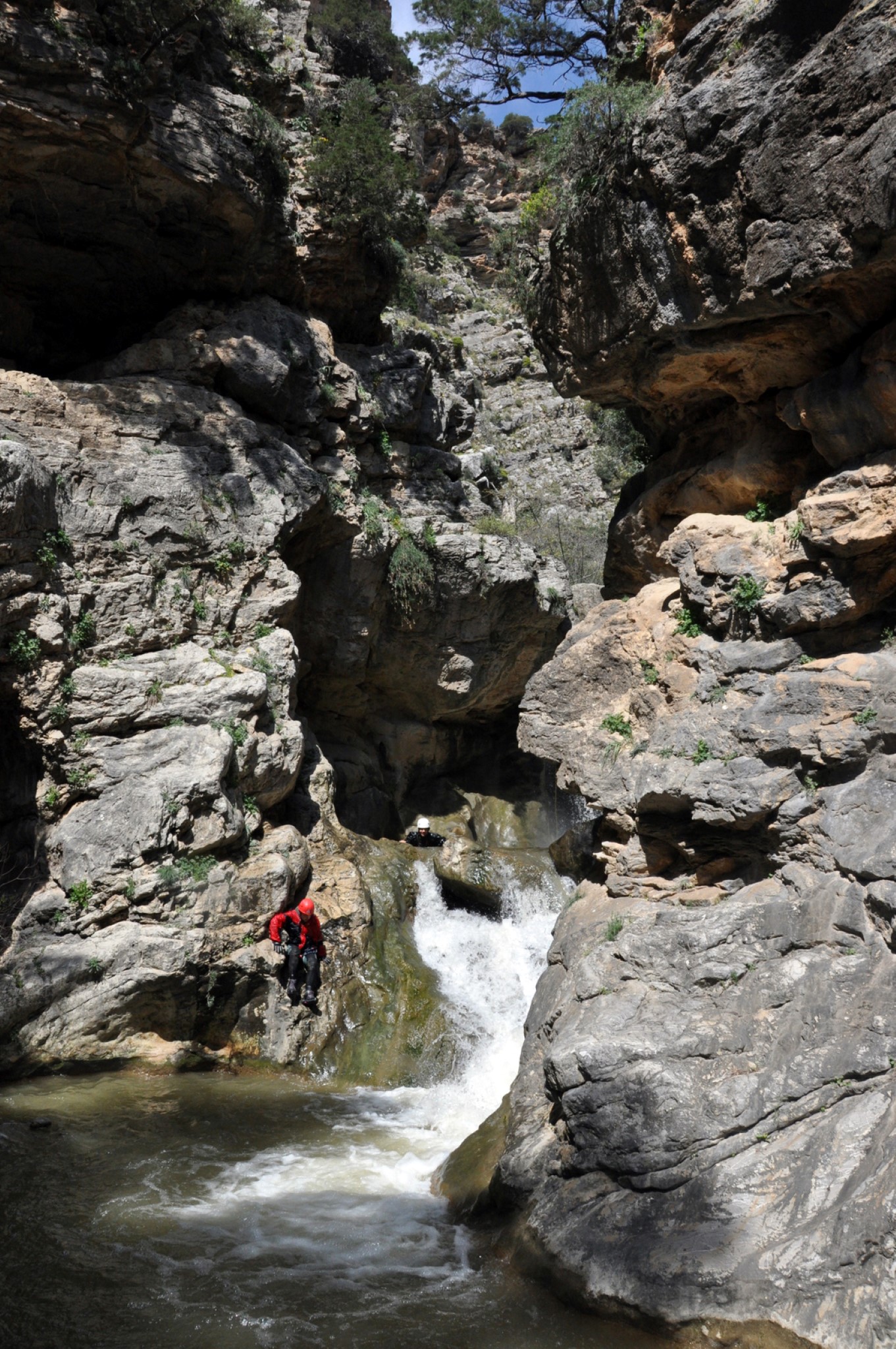
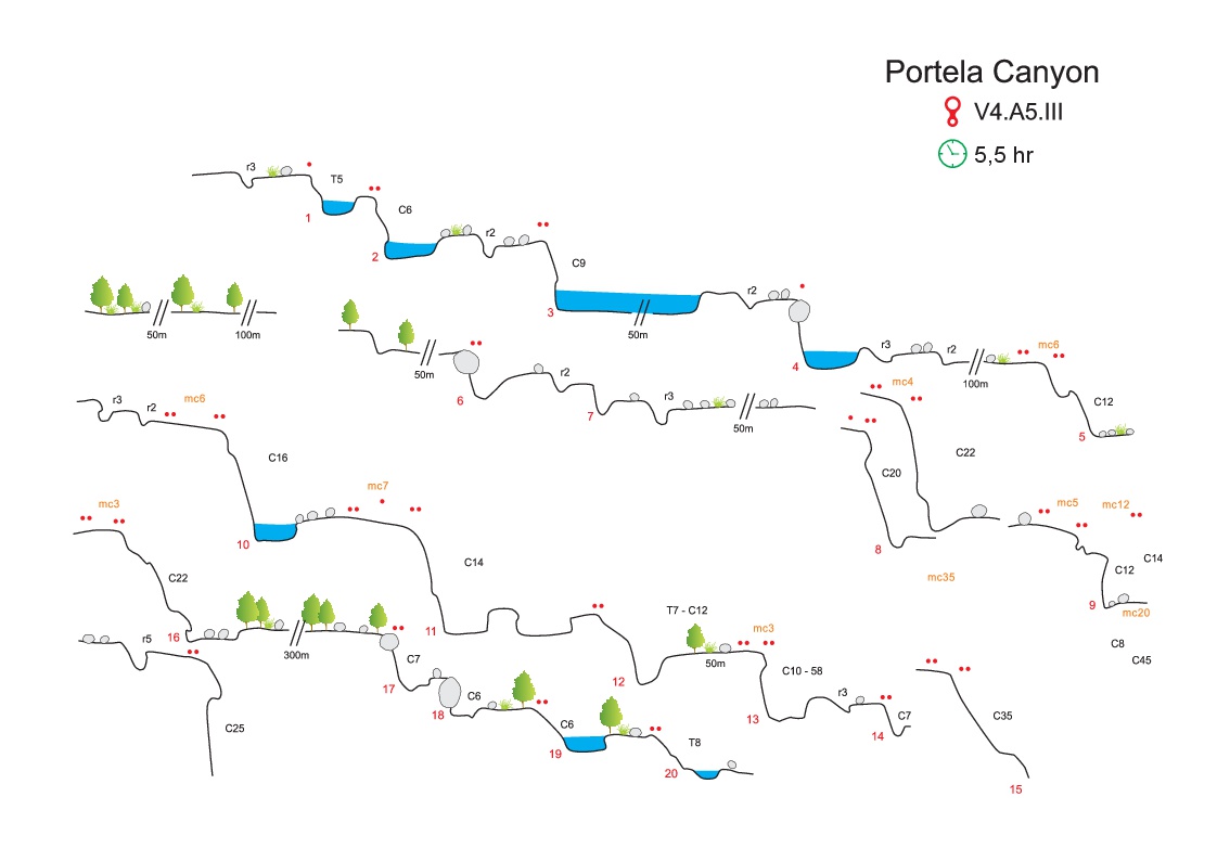
It is a very beautiful and yet wild gorge, that’s why it is a legend of the region and considered as one of the most known canyoning spots of Crete alongside with Ha and Arvi. During winter and early spring it has the largest quantity of water, compared to the rest gorges in the area. The canyon has 25 technical descents and the highest is 30m, the altitude difference between entrance and exit is 340m. Due to the inaccessibility of the area, the locals know mainly the last waterfall of Richtra at its exit, where anyone can approach without equipment.
The canyon is intersected by five faults which are responsible for its creation alongside with the gully erotion. These faults split Portela into three parts that make the gorge to have great diversity in plants, landscapes etc. Additionally something unique in this canyon is the huge quantities of mud that it contains. Perhaps this is because the appearance of the “Viannos” rock formation appearing before the gorge. This formation contains large quantities of argil, which the waters flow brings into the canyon. The trademark of the gorge is the beautiful Sifoni (siphon), a large waterfall in a dolin, the "bottom" of which has been opened leaving the waters to continue their course.